Navigation system for target area and navigation method

A technology of target area and navigation system, applied in the field of Bluetooth positioning, it can solve the problems of inability to reach smoothly, consumers consume too much time, detailed instructions, etc., and achieve the effect of saving network traffic

Inactive Publication Date: 2017-06-13
SHUNDE POLYTECHNIC
View PDF3 Cites 11 Cited by
  • Summary
  • Abstract
  • Description
  • Claims
  • Application Information

AI Technical Summary

Problems solved by technology

However, GPS navigation is only for the positioning and navigation of the public transportation system. Most of the maps called are public maps (such as the free map software provided by Baidu). The...

Method used


Image

  • Navigation system for target area and navigation method

Examples


Embodiment Construction

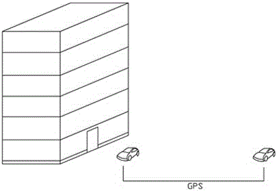
[0024] Embodiments of the present invention are described in detail below, examples of which are shown in the drawings, wherein the same or similar reference numerals designate the same or similar elements or elements having the same or similar functions throughout. The embodiments described below by referring to the figures are exemplary only for explaining the present invention and should not be construed as limiting the present invention.

[0025] In the description of the present invention, it should be noted that the terms "installation", "connection" and "connection" should be interpreted in a broad sense, for example, may be a fixed connection, unless otherwise specified and limited. It can also be a detachable connection or an integral connection; it can be a mechanical connection or an electrical connection; it can be a direct connection or an indirect connection through an intermediary, and it can be the internal communication of two components. Those of ordinary ski...


PUM


Abstract

The invention discloses a navigation system for a target area. The navigation system comprises a mobile terminal, an original vehicle navigation module, a Bluetooth module, a plurality of Bluetooth signal sources and a system server, wherein the original vehicle navigation module and the Bluetooth module are arranged on the mobile terminal; the Bluetooth signal sources are arranged in the target area; each Bluetooth signal source is corresponding to one ID number; the ID number is corresponding to a fixed target area position information; the fixed target area position information comprises stereo-positioning information of spatial height; the mobile terminal can download a navigation APP of the target area; when the Bluetooth module of the mobile terminal responds to the Bluetooth signal sources set in the target area, the navigation APP of the mobile terminal can generate a navigation route according to the stereoscopic space address of a destination of the target area. The mobile terminal provided by the invention can receive the visiting information of an inviting party and can navigate according to the address index. When the mobile terminal is nearby the target area, APP is used for starting the internal accurate navigation and the mobile terminal can quickly arrive at the appointed site.

Description

technical field [0001] The invention relates to the technical field of bluetooth positioning, and more specifically, relates to a target area navigation system and a navigation method. Background technique [0002] Bluetooth (Bluetooth) technology is essentially a short-range wireless communication standard. It is based on low-cost short-range wireless connections, and establishes a special connection for fixed and mobile device communication environments for data communication between devices. [0003] At present, the outdoor navigation system usually adopts the GPS global positioning system, and the mobile terminal cooperates with the tracking device to realize the positioning and tracking of the target object. For example, the tracking device transmits the location information of the target object obtained through GPS positioning to the terminal through the Global System for Mobile Communication (GSM) network, and the location can be identified through the map and other ...

Claims


Application Information

Patent Timeline
IPC IPC(8): G01C21/34G01S19/46
CPCG01C21/3415G01S19/46
Inventor 吴治将彭莺徐言生李东洺王斯焱鄞楠
Owner SHUNDE POLYTECHNIC
Why Eureka
Try Eureka