
Subregion map navigation system

A navigation system and small area technology, applied in the field of small area map navigation system, can solve the problem that regional seats cannot be accurately positioned and navigated, etc.

Inactive Publication Date: 2017-08-08
武汉众睿科技发展股份有限公司
View PDF8 Cites 0 Cited by
  • Summary
  • Abstract
  • Description
  • Claims
  • Application Information

AI Technical Summary

Problems solved by technology

The current electronic maps such as Baidu map, Google map, Gaode map, etc., are practical and real-time positioning and navigation in a large area, but it is impossible to accurately locate and navigate the seats in a small area. Therefore, we propose a small area map navigation system to solve the above problems

Method used


Image

  • Subregion map navigation system
  • Subregion map navigation system
  • Subregion map navigation system

Examples


Embodiment Construction

[0017] The present invention will be further explained below in conjunction with specific embodiments.

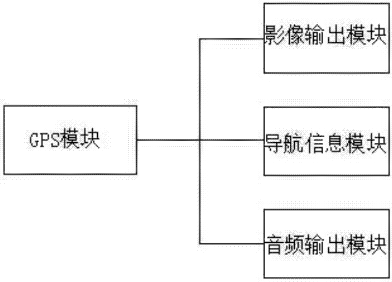
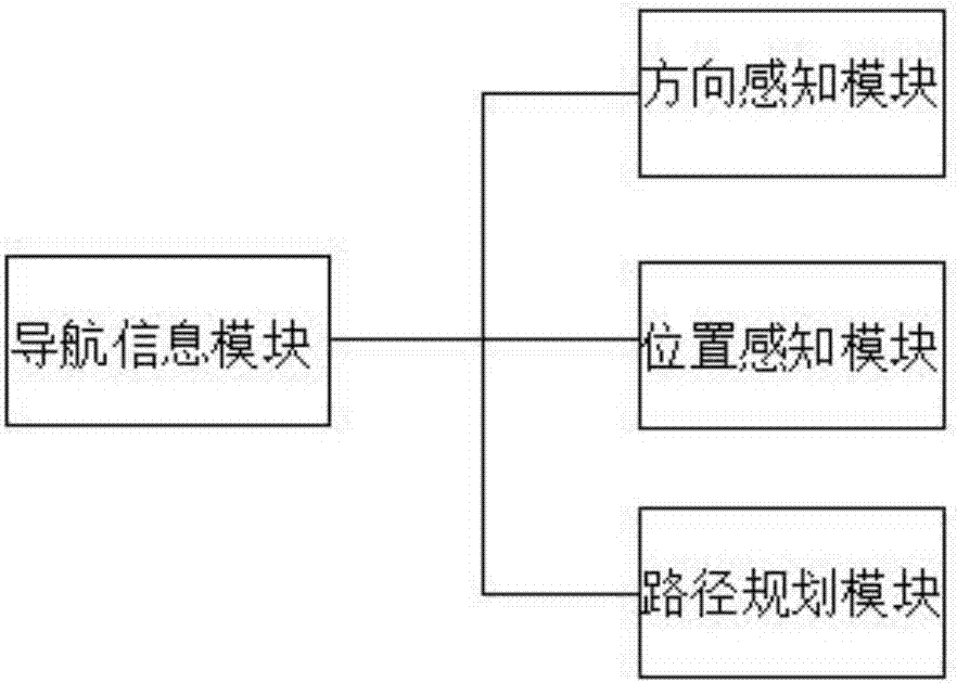
[0018] refer to Figure 1-3 , a small area map navigation system comprising:

[0019] The control module is arranged on the console and is used to control the whole system. The control module includes a keyboard arranged on the console, and the operator can control the operation through the keyboard.

[0020] The GPS module is used to receive satellite signals and calculate positioning and navigation information. After calculation, the longitude, latitude, and altitude positioning information of the location of the GPS module are obtained, and the number of satellites received, time and other information are sent to NMEA-0183 The position of the GPS module at this time is extracted from the format information, and the GPS module and the control module are connected through serial port level conversion.

[0021] A display module, the display module includes a display scree...


PUM


Abstract

The invention discloses a subregion map navigation system, which comprises a control module, a GPS (global positioning system) module and a display module, wherein the control module is arranged on an operation table, and is used for controlling the whole system; the control module comprises a keyboard arranged on the operation table; the GPS module is used for receiving a satellite signal and calculating positioning navigation information; through calculation, the longitude, latitude and altitude positioning information of the located position of the GPS module is obtained through calculation; the position of the GPS module at the moment is extracted from the NMEA-0183 format information together with the received information of satellite number, time and the like; the GPS module and the control module are in conversion connection through a serial port level; the display module comprises a display screen arranged on the operation table; the control module extracts the information of the GPS module and performs information and map configuration; a result is displayed by the display screen. The local real-time map can be drawn in a small region; target positioning can be performed; the geographical environment current condition can be more clearly displayed; the change can be conveniently performed according to the change of the real-time geographical environment.

Description

technical field [0001] The invention relates to the technical field of navigation, in particular to a small area map navigation system. Background technique [0002] Electronic map, that is, digital map, is a map that is stored and consulted digitally using computer technology. The method of storing information in electronic maps generally uses vector image storage. The scale of the map can be enlarged, reduced or rotated without affecting the display effect. In the early days, bitmap storage was used, and the scale of the map cannot be enlarged or reduced. Modern electronic map software generally uses geographical information systems to store and transmit map data, and other information systems. The current electronic maps such as Baidu map, Google map, Gaode map, etc., are practical and real-time positioning and navigation in a large area, but it is impossible to accurately locate and navigate the seats in a small area. Therefore, we propose a small area map navigation sy...

Claims


Application Information

Patent Timeline
IPC IPC(8): G01C21/00G01S19/45G05B19/042
CPCG01C21/005G01S19/45G05B19/042G05B2219/25178
Inventor 汪龙张章周美玲张超吴祥
Owner 武汉众睿科技发展股份有限公司
Learn More