
Datum line device for controlling pavement elevation and coordinate

A baseline and elevation technology, applied in the direction of roads, roads, road repairs, etc., can solve problems such as measurement and setting out and elevation control links, cumulative errors in measurement and setting out, and the length of the line involved

Inactive Publication Date: 2017-09-29
GUIZHOU ROAD & BRIDGE GRP
View PDF6 Cites 3 Cited by
  • Summary
  • Abstract
  • Description
  • Claims
  • Application Information

AI Technical Summary

Problems solved by technology

[0003] 1. Surveyors need to use precision measuring instruments for measurement and setting-out work many times, and they are easily damaged during the round-trip process; all marked coordinate points are temporary control points, which are easily damaged during construction
[0004] 2. Repeated measurement requires a lot of manpower and material resources. Data calculations are required each time. During construction, wire control piles must be driven every time, and the piles are fixed one by one and the elevation and coordinate control wires are fixed. The work efficiency is low and the progress is slow. high labor cost
[0005] 3. Since the construction of a pavement structure layer is completed, it is necessary to carry out a survey and stakeout and piling and hanging line work. There are many links in the survey, stakeout and elevation control, involving long lines and wide working areas, which are prone to cumulative errors or human errors in measurement and stakeout.

Method used


Image

  • Datum line device for controlling pavement elevation and coordinate
  • Datum line device for controlling pavement elevation and coordinate
  • Datum line device for controlling pavement elevation and coordinate

Examples


Embodiment Construction

[0022] Below in conjunction with the accompanying drawings and preferred embodiments, the reference line device for controlling road surface elevation and coordinates according to the present invention, its specific implementation, structure, features and functions, will be described in detail below.

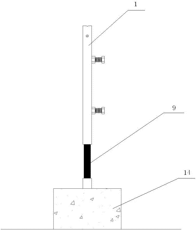
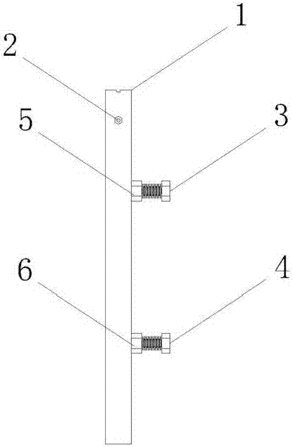
[0023] see Figure 1-7 , the reference line device for controlling road surface elevation and coordinates of the present invention includes a movable pipe 1, a fixed rod 9, and a base 14, wherein: the base 14 includes an embedded pipe 10, an encapsulating embedded pipe 10 encapsulating concrete 11, and Plastic pile number identification plate 12, the top of the embedded pipe 10 is a fixed elevation point; the movable pipe 1 is provided with a fixed nut A5 and a fixed nut B6, and the upper end of the movable pipe 1 is provided with a spring fixed bolt 2 perpendicular to the positioning bolt A, The spring 8 is fixed in the movable tube upper end pipe by the spring fixing bolt, and...


PUM


Abstract

The invention discloses a datum line device for controlling pavement elevation and coordinate. The datum line device comprises a movable pipe (1), a fixed rod (9), and a base (14), wherein the base (14) comprises an embedded pipe (10), encapsulation concrete (11) for encapsulating the embedded pipe (10), and a stake mark signboard (12), and the top end of the embedded pipe (10) is a fixed elevation point; a retaining nut A (5) and a retaining nut B (6) are arranged on the movable pipe (1); a spring fixing bolt (2) vertical to a positioning bolt A is arranged at the upper end head of the movable pipe (1); a spring (8) is fixedly in the upper end pipe of the movable pipe through a spring retaining bolt (2); the fixed rod (9) is fixed in the embedded pipe (10) of the base (14) by inserting into the same; the movable pipe (1) is fixed on the fixed rod (9) through the positioning bolt A (3) and the positioning bolt B (4) matched with the retaining nut A (5) and the retaining nut B (6). By using the datum line device disclosed by the invention, the measurement lofting work at each structure layer construction of a pavement can be completed in disposable, measure workers and equipment input are reduced, the measurement time is shortened, the working efficiency is improved, and the operation is simple.

Description

technical field [0001] The invention relates to the technical field of road surface construction, in particular to a reference line device for controlling road surface elevation and coordinates. Background technique [0002] In order to ensure that the cross slope, flatness, elevation and plane position of each structural layer of the pavement meet the design and specification requirements, and that the pavement is straight and beautiful after construction, measurement and stakeout control is required during the pavement construction process. The traditional road construction measurement and stakeout method is to carry out coordinate stakeout on both sides of the pavement according to the elevation and plane position of each structural layer of the road surface at an interval of 5m-10m. Before construction, mark the coordinate points at each place First, vertically drive the wire control pile (Φ15-25mm steel bar), and then fix the Φ2-3mm thick elevation control guide (stee...

Claims


Application Information

Patent Timeline
Patent Type & Authority Applications(China)
IPC IPC(8): E01C23/01
CPCE01C23/01
Inventor 向仕飞方锦郭德昌唐定成唐水国陶福德
Owner GUIZHOU ROAD & BRIDGE GRP
Learn More