Vehicle Lane Prediction Method and Lane Level Map

A prediction method and lane-level technology, applied in traffic control systems, instruments, traffic control systems, etc. of road vehicles, can solve problems that affect drivers' normal driving, and achieve the effect of improving prediction accuracy and accuracy

Active Publication Date: 2020-03-17
CHONGQING CHANGAN AUTOMOBILE CO LTD
View PDF9 Cites 0 Cited by
  • Summary
  • Abstract
  • Description
  • Claims
  • Application Information

AI Technical Summary

Problems solved by technology

[0003] The existing radar-based and V2X system-based intersection collision warning systems can only be used in two-dimensional plane traffic. In three-dimensional traffic, it is easy to mistake vehicles in different plane levels as potential threats and generate false warnings, which will affect the normal operation of drivers. drive

Method used


Image

  • Vehicle Lane Prediction Method and Lane Level Map
  • Vehicle Lane Prediction Method and Lane Level Map
  • Vehicle Lane Prediction Method and Lane Level Map

Examples


Embodiment Construction

[0083] The present invention will be further described below in conjunction with accompanying drawing.

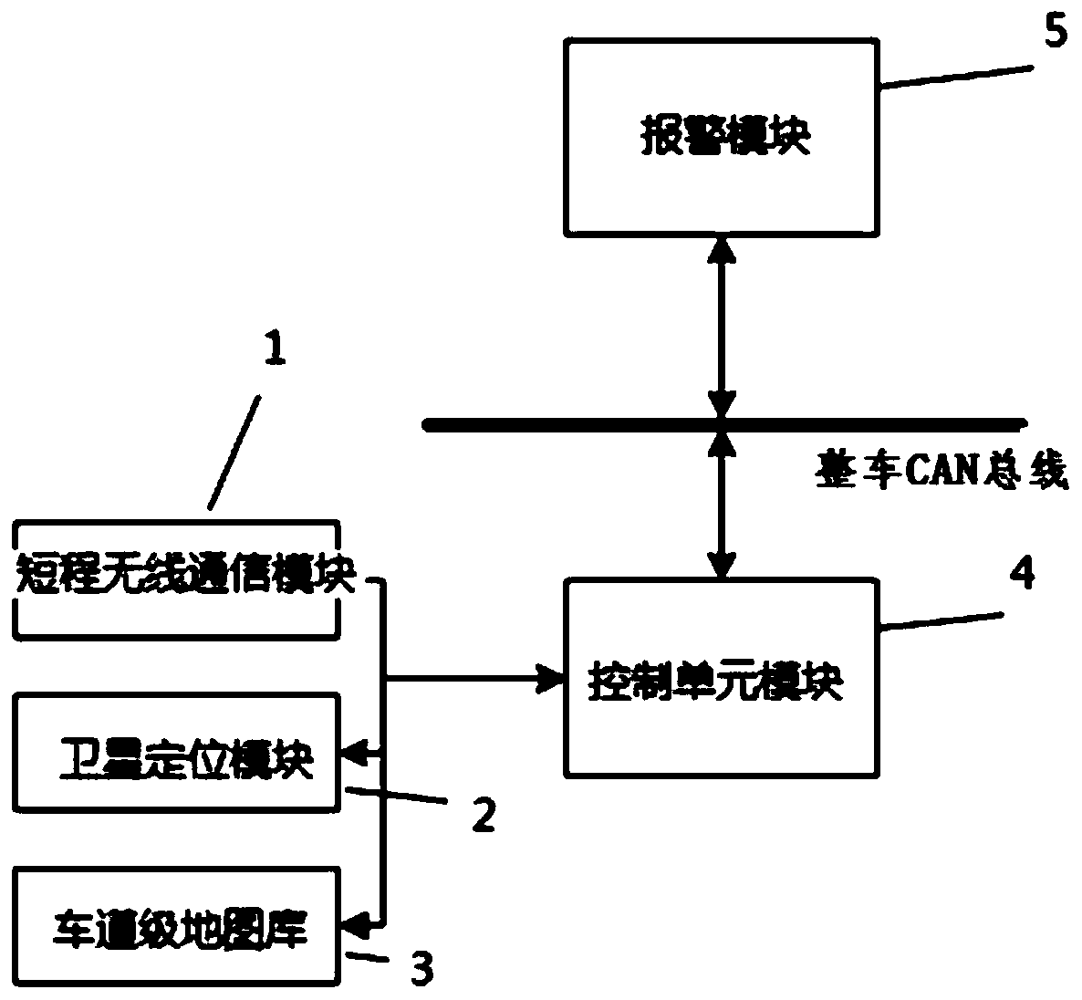
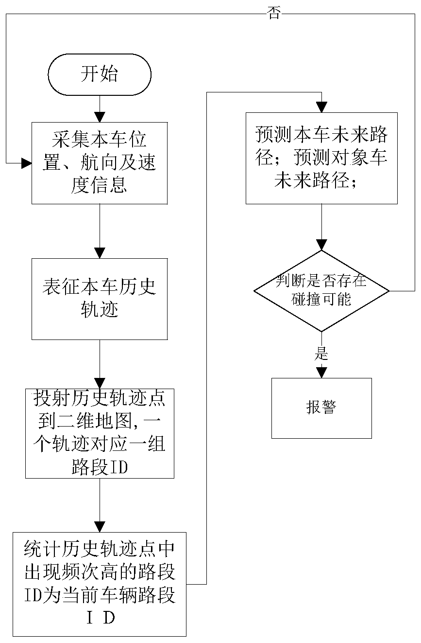
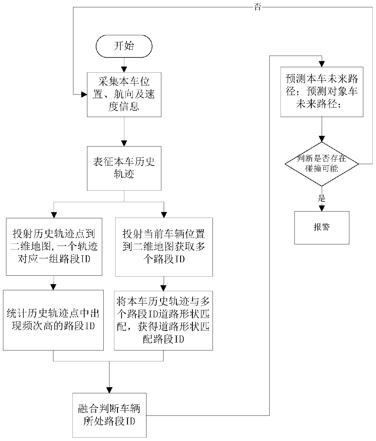
[0084] Such as figure 2 As shown, the vehicle lane prediction method includes the following steps,

[0085] 1) Retrieve the lane-level map in the vehicle information, the lane-level map includes a two-dimensional map and a unique road section ID number that can distinguish the three-dimensional space level of each road on the two-dimensional map;

[0086] 2) Collect and store historical traces:

[0087] Collect a set of vehicle position and heading information data for a period of time before the current time point through satellite positioning to form a set of vehicle driving history track points;

[0088] 3) Determine the ID number of the road section where the current vehicle is located:

[0089] Project a group of vehicle driving history trajectory points in step 2) onto the two-dimensional map in the lane-level map, one vehicle driving history trajectory point corr...


PUM


Abstract

The invention discloses a vehicle lane prediction method and a lane-level map, which can use historical trajectory data and lane-level map data to judge the level of the vehicle's current driving road section, especially in the case of overpasses and other road space level transitions, to judge the level of the vehicle. Whether it is at the same level as the target vehicle, and whether there is a risk of collision in the three-dimensional space range, thereby suppressing false alarms.

Description

technical field [0001] The invention belongs to the field of vehicle intelligent driving, and in particular relates to a road adaptive prediction method. Background technique [0002] Intersection Collision Warning System (ICWS) is an important part of Advanced Driver Assistance Systems (ADAS). For road traffic, it can prevent collision accidents at intersections and increase traffic efficiency at intersections. [0003] The existing radar-based and V2X system-based intersection collision warning systems can only be used in two-dimensional plane traffic. In three-dimensional traffic, it is easy to mistake vehicles in different plane levels as potential threats and generate false warnings, which will affect the normal operation of drivers. drive. [0004] Therefore, it is necessary to provide a vehicle road prediction method based on three-dimensional space. Before the vehicle collision warning, the spatial road information of the vehicle and the object vehicle can be judged...

Claims


Application Information

Patent Timeline
Patent Type & Authority Patents(China)
IPC IPC(8): G08G1/16
CPCG08G1/166G08G1/167
Inventor 邓杰李增文牛雷张盼蒲果刘鑫
Owner CHONGQING CHANGAN AUTOMOBILE CO LTD
Why Eureka
Try Eureka