

Population density analyzing system based on high resolution satellite remote sensing data
A technology for satellite remote sensing data and population density, which is applied in the field of population density analysis systems based on high-resolution satellite remote sensing data combined with ground object types, can solve problems such as poor accuracy and unknown population distribution, and achieve high accuracy.
- Summary
- Abstract
- Description
- Claims
- Application Information
AI Technical Summary
Problems solved by technology
Method used
Image

Examples
Embodiment Construction
[0046] Embodiments of the technical solutions of the present invention will be described in detail below in conjunction with the accompanying drawings. The following examples are only used to illustrate the technical solution of the present invention more clearly, so they are only examples, and should not be used to limit the protection scope of the present invention.
[0047] It should be noted that, unless otherwise specified, the technical terms or scientific terms used in the present application shall have the usual meanings understood by those skilled in the art to which the present invention belongs.
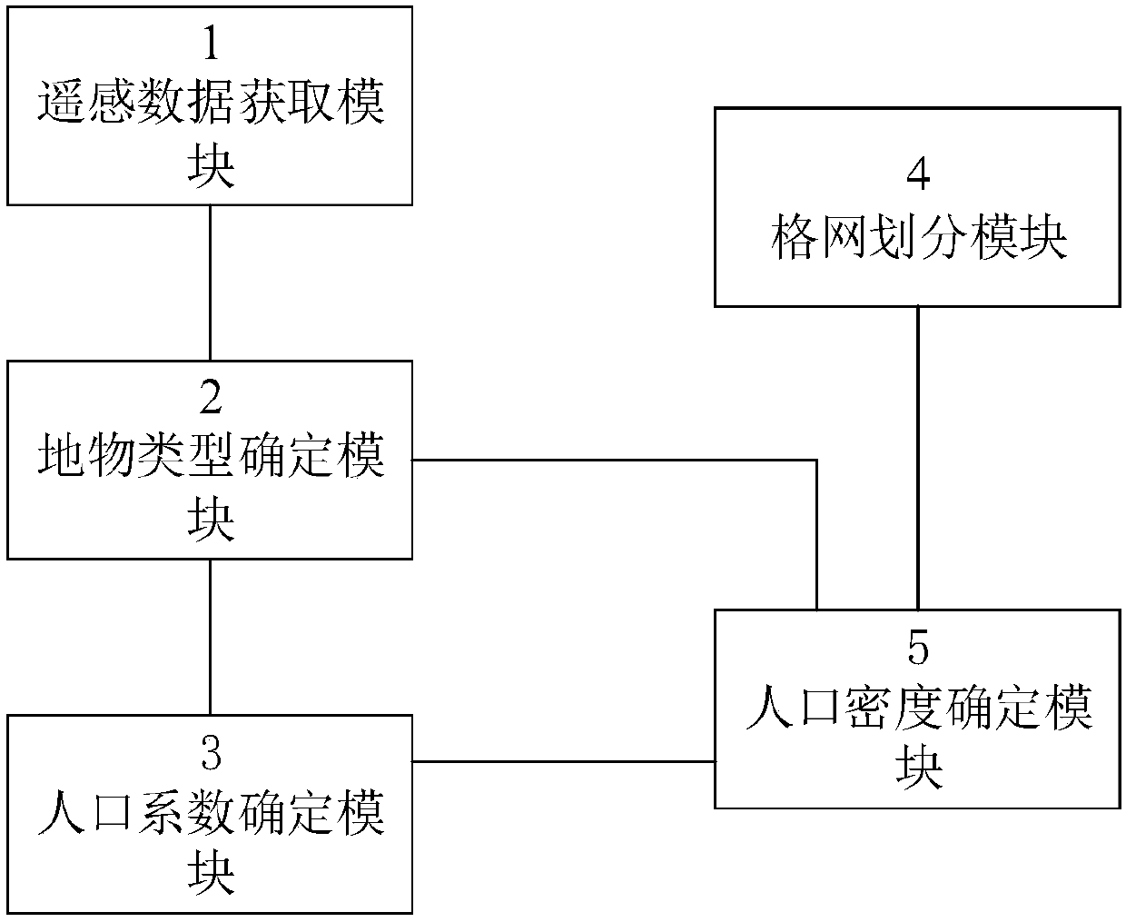
[0048] The invention provides a population density analysis system based on high-resolution satellite remote sensing data combined with surface object types. Embodiments of the present invention will be described below in conjunction with the accompanying drawings.
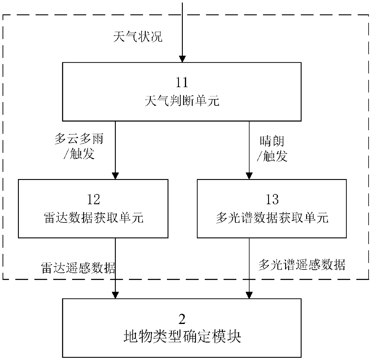
[0049] figure 1 A schematic diagram of a population density analysis system based on high-resolution sate...
PUM
 Abstract
Description
Claims
Application Information