Achieving method for automatically publishing road construction quality information map based on GeoServer
A technology of road construction and quality information, applied in the field of Internet and software engineering, can solve problems such as huge data processing and data analysis work
- Summary
- Abstract
- Description
- Claims
- Application Information
AI Technical Summary
Problems solved by technology
Method used
Image
Examples
Embodiment Construction
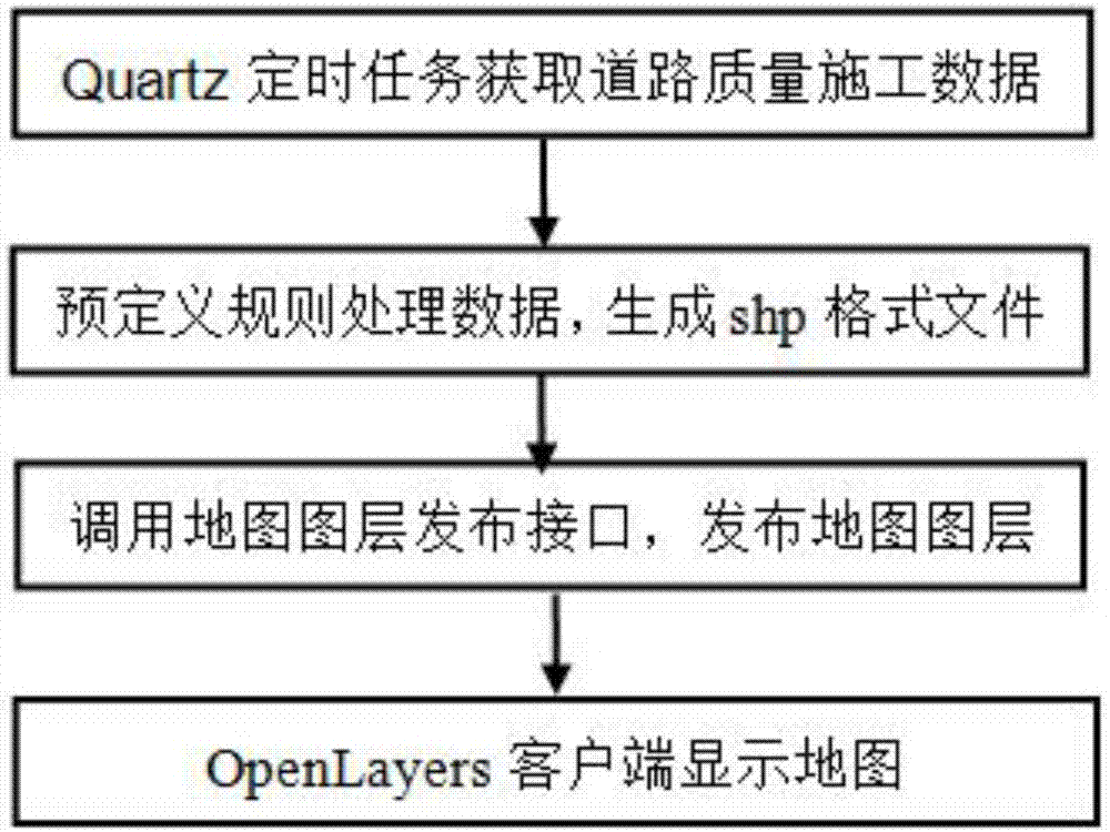
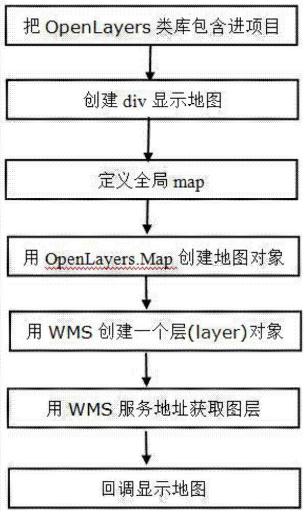
[0031] The present invention will be described in further detail below in conjunction with the accompanying drawings.
[0032] Step 1: Deploy the GeoServer service.
[0033] Users can publish and generate map layers through the deployed GeoServer service. The GeoServer service not only provides a graphical interface to publish layers, but also provides an interface publishing method. Developers can call the interface to publish layers, which provides us with the feasibility of automatically publishing road construction quality maps.
[0034] For how to deploy the GeoServer service and publish map layers through the service, the official provides related toolkits.
[0035]First go to the official website to download the GeoServer service web program, and then deploy it to the tomcat server. You can access the GeoServer service through the running tomcat server; then access the GeoServer service through the default user information, and configure the service: set the workspace ...
PUM
 Abstract
Description
Claims
Application Information
 - R&D
- Intellectual Property
- Life Sciences
- Materials
- Tech Scout
- Unparalleled Data Quality
- Higher Quality Content
- 60% Fewer Hallucinations
Browse by: Latest US Patents, China's latest patents, Technical Efficacy Thesaurus, Application Domain, Technology Topic, Popular Technical Reports.
© 2025 PatSnap. All rights reserved.Legal|Privacy policy|Modern Slavery Act Transparency Statement|Sitemap|About US| Contact US: help@patsnap.com


