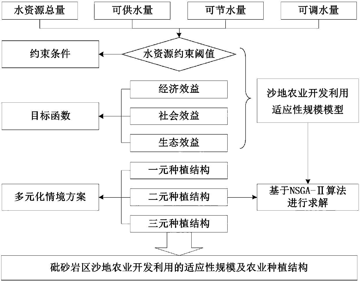
Determination method for sandy land agricultural development and utilization adaptability scale of sandstone area
A deterministic, adaptive technology that can be used in data processing applications, instruments, forecasting, etc., to solve problems such as water shortages
- Summary
- Abstract
- Description
- Claims
- Application Information
AI Technical Summary
Problems solved by technology
Method used
Image
Examples
Embodiment
[0093] A method for determining the adaptive scale of agricultural development and utilization of sandy land in the sandstone area of the present invention, such as figure 1 As shown, the specific steps are as follows:
[0094] Step 1, calculate the water resource constraint threshold;
[0095] Taking Yuyang District of Yulin City as a typical demonstration area for research; Yuyang District of Yulin City is located in the north-central part of Yulin City, Shaanxi Province, on the middle reaches of the Wuding River, adjacent to Shenmu in the east, bordering on Inner Mongolia in the northwest, and Jiaxian County and Mizhi County in the southeast Handover; Yuyang District is located in the hinterland of the Mu Us Sandy Land, about 30km north of the Great Wall; there are a large number of arsenic sandstone and sand widely distributed around the area, which is a typical wind-sand grass beach area;
[0096] Taking 2013 as the current year, collect and analyze the basic data of w...
PUM
 Abstract
Description
Claims
Application Information
 - R&D
- Intellectual Property
- Life Sciences
- Materials
- Tech Scout
- Unparalleled Data Quality
- Higher Quality Content
- 60% Fewer Hallucinations
Browse by: Latest US Patents, China's latest patents, Technical Efficacy Thesaurus, Application Domain, Technology Topic, Popular Technical Reports.
© 2025 PatSnap. All rights reserved.Legal|Privacy policy|Modern Slavery Act Transparency Statement|Sitemap|About US| Contact US: help@patsnap.com


