
Terrestrial positioning system calibration

A map and map layer technology, applied in positioning, radio wave measurement system, service based on location information, etc., can solve problems such as resource-intensive and cumbersome calibration procedures

Inactive Publication Date: 2018-01-23
QUALCOMM INC
View PDF4 Cites 6 Cited by
  • Summary
  • Abstract
  • Description
  • Claims
  • Application Information

AI Technical Summary

Problems solved by technology

[0010] However, current calibration procedures are cumbersome and resource-intensive, and often involve active field data collection in the vicinity of each cell transmitter in the network

Method used


Image

  • Terrestrial positioning system calibration
  • Terrestrial positioning system calibration
  • Terrestrial positioning system calibration

Examples


Embodiment Construction

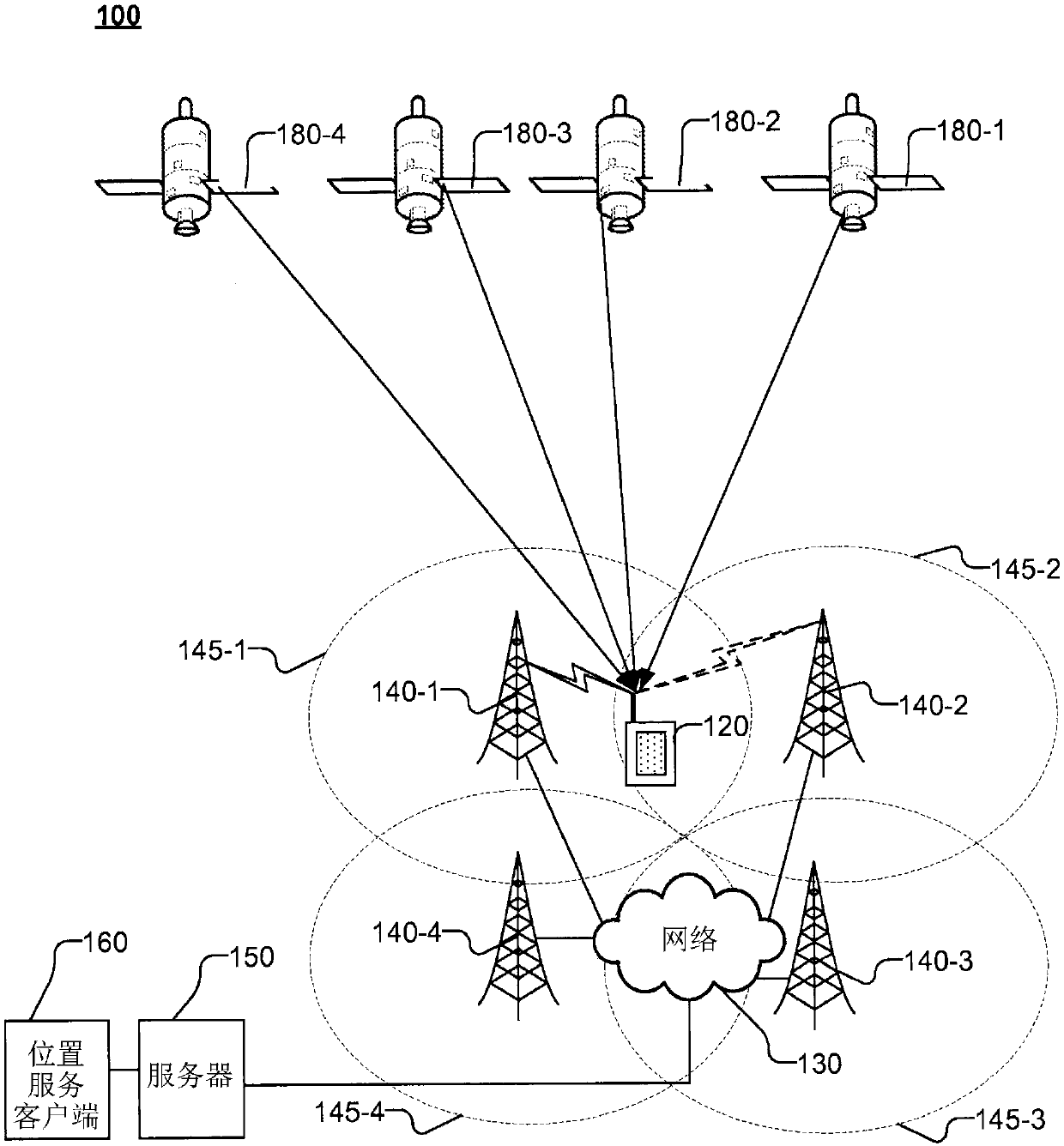
[0037] The terms "mobile station (MS)", "user equipment (UE)" or "target" are used interchangeably herein and may refer to a device such as a cellular or other wireless communication device, personal communication system (PCS ) device, personal navigation device (PND), personal information manager (PIM), personal digital assistant (PDA), laptop computer, or other suitable mobile device capable of receiving wireless communication and / or navigation signals. The term is also intended to encompass a device that communicates with a personal navigation device (PND), such as by short-range wireless, infrared, wired or other connection, regardless of whether satellite signal reception, assistance data reception, and / or Position-dependent processing. A MS may represent a mobile phone, a notebook computer or a laptop computer, or it may be a vehicle here collecting measurement sets for the purpose of generating street maps and / or delay and / or signal strength maps.

[0038] Additionally...


PUM


Abstract

The invention relates to terrestrial positioning system calibration. Embodiments disclosed aggregate a plurality of crowdsourced measurement sets for antennas received from a plurality of Mobile Stations (MS) with a Base Station Almanac (BSA), based on a measurement location estimate and a measurement location uncertainty estimate associated with each measurement set. A map comprising a pluralityof map layers may be obtained, wherein each map layer associates locations in the BSA with spatially variable Forward Link Calibration (FLC) values for the antenna derived from the updated BSA data. Each spatially variable FLC value is associated with a corresponding location in the updated BSA data. Map layers, which may also include multipath map and / or received signal strength layers, may be provided to MS as location assistance data.

Description

[0001] Information about divisional applications [0002] This case is a divisional application. The parent case of this divisional case is an invention patent application with an application date of February 6, 2014, an application number of 201480007489.3, and an invention title of "Ground Positioning System Calibration". [0003] Cross References to Related Applications [0004] This application claims the benefit and priority of U.S. Application Serial No. 14 / 173,717, filed February 5, 2014, entitled "Terrestrial Positioning System Calibration," which in turn claims application filed February 7, 2013, entitled "Cloud Based Calibration of Terrestrial Positioning Systems, U.S. Provisional Application No. 61 / 762,305, U.S. Provisional Application No. 61 / 807,662, filed April 2, 2013, entitled "Determination of Differential Forward Link Calibration in LTE Networks for Positioning", U.S. Provisional Application No. 61 / 817,813, filed April 30, 2013, entitled "Determination of D...

Claims


Application Information

Patent Timeline
Patent Type & Authority Applications(China)
IPC IPC(8): G01S5/02H04W4/02H04W4/029
CPCG01S5/021G01S5/0215G01S5/0236H04W4/02G01S5/02525G01S5/0218G01S5/012G01S5/0273H04W4/029
Inventor 格朗·亚历山大·马歇尔马克·利奥·默格里恩
Owner QUALCOMM INC
Learn More