
Method for generating microwave spectrum hybrid image based on vegetation distribution

A technology of vegetation distribution and spectral mixing, applied in the field of geographic information system and remote sensing, can solve the problems of low precision of plant distribution area, inability to see geographical and biological significance, and achieve the goal of improving spatial resolution and high spatial resolution Effect

Active Publication Date: 2018-02-02
GEOVIS CO LTD
View PDF2 Cites 0 Cited by
  • Summary
  • Abstract
  • Description
  • Claims
  • Application Information

AI Technical Summary

Problems solved by technology

[0005] At present, the research on the classification of land vegetation distribution at home and abroad is currently mainly concentrated in the classification of medium and low resolution remote sensing images, often unable to see the clear geographical and biological significance, and the accuracy of the extracted plant distribution area is low

Method used


Image

  • Method for generating microwave spectrum hybrid image based on vegetation distribution
  • Method for generating microwave spectrum hybrid image based on vegetation distribution

Examples


Embodiment Construction

[0027] In order to better understand the present invention, the method of the present invention will be further described below with reference to the description of the embodiments in conjunction with the accompanying drawings.

[0028] In the following detailed description, numerous specific details are set forth in order to provide a thorough understanding of the present invention. However, it will be understood by those skilled in the art that the present invention may be practiced without these specific details. In the embodiments, well-known methods, procedures, components have not been described in detail so as not to unnecessarily obscure the embodiments.

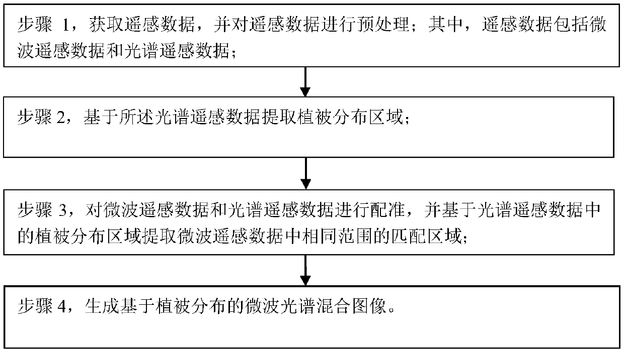
[0029] see figure 1 As shown, a method for generating a microwave spectrum mixed image based on vegetation distribution of the present invention is characterized in that it comprises the following steps:

[0030] Step 1, obtaining remote sensing data, and preprocessing the remote sensing data; wherein, the remote s...


PUM


Abstract

The invention discloses a method for generating a microwave spectrum hybrid image based on vegetation distribution. The method is characterized by comprising the steps of: acquiring remote sensing data and preprocessing the remote sensing data, wherein the remote sensing data comprises microwave remote sensing data and spectral remote sensing data; extracting a vegetation distribution region basedon the spectral remote sensing data; registering the microwave remote sensing data and the spectral remote sensing data, and extracting matched regions in the same range in the microwave remote sensing data based on the vegetation distribution region in the spectral remote sensing data; and generating the microwave spectrum hybrid image based on vegetation distribution. The method integrates theadvantages of microwave remote sensing and spectral remote sensing, overcomes the defect that features of land and plant distribution cannot be comprehensively characterized by using a remote sensingtechnology independently, improves the spatial resolution of microwave-spectrum hybrid pixels according to specific brightness temperature and distribution positions of vegetation, and can obtain high-spatial-resolution surface feature brightness temperature and vegetation distribution information.

Description

Technical field: [0001] The invention relates to the technical fields of geographic information system and remote sensing, in particular to a method for generating a microwave spectrum mixed image based on vegetation distribution. Background technique: [0002] Remote sensing technology, as the cutting-edge technology of earth information science, can continuously obtain large-scale ground information in a short period of time, realize rapid collection and quantitative analysis of vegetation information, respond quickly, and have strong objectivity. It is currently the most effective earth observation technology and information means of acquisition. [0003] The wavelength of microwave remote sensing in remote sensing technology is generally from 1cm-1m. Due to the longer wavelength, its energy can penetrate clouds, fog, sand and dust, and other atmospheric states except heavy rain. These advantages enable spaceborne passive microwave remote sensing to monitor the microwave...

Claims


Application Information

Patent Timeline
Patent Type & Authority Applications(China)
IPC IPC(8): G06T7/30G06T7/10
CPCG06T2207/10036
Inventor 李会丹刘成基李海侠
Owner GEOVIS CO LTD
Learn More