Coastline matching based infrared remote sensing image sea-land segmentation method

A remote sensing image, sea and land segmentation technology, applied in image analysis, image enhancement, image data processing, etc., can solve the problems of edge loss and discontinuity, and achieve the effect of avoiding segmentation errors, improving efficiency, and reducing a large number of holes

Active Publication Date: 2018-04-13
BEIHANG UNIV
View PDF5 Cites 11 Cited by
  • Summary
  • Abstract
  • Description
  • Claims
  • Application Information

AI Technical Summary

Problems solved by technology

This method is good for images with simple land environment and obvious coastline grayscale changes, but for complex land environment

Method used


Image

  • Coastline matching based infrared remote sensing image sea-land segmentation method
  • Coastline matching based infrared remote sensing image sea-land segmentation method
  • Coastline matching based infrared remote sensing image sea-land segmentation method

Examples


Embodiment Construction

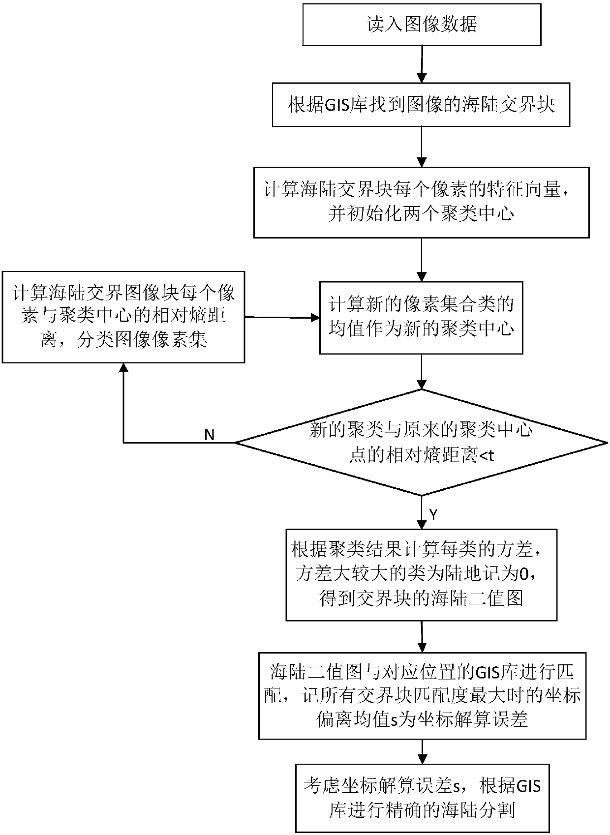
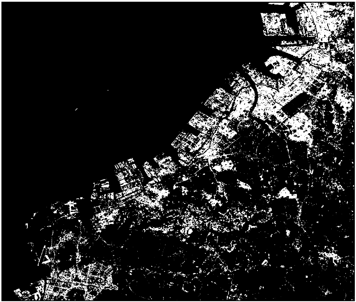
[0039] Next, use figure 2 The infrared remote sensing image with the highest resolution shown is the image to be segmented. The specific implementation steps of the GIS-based sea-land segmentation method for infrared remote sensing images provided by this application are described in detail. For the processing flow, see figure 1 . figure 2 The size of the medium remote sensing image is 7680 pixels × 7680 pixels.

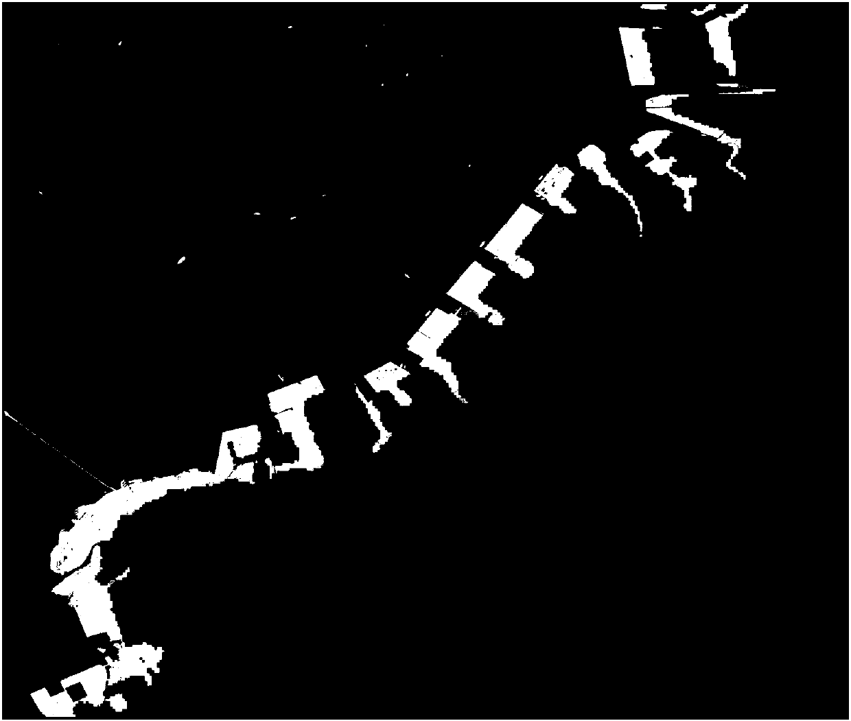
[0040] Step 1: According to the GIS library information, the figure 2 Carry out sea and land segmentation, the segmentation result is as follows image 3 ,Bundle figure 2 Divide it into blocks of m×m size, calculate the geographical coordinates of the upper left corner and lower right corner of the image block, take the block between these two points in the GIS database, sample to the same size as the original image block, and find the sea-land junction block such as Figure 4 ;

[0041] Step 2: Use k-means to sequentially Figure 4 The sea-land junction bl...


PUM


Abstract

The invention discloses a GIS based infrared remote sensing image ship detection method, which mainly comprises the steps of firstly finding out a sea-land boundary image block by using information ofa GIS library, and extracting feature vectors of the image; then performing clustering on the feature vectors of the image by using an improved k-means method to obtain a sea-land segmentation binaryimage of the image block; and finally performing sliding matching in the GIS library at the corresponding position by using the obtained binary image to find out a position with the highest matchingdegree to serve as an error value of coordinate calculation, performing coordinate correction by using the value, and acquiring a final sea-land segmentation result.

Description

technical field [0001] The application belongs to the technical field of digital image processing, and relates to a method for segmenting land and sea in remote sensing images, more specifically, a method for segmenting land and sea in infrared remote sensing images based on GIS. Background technique [0002] Our country has a vast sea area and rich marine resources. As an important carrier of maritime transportation, ships have broad application prospects. Ship target detection is the task of various coastal countries in the world: in terms of civilian use, it can monitor the shipping traffic conditions in various ports, quickly search for ships in distress, monitor illegal fishing ships and immigrants, and combat illegal dumping of oil pollution and smuggling; in military Above all, it can monitor the enemy's maritime military strength and deployment, form maritime military intelligence, and maintain national security and territorial integrity. Satellite remote sensing te...

Claims


Application Information

Patent Timeline
IPC IPC(8): G06K9/00G06K9/46G06K9/62G06T7/10
CPCG06T7/10G06T2207/10048G06T2207/10032G06V20/13G06V10/462G06F18/23213
Inventor 肖慧慧李波赵鹏季艳
Owner BEIHANG UNIV
Why Eureka
Try Eureka