A No-Fly Zone Recognition and Navigation System with Arbitrary Graphics for Unmanned Aerial Vehicles
A technology for identifying navigation and drones, applied in radio wave measurement systems, satellite radio beacon positioning systems, navigation computing tools, etc., can solve problems such as low algorithm complexity, illegal flights, and difficult hardware deployment
- Summary
- Abstract
- Description
- Claims
- Application Information
AI Technical Summary
Problems solved by technology
Method used
Image
Examples
Embodiment Construction
[0050] Below in conjunction with accompanying drawing, technical scheme of the present invention is described in further detail:
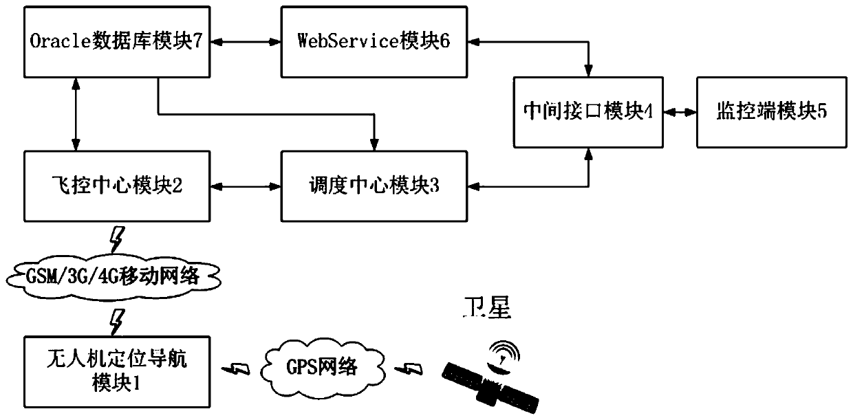
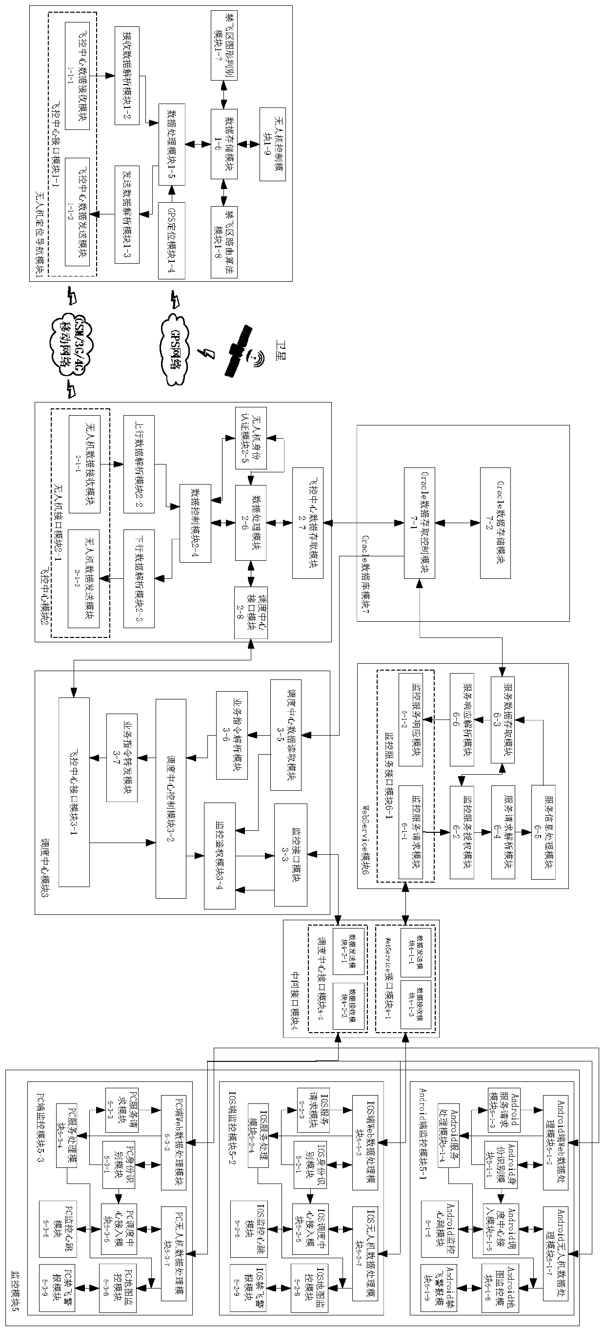
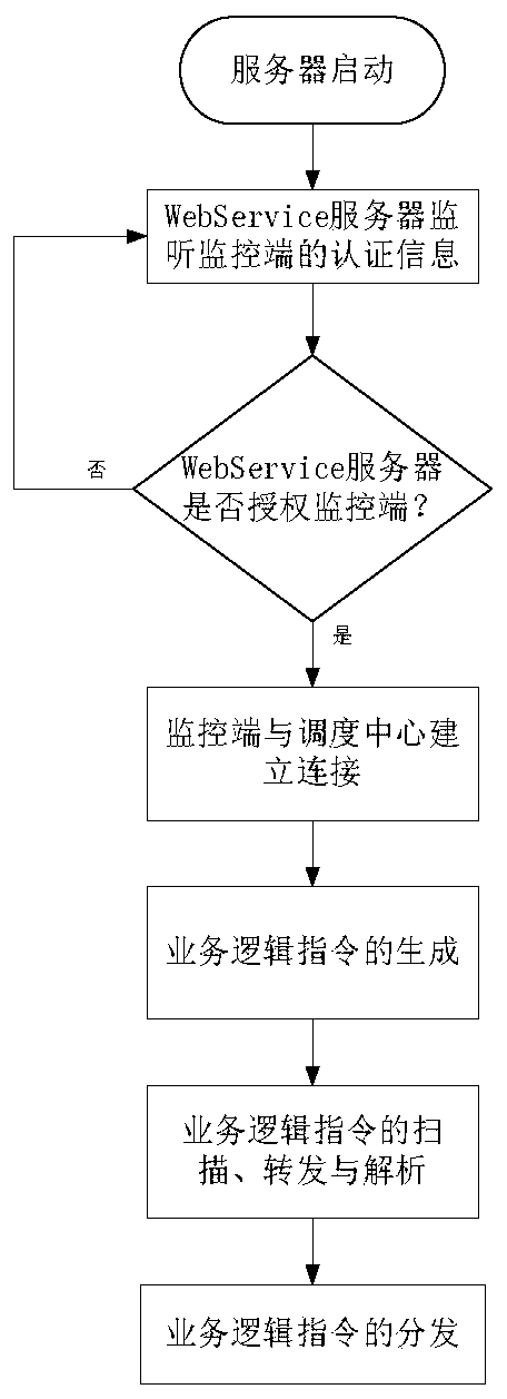
[0051] Such as figure 1 and figure 2 As shown, a kind of unmanned aerial vehicle arbitrary graphics no-fly zone identification navigation system provided by the present invention has: unmanned aerial vehicle positioning and navigation module 1, flight control center module 2, dispatching center module 3, intermediate interface module 4, monitoring module 5, WebService module 6, Oracle database module 7. The present invention is applicable to UAV positioning terminals that can send GSM / 3G / 4G signals and monitoring clients that can access the Internet. The positioning terminals are usually set on UAVs that need to be monitored and dispatched, and the monitoring clients are kept in unmanned machine user side. The UAV positioning and navigation module uses the TCP / IP protocol to transmit data through the flight control center interface module 1-1 a...
PUM
 Abstract
Description
Claims
Application Information
 - R&D
- Intellectual Property
- Life Sciences
- Materials
- Tech Scout
- Unparalleled Data Quality
- Higher Quality Content
- 60% Fewer Hallucinations
Browse by: Latest US Patents, China's latest patents, Technical Efficacy Thesaurus, Application Domain, Technology Topic, Popular Technical Reports.
© 2025 PatSnap. All rights reserved.Legal|Privacy policy|Modern Slavery Act Transparency Statement|Sitemap|About US| Contact US: help@patsnap.com


