
A Correction Method of Spatial Scale Error of Leaf Area Index Based on Wavelet Transform
A leaf area index and wavelet transform technology, applied in the field of correction, can solve the problems of affecting the correction accuracy of scale errors, the estimation cannot be separated, and the large error of the nonlinearity of the inversion model. Effect of Remote Sensing Inversion Accuracy
- Summary
- Abstract
- Description
- Claims
- Application Information
AI Technical Summary
Problems solved by technology
Method used
Image


Examples
Embodiment Construction
[0046] The present invention will be further described in detail below in conjunction with the accompanying drawings and specific embodiments.
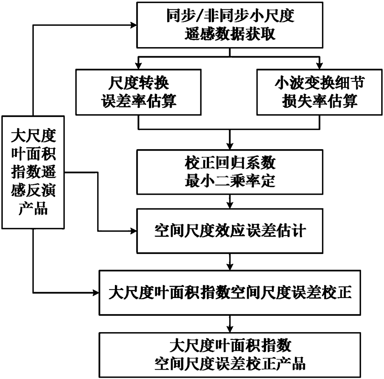
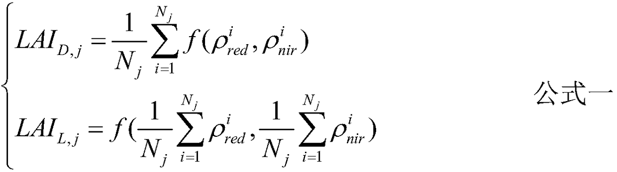
[0047] figure 1 A wavelet transform-based error correction method for leaf area index spatial scale is shown, which is to perform wavelet transform on the small-scale leaf area index products obtained from the inversion of synchronous / non-synchronous red light and near-infrared band surface reflectance data. Establishing the relationship between scale conversion error rate and wavelet transform detail loss rate to estimate the spatial scale error of leaf area index, so as to realize the error correction method of large-scale leaf area index products. The present invention is mainly divided into the following six steps: synchronous / asynchronous small-scale remote sensing data acquisition; scale conversion error rate estimation; wavelet transform detail loss rate estimation; correction regression coefficient least square rate determinat...
PUM
 Abstract
Description
Claims
Application Information