
Arcgis-based vector data parallel processing method and system

A vector data and parallel processing technology, which is applied in special data processing applications, database indexing, geographic information databases, etc., can solve problems such as low processing efficiency of vector big data, low utilization of computing resources, and parallel processing of big vector data

Active Publication Date: 2020-05-22
湖北地信科技集团股份有限公司
View PDF4 Cites 0 Cited by
  • Summary
  • Abstract
  • Description
  • Claims
  • Application Information

AI Technical Summary

Problems solved by technology

[0003] The technical problem to be solved by the present invention is that the above-mentioned existing ArcGIS vector data processing tools cannot use parallel computing resources to process large vector data in parallel, resulting in technical defects of low processing efficiency of large vector data and low utilization of computing resources , providing a method and system for parallel processing of vector data based on ArcGIS

Method used


Image

  • Arcgis-based vector data parallel processing method and system
  • Arcgis-based vector data parallel processing method and system

Examples


Embodiment Construction

[0058] In order to have a clearer understanding of the technical features, purposes and effects of the present invention, the specific implementation manners of the present invention will now be described in detail with reference to the accompanying drawings.

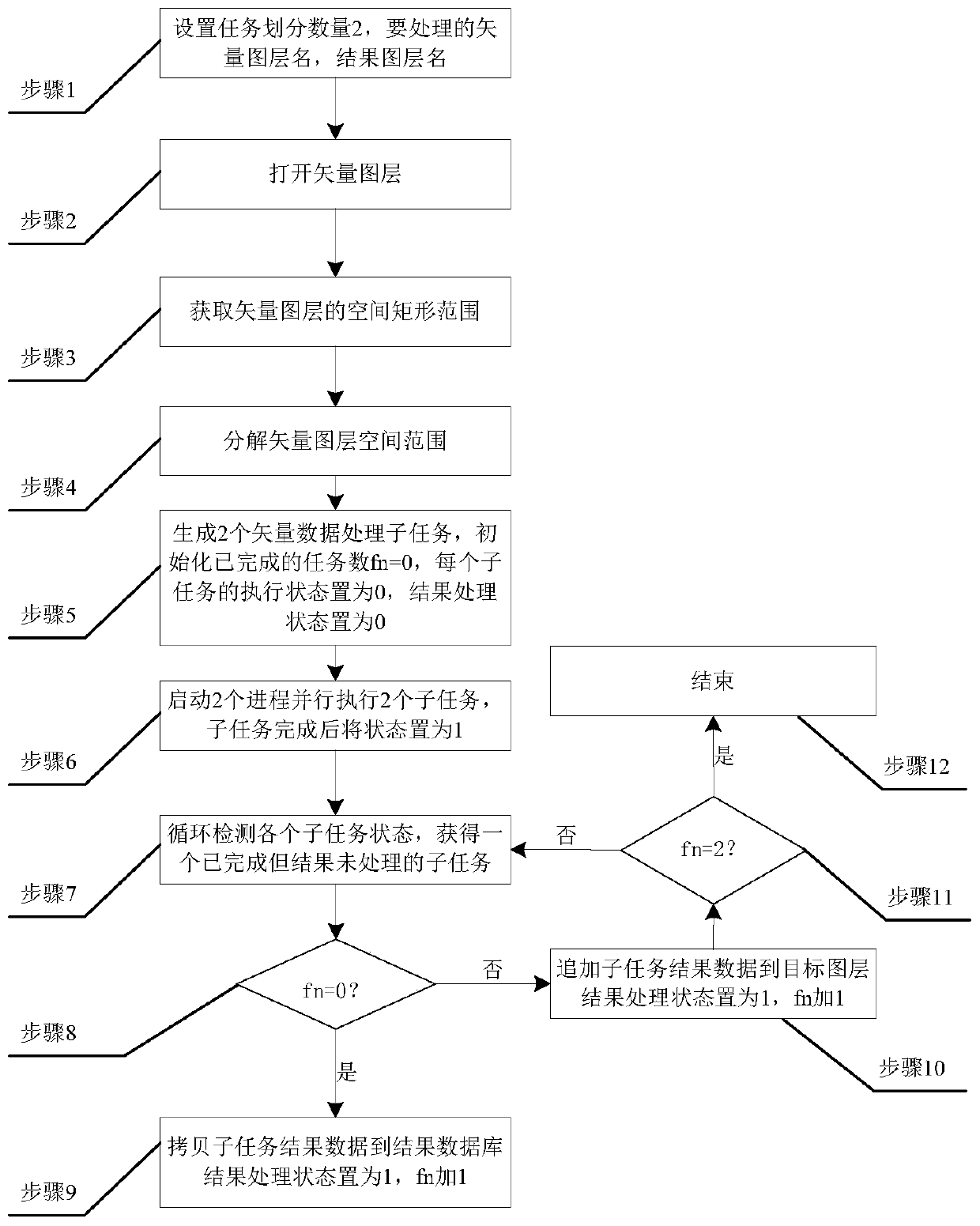
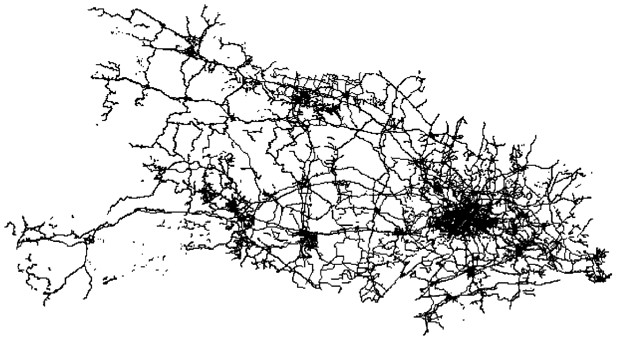
[0059] In order to illustrate the idea of ​​the present invention more clearly, the vector data parallel processing method based on ArcGIS is further described below, and the flow chart of an embodiment of the ArcGIS-based vector data parallel processing method adopted in this embodiment is as follows figure 1 As shown, this embodiment uses the road vector data of Hubei Province as example data, such as figure 2 As shown, it is stored in the spatial database Default.gdb, the layer name is HUBEIROAD, the coordinates of the lower left corner of the spatial range are (108.416417, 29.065332), and the coordinates of the upper right corner are (116.127877, 33.258084). The smooth line in ArcGIS (Smooth Line) processing tool a...


PUM


Abstract

The invention discloses an ArcGIS-based vector data parallel processing method and system. The method comprises: acquiring a spatial range of a vector layer to be processed, dividing the spatial rangeinto multiple sub-spatial ranges, constructing multiple subtask information, starting multiple processes, setting ambient variable parameters of an ArcGIS vector data processing tool, calling the ArcGIS vector data processing tool, executing multiple subtasks, copying a resultant layer to a resultant database for the firstly completed subtask, and adding resultant data of the other subtasks sequentially to the resultant layer. The ArcGIS-based vector data parallel processing method and system have the advantages that vector big data processing tasks can be divided spatially into multiple calculation subtasks, the subtasks are parallelly processed with the ambient variable parameters of the ArcGIS vector data processing tool by using a multi-process technique and calling multiple ArcGIS vector data processing tools, parallel acceleration can be achieved for ArcGIS vector data processing, and vector big data can be processed more efficiently with ArcGIS.

Description

technical field [0001] The invention relates to high-performance geospatial computing technology, in particular to an ArcGIS-based vector data parallel processing method and system. Background technique [0002] The fast real-time processing of vector big data is one of the key problems to be solved in high-performance spatial computing. In the multi-core cluster parallel computing environment, the use of multi-thread or multi-process technology can make full use of parallel computing resources and realize the parallel computing of intensive tasks. accelerate. Due to the complex storage and calculation of vector data, the existing ArcGIS vector data processing tools cannot use parallel computing resources to process large vector data in parallel, resulting in low processing efficiency and low utilization of computing resources. Contents of the invention [0003] The technical problem to be solved by the present invention is that the above-mentioned existing ArcGIS vector ...

Claims


Application Information

Patent Timeline
Patent Type & Authority Patents(China)
IPC IPC(8): G06F16/29G06F16/22
CPCG06F16/2237G06F16/29
Inventor 郭明强黄颖谢忠关庆锋吴亮刘袁缘
Owner 湖北地信科技集团股份有限公司
Learn More