Unmanned aerial vehicle cluster intelligent geographical routing method of Q-learning

A geographical routing and UAV technology, applied in the field of UAV cluster networking, can solve problems such as frequent retransmissions, failure to consider link status or location errors, obstacles, etc., to improve robustness and solve path problems unreliable effect

Inactive Publication Date: 2018-05-15
BEIJING UNIV OF TECH
View PDF3 Cites 16 Cited by
  • Summary
  • Abstract
  • Description
  • Claims
  • Application Information

AI Technical Summary

Problems solved by technology

[0005] Generally, location-based routing protocols aim at maximizing packet transmission distance, lack of understanding of network dynamic time-varying behavior, and do not take into account the influence of factors such as link status or location error when selecting forwarding nodes, and the resulting interference / Blocking causes frequent retransmissions

Method used


Image

  • Unmanned aerial vehicle cluster intelligent geographical routing method of Q-learning
  • Unmanned aerial vehicle cluster intelligent geographical routing method of Q-learning
  • Unmanned aerial vehicle cluster intelligent geographical routing method of Q-learning

Examples


Embodiment Construction

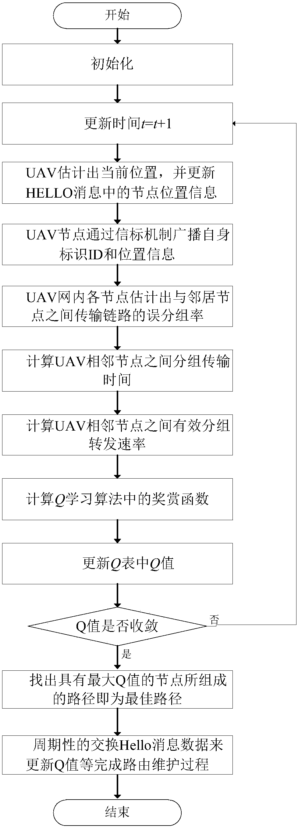
[0024] The present invention will be further described below in conjunction with the accompanying drawings and implementation steps.

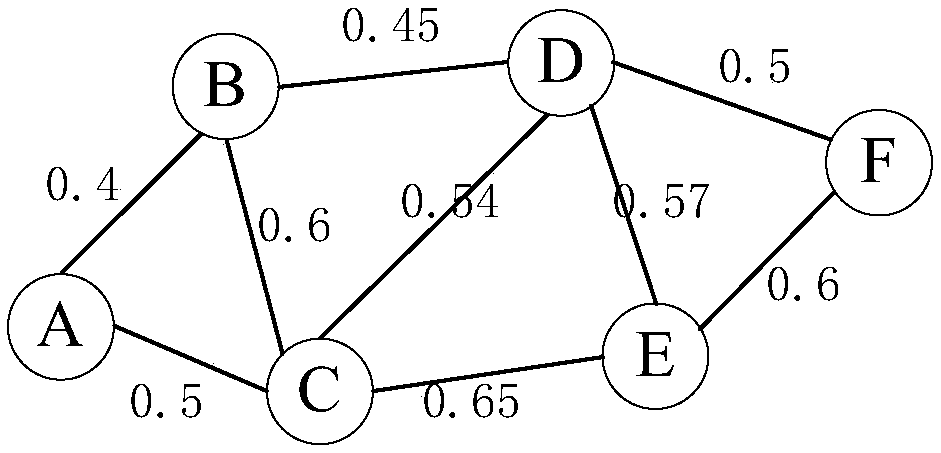
[0025] Such as figure 1 Shown, the present invention provides a kind of UAV swarm intelligent geographical routing method of Q learning, comprises the following steps:

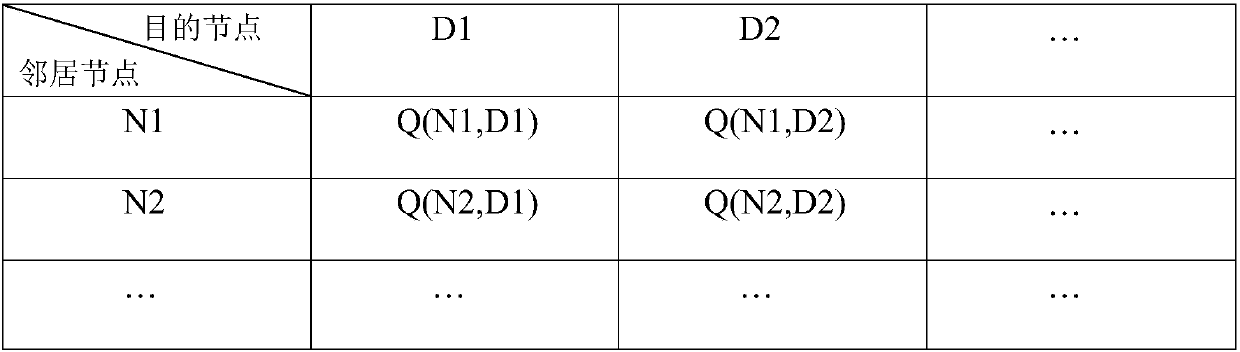
[0026] Step (1): Each node in the UAV cluster network sets the initial time t=0, and the Q value function Q(s i ,a i )=0, where s i Neighbor nodes selected for the next hop of each node i, a i To perform routing actions according to the state, they constitute the state-action set {s i ,a i}.

[0027] Step (2): update time t=t+1.

[0028] Step (3): The UAV node uses the installed GPS to report the current location, and updates the node location information in the Hello message.

[0029] Step (4): The UAV node broadcasts its own identification ID and address location information through the beacon mechanism, so that each member in the network can obtain the address inform...


PUM


Abstract

The invention provides an unmanned aerial vehicle cluster intelligent geographical routing method of Q-learning. The method comprises the following steps: distributing an autonomous learning task to each network by adopting the advantage of continuously exchanging information with surrounding environment to obtain an optimal solution of a Q-learning algorithm, and computing an award function in the Q-learning algorithm by using effective packet forwarding rate when the influences on the packet transmission performance by the link quality state and the transmission distance are considered at the same time. Each node performs the dynamic adjusting by periodically exchanging information with a neighbor node so as to search the optimal routing path, the problem that the path is unreliable dueto the topology change in a UAV cluster network is effectively solved.

Description

technical field [0001] The invention belongs to the field of unmanned aerial vehicle cluster networking, and in particular relates to a Q-learning intelligent geographic routing method for unmanned aerial vehicle clusters. Background technique [0002] Unmanned Aerial Vehicle (UAV) has the advantages of multi-purpose, strong flexibility and low cost, so it has received extensive attention in military and civilian fields. The multi-UAV collaborative application has the advantages of stronger survivability and higher scalability than a single UAV, but it also brings practical problems in the cooperative communication among multi-UAVs. Therefore, it is necessary to design a multi-UAV communication network that meets the needs of future development. As an important development direction of UAV clustering, networking, and intelligence, UAV ad hoc network is an emerging UAV cluster application mode. [0003] UAV ad hoc network uses a dynamic network to complete the interconnecti...

Claims


Application Information

Patent Timeline
Patent Type & Authority Applications(China)
IPC IPC(8): H04W40/04H04W40/24
CPCH04W40/04H04W40/248
Inventor 黎海涛
Owner BEIJING UNIV OF TECH
Why Eureka
Try Eureka