AR-HUD navigation system utilizing GPS data and navigation method
A GPS data and navigation system technology, applied in the automotive field, can solve the problems of large deviation of GPS positioning vehicle position, loss of GPS signal, low update frequency of GPS signal, etc., and achieve good continuity, low refresh frequency, and low real-time effect
- Summary
- Abstract
- Description
- Claims
- Application Information
AI Technical Summary
Problems solved by technology
Method used
Image
Examples
Embodiment Construction
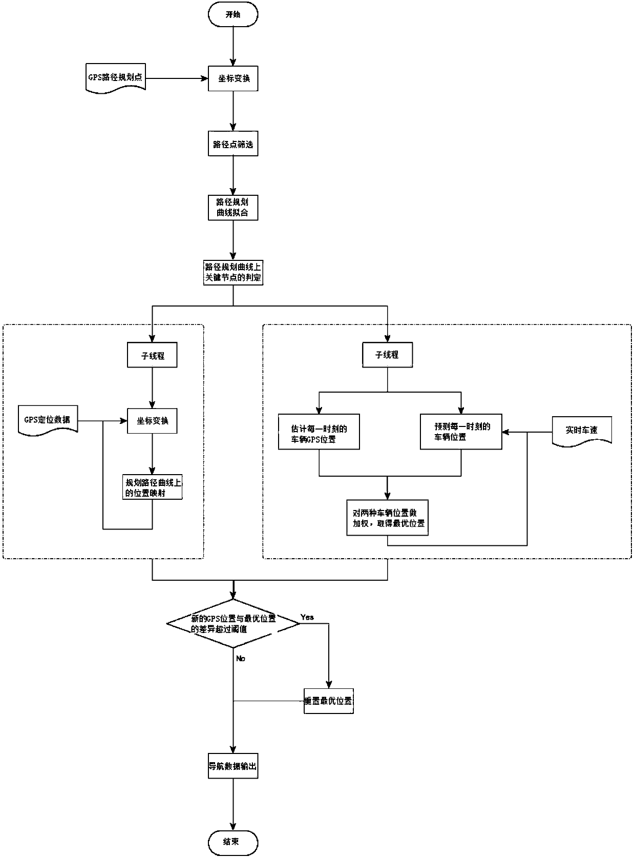
[0057] Such as figure 1 As shown, the present invention provides an AR-HUD navigation system utilizing GPS data, and adopts the following steps to utilize GPS data for navigation:
[0058]1) Convert the Martian coordinates of the discrete points in the path planning provided by GPS into coordinate points in the three-dimensional scene, which are called path points;
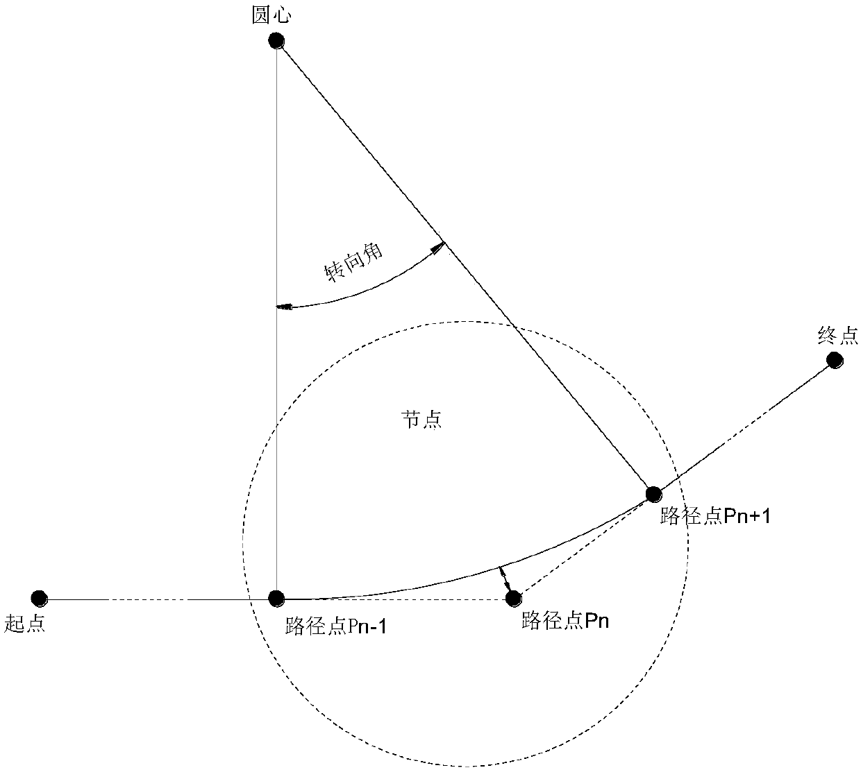
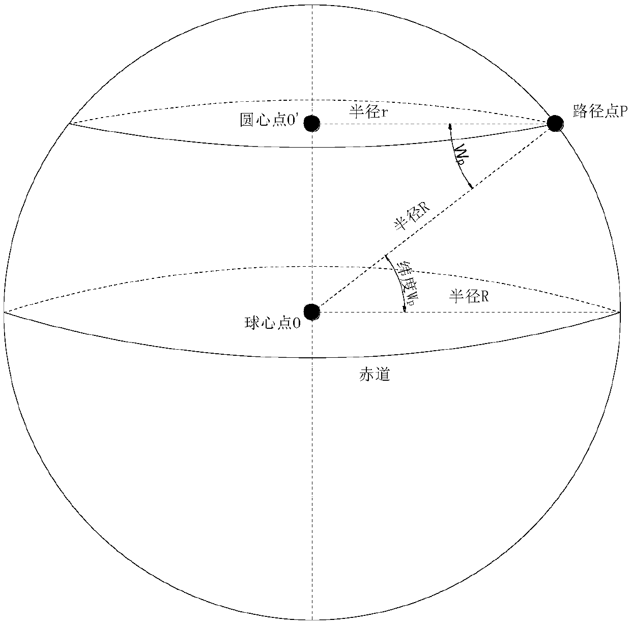
[0059] refer to figure 2 As shown, the conversion process is as follows:
[0060] a) Knowing the latitude and longitude of each coordinate point, calculate the distance between each point and the first point through the distance calculation function that comes with the Android system;
[0061] b) Take the first point as the origin in the three-dimensional coordinate system, that is, its coordinates are (0,0,0);
[0062] c) Subsequently, using the latitude and longitude coordinates of each point and the origin and the distance from the origin, calculate the coordinate value of each point in the three-dimensiona...
PUM
 Abstract
Description
Claims
Application Information
 - R&D
- Intellectual Property
- Life Sciences
- Materials
- Tech Scout
- Unparalleled Data Quality
- Higher Quality Content
- 60% Fewer Hallucinations
Browse by: Latest US Patents, China's latest patents, Technical Efficacy Thesaurus, Application Domain, Technology Topic, Popular Technical Reports.
© 2025 PatSnap. All rights reserved.Legal|Privacy policy|Modern Slavery Act Transparency Statement|Sitemap|About US| Contact US: help@patsnap.com


