High-resolution remote sensing image road extraction method based on deep learning

A remote sensing image and deep learning technology, applied in the field of image processing, to achieve the effect of clear principle, improved classification accuracy and simple design

Inactive Publication Date: 2018-07-06
中交信息技术国家工程实验室有限公司
View PDF6 Cites 25 Cited by
  • Summary
  • Abstract
  • Description
  • Claims
  • Application Information

AI Technical Summary

Problems solved by technology

For the identification and extraction of traffic roads, there are also some algorithms in remote sensing, including Hough transform, Snake algorithm, edge features, etc., which have their own advantages and disadvantages, and are not suitable for all remote sensing images.

Method used


Image

  • High-resolution remote sensing image road extraction method based on deep learning
  • High-resolution remote sensing image road extraction method based on deep learning
  • High-resolution remote sensing image road extraction method based on deep learning

Examples


Embodiment Construction

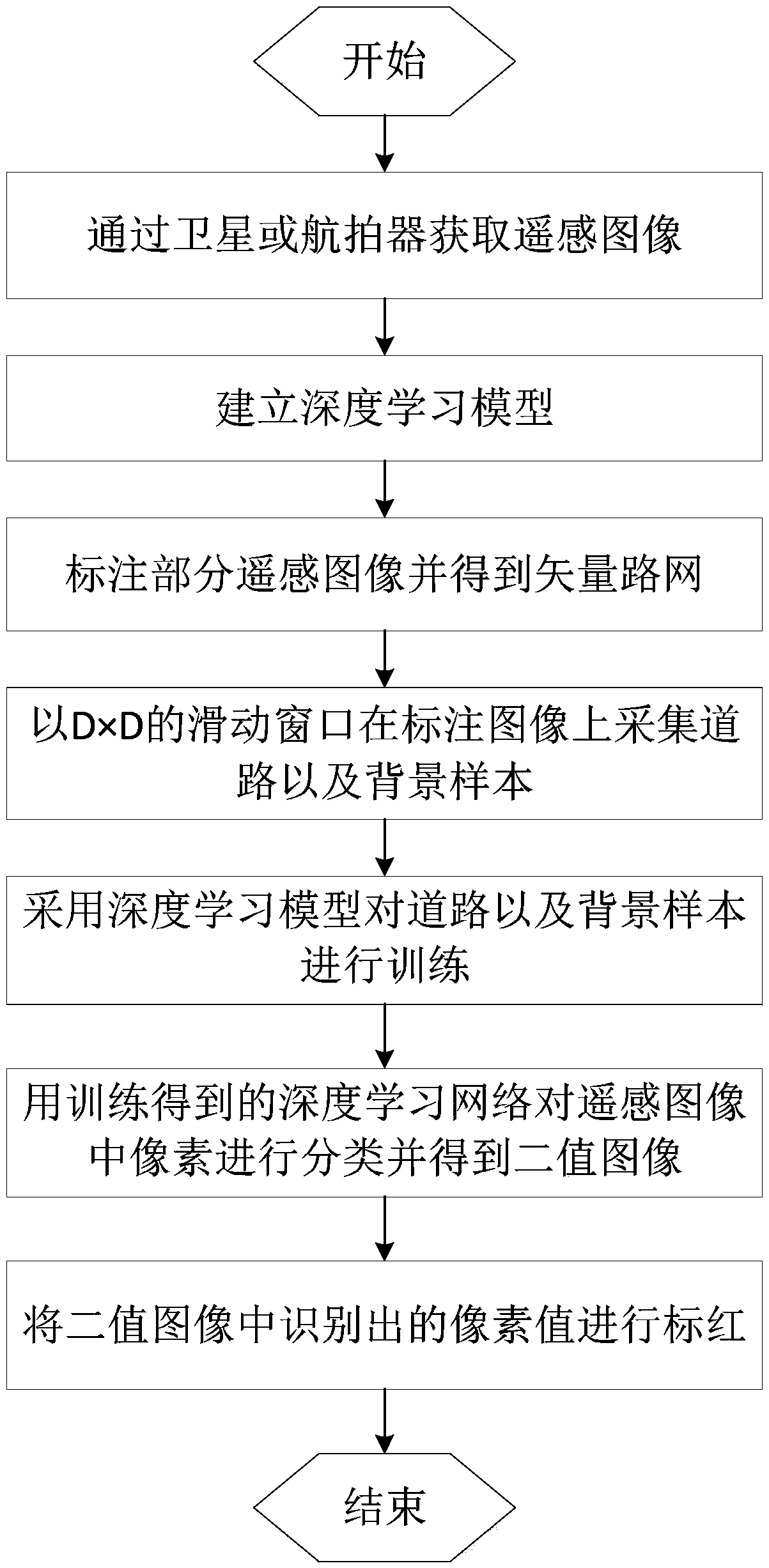
[0035] In order to explain the present invention more clearly, the present invention will be further described below in conjunction with preferred embodiments and drawings. Similar components in the drawings are denoted by the same reference numerals. Those skilled in the art should understand that the content described below is illustrative rather than restrictive, and should not limit the protection scope of the present invention.

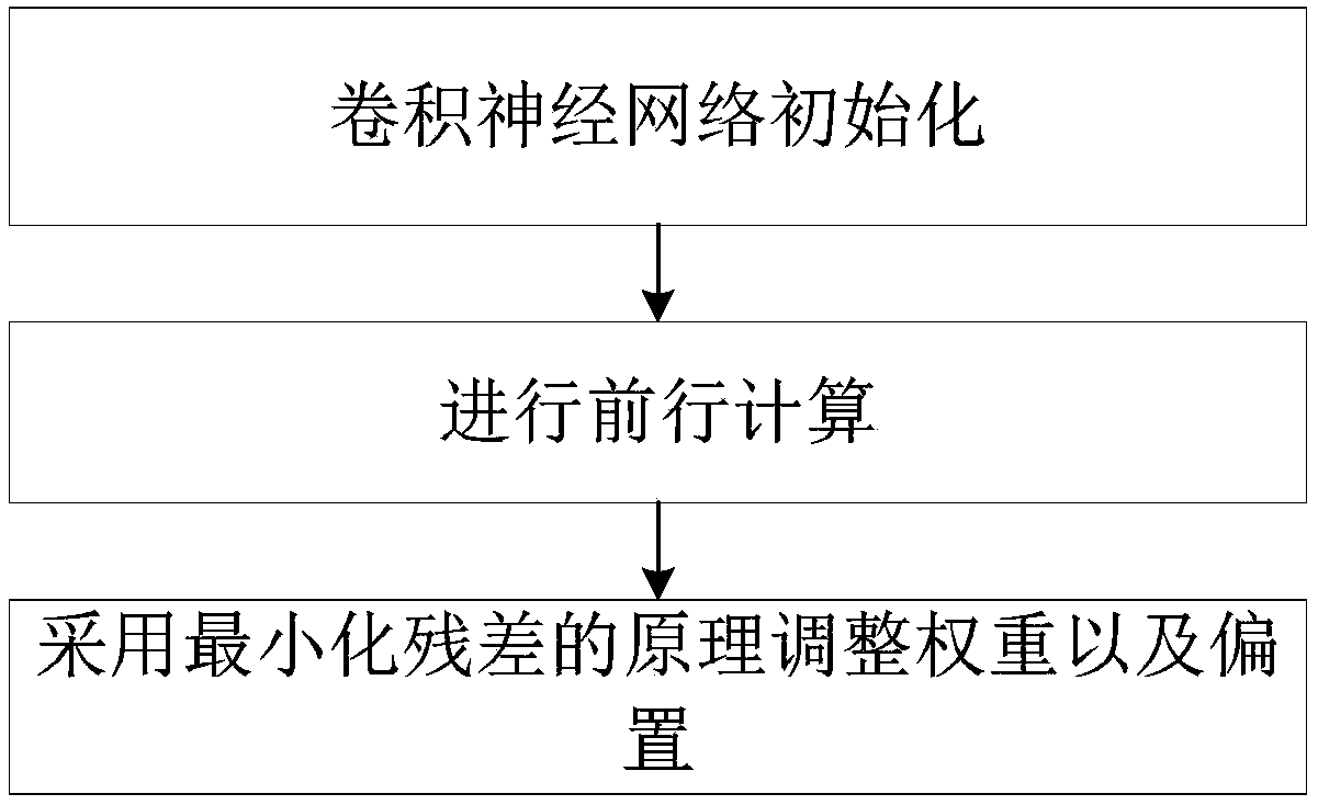
[0036] Deep learning uses computers to simulate human learning behaviors, acquire new knowledge and skills, reorganize the existing knowledge structure and continuously optimize the knowledge base, and finally make the best decision, deep learning image recognition, using convolutional neural networks to randomly select from images A small area is used as a training sample, and some features of characteristic information are learned from the sample, and then these features are used as filters to perform operations on the original image to obtain the...


PUM


Abstract

The invention discloses a high-resolution remote sensing image road extraction method based on deep learning. The high-resolution remote sensing image road extraction method comprises the steps of: acquiring a remote sensing image by means of a satellite or an aerial camera; establishing a deep learning model; labeling part of the remote sensing image and acquiring a vector road network; acquiringroad and background samples on the remote sensing image and the vector road network; training the road and background samples by using the deep learning model; classifying pixels in the remote sensing image by using a trained deep learning network to obtain a binary image; and labeling identified pixel values in the binary image. The high-resolution remote sensing image road extraction method canimprove the classification precision, so as to identify ground feature information.

Description

Technical field [0001] The invention relates to the technical field of image processing, in particular to a method for extracting roads from high-resolution remote sensing images based on deep learning. Background technique [0002] With the development of my country's aerospace industry, more and more ground object information is obtained from earth observation, and the resolution of images obtained from satellite images and aerial images is also getting higher and higher. Early medium-resolution remote sensing images were used to identify large-scale features such as land classification, and roads in the images appeared linearly. Nowadays, high-resolution remote sensing images can obtain features of 1m in size. This urgently requires us to excavate useful information in remote sensing data, to provide a basis for studying the early warning of features and disasters, and to facilitate people's production and life. The road in the high-resolution remote sensing image is presente...

Claims


Application Information

Patent Timeline
Patent Type & Authority Applications(China)
IPC IPC(8): G06K9/00G06K9/62
CPCG06V20/182G06F18/29
Inventor 刘建耿丹阳罗伦钟南夏威阳柯苏航孙士凯刘志强邓蕾佘绍一祁钰茜
Owner 中交信息技术国家工程实验室有限公司
Why Eureka
Try Eureka