Bottom vision and inertial navigation information fusion directional compass

A directional compass and visual technology, applied in surveying and mapping and navigation, navigation, navigation calculation tools, etc., can solve the problems of complex preprocessing process, large environmental factors interference, large use distortion, etc., to reduce complexity, reliability and resistance Strong interference, reduce the effect of cumulative error and temperature drift

Active Publication Date: 2018-08-24
ZHEJIANG UNIV
View PDF9 Cites 4 Cited by
  • Summary
  • Abstract
  • Description
  • Claims
  • Application Information

AI Technical Summary

Problems solved by technology

[0007] The purpose of the present invention is to provide a multi-source information fusion directional compass, which can obtain reliable, stable and high-precision UAV course angle information, and overcome the shortcomings of the existing compass technology, such as large environmental factors and unreliable data. , while avoiding the use of panoramic cameras with large distortion and complex preprocessing

Method used


Image

  • Bottom vision and inertial navigation information fusion directional compass
  • Bottom vision and inertial navigation information fusion directional compass
  • Bottom vision and inertial navigation information fusion directional compass

Examples


Embodiment Construction

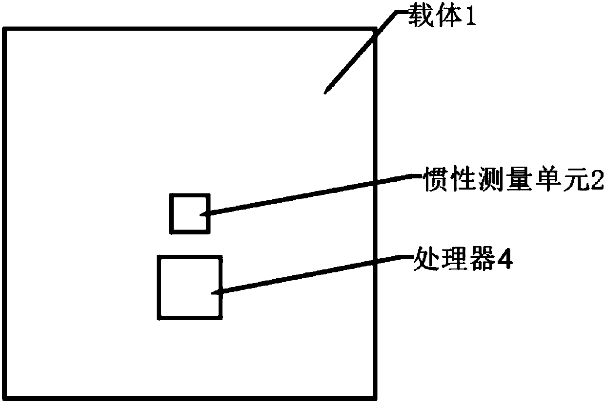
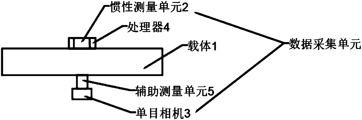
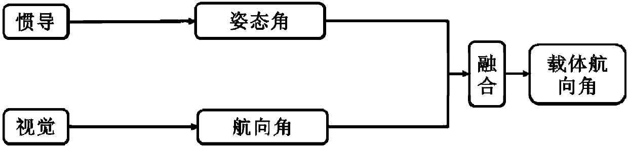
[0036] The embodiment of the present invention provides an orientation compass that combines down-looking vision and inertial navigation information, which is used to measure the heading angle of a carrier in three-dimensional space, and can reliably provide the heading angle information of the carrier in a high real-time and high-precision manner.

[0037] In order to enable those skilled in the art to better understand the solution of the present invention, the technical solution of the present invention will be clearly and completely described below in conjunction with the drawings of the embodiments of the present invention. Apparently, the described embodiments are only some of the embodiments of the present invention, not all of them. Based on the embodiments of the present invention, all other embodiments obtained by persons of ordinary skill in the art without making creative efforts shall fall within the protection scope of the present invention.

[0038] figure 1 an...


PUM


Abstract

The invention discloses a bottom vision and inertial navigation information fusion directional compass, and belongs to the technical field of positioning devices. The directional compass includes a data acquisition unit and a processor; the data acquisition unit includes an inertial measurement unit and a bottom-view mounted camera, the inertial measurement unit is used for collecting the three-axis angular velocity and the acceleration of a carrier in a three-dimensional space, and the camera is used for acquiring the image sequence of the bottom of the carrier; and the processor obtains an attitude angle by using data acquired by the inertial measurement unit, obtains a course angle by using data acquired by the camera, and fuses the attitude angle with the course angle to obtain the final course angle of the carrier. The directional compass has a high reliability and a strong real-time performance, can work in an environment with magnetic interference and aerial works, and can be used for measuring the course angles of robots and unmanned aerial vehicles.

Description

technical field [0001] The invention relates to the technical field of positioning equipment, in particular to an orientation compass that combines down-looking vision and inertial navigation information. Background technique [0002] In recent years, drones have played an important role in dangerous and boring tasks and harsh working environments, such as: aerial photography, plant protection, disaster rescue, power inspection, etc. As a new force, drones have received more and more attention and investment from research institutions and governments. The autonomous navigation function is an important basis for the UAV to achieve the above tasks, and to achieve reliable and accurate autonomous navigation, the UAV must be able to accurately obtain heading information, that is, have a good orientation function. [0003] According to the particularity of UAV missions and the characteristics of fast flight speed, the heading measurement system needs to have very reliable and hi...

Claims


Application Information

Patent Timeline
Patent Type & Authority Applications(China)
IPC IPC(8): G01C21/16G01C21/20
CPCG01C21/165G01C21/20
Inventor 张宇柳莹李平
Owner ZHEJIANG UNIV
Why Eureka
Try Eureka