Unmanned aerial vehicle GPS location fault detection and reconstruction method based on distance measurement between vehicles

A GPS positioning and fault detection technology, which is applied in satellite radio beacon positioning systems, measuring devices, radio wave measuring systems, etc., can solve the problems of not making full use of multi-machine cooperative anti-interference, diagnosis and positioning faults, etc., and achieve good application value , the effect of improving reliability

Active Publication Date: 2018-09-07
CENT SOUTH UNIV
View PDF2 Cites 4 Cited by
  • Summary
  • Abstract
  • Description
  • Claims
  • Application Information

AI Technical Summary

Problems solved by technology

However, these methods are all for single-system navigation sensor fault diagnosis, and rarely involve the study of multi-system navigation sensor fault judgm

Method used


Image

  • Unmanned aerial vehicle GPS location fault detection and reconstruction method based on distance measurement between vehicles
  • Unmanned aerial vehicle GPS location fault detection and reconstruction method based on distance measurement between vehicles
  • Unmanned aerial vehicle GPS location fault detection and reconstruction method based on distance measurement between vehicles

Examples


Embodiment Construction

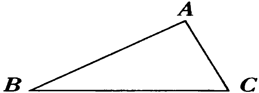
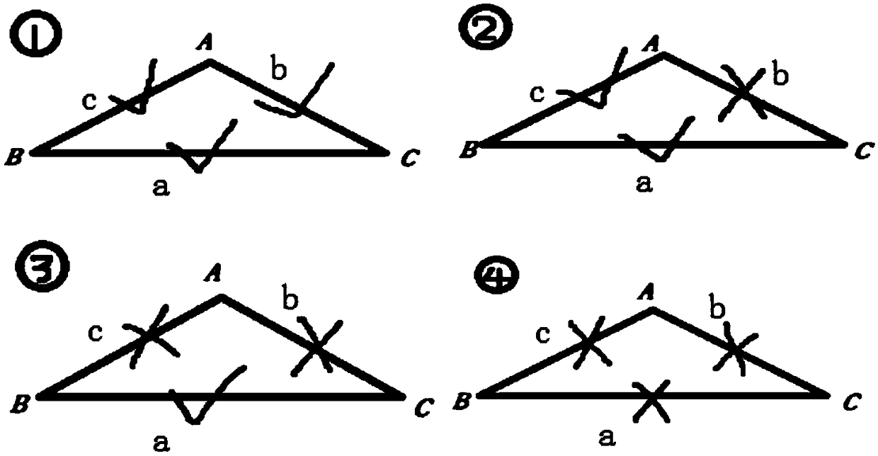
[0029] The present invention establishes an algebraic graph theory model based on mutual ranging for multi-UAV systems; in a multi-machine network, each UAV can be regarded as a node, and UAVs and UAVs Inter-communication can be seen as edges connecting nodes.

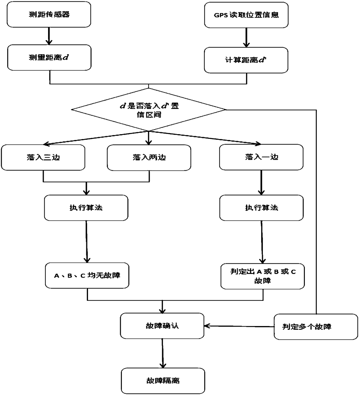
[0030] With the location data provided by the GPS positioning system, we can first obtain the GPS location information of each drone. Of course, the GPS itself has errors, so the location information we get is not the real UAV location information, but the location information with GPS errors. Now we consider two adjacent frames, let (x 1 ',y 1 ') and (x 2 ',y 2 ') is the position information with GPS errors obtained by two adjacent drones. Then it can be concluded that the distance between the two drones is: For the convenience of the following description, we call it the calculation distance, denoted by d'. Since each UAV is equipped with a ranging sensor (such as a radio ranging sensor, etc.), then we can dir...


PUM


Abstract

The present invention discloses an unmanned aerial vehicle GPS location fault detection and reconstruction method based on distance measurement between vehicles. The GPS of an unmanned aerial vehicleis employed to obtain correlation properties of a calculation distance and a measurement distance obtained by a distance measurement sensor and construct a fault detection model to complete diagnosisof location faults of the unmanned aerial vehicle in a multi-unmanned aerial vehicle system. A consistency detection method of location and distances of non-central chi square distribution is employed, a node fault location method improving a wireless sensor network field is employed to detect and determine location faults caused by GPS of part of unmanned aerial vehicles being interfered or shielded in an unmanned aerial vehicle group, fully utilize advantages of the multi-unmanned aerial vehicle system and overcome the problem that a single unmanned aerial vehicle GPS is interfered and deceived. The unmanned aerial vehicle GPS location fault detection and reconstruction method improves the reliability of the detection result under the condition without improving the system hardware performances and has a good application value.

Description

technical field [0001] The invention relates to the field of UAV fault location, in particular to a UAV GPS location fault detection and reconstruction method based on distance measurement between machines. Background technique [0002] With the continuous development of sensing technology, artificial intelligence technology and computer technology, autonomous UAVs with perception, detection and action capabilities have been widely used in military, civilian and scientific research. With the expansion of the service field, a single UAV can no longer meet the task requirements. The coordination and cooperation between multiple UAVs will greatly improve the intelligence of individual behavior, and better complete many tasks that cannot be completed by a single individual. , and has the advantages of high efficiency, strong scalability and inherent parallelism. Drone swarms are gradually becoming a trend. [0003] The coordination and cooperation of multiple drones is insepar...

Claims


Application Information

Patent Timeline
IPC IPC(8): G01S19/23G01S19/20
CPCG01S19/20G01S19/23
Inventor 陈琪锋李松孟云鹤韩耀昆刘俊
Owner CENT SOUTH UNIV
Why Eureka
Try Eureka