Job-housing space evaluation method and system under different scales based on multi-data integration
An evaluation method and multi-data technology, applied in data processing applications, instruments, computing, etc., can solve problems such as the inability to comprehensively obtain the spatial characteristics of urban jobs and residences, and achieve the effect of layout optimization.
- Summary
- Abstract
- Description
- Claims
- Application Information
AI Technical Summary
Problems solved by technology
Method used
Image
Examples
Embodiment Construction
[0040] It should be noted that, in the case of no conflict, the embodiments in the present application and the features in the embodiments can be combined with each other.
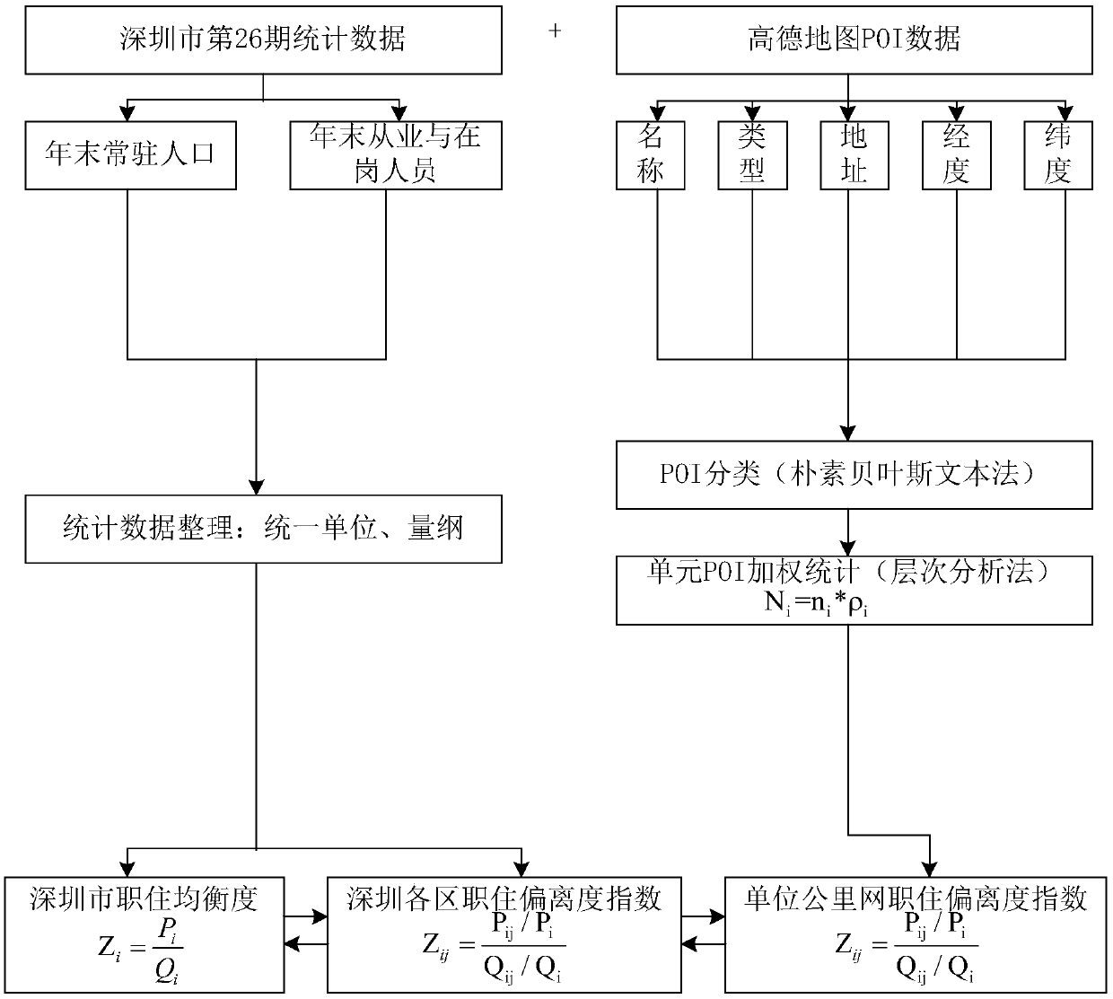
[0041] A method for evaluating occupational and housing space at different scales based on multi-data fusion, including the following steps:
[0042] Step A: Data collection and processing. First, through the city statistical yearbook, collect the year-end resident population data and employee data at the city level, and unify the units. Secondly, collect POI data. For example, the POI data of Gaode map can be crawled by crawler software. Each piece of data contains the basic spatial information and attribute information such as the name, category, address, longitude and latitude, and administrative area of the point; then according to the longitude and latitude information of the POI data for visualization.
[0043] Step B: Evaluation of macro-scale occupation and housing space based on traditional da...
PUM
 Abstract
Description
Claims
Application Information
 - R&D
- Intellectual Property
- Life Sciences
- Materials
- Tech Scout
- Unparalleled Data Quality
- Higher Quality Content
- 60% Fewer Hallucinations
Browse by: Latest US Patents, China's latest patents, Technical Efficacy Thesaurus, Application Domain, Technology Topic, Popular Technical Reports.
© 2025 PatSnap. All rights reserved.Legal|Privacy policy|Modern Slavery Act Transparency Statement|Sitemap|About US| Contact US: help@patsnap.com


