Remote navigation path planning method based on energy consumption optimization and considering ocean circulation influence for UUV
A technology of energy consumption and path planning, applied in navigation, measuring device, mapping and navigation, etc., can solve the problems of lack of effectiveness, monotonous X-axis direction, weakening the diversity of output results, etc.
- Summary
- Abstract
- Description
- Claims
- Application Information
AI Technical Summary
Problems solved by technology
Method used
Image
Examples
Embodiment Construction
[0056] The present invention is described in more detail below in conjunction with accompanying drawing example:
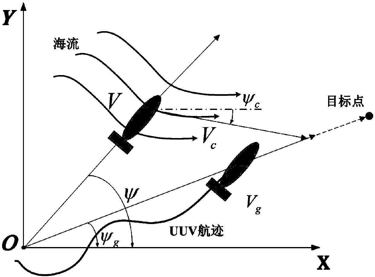
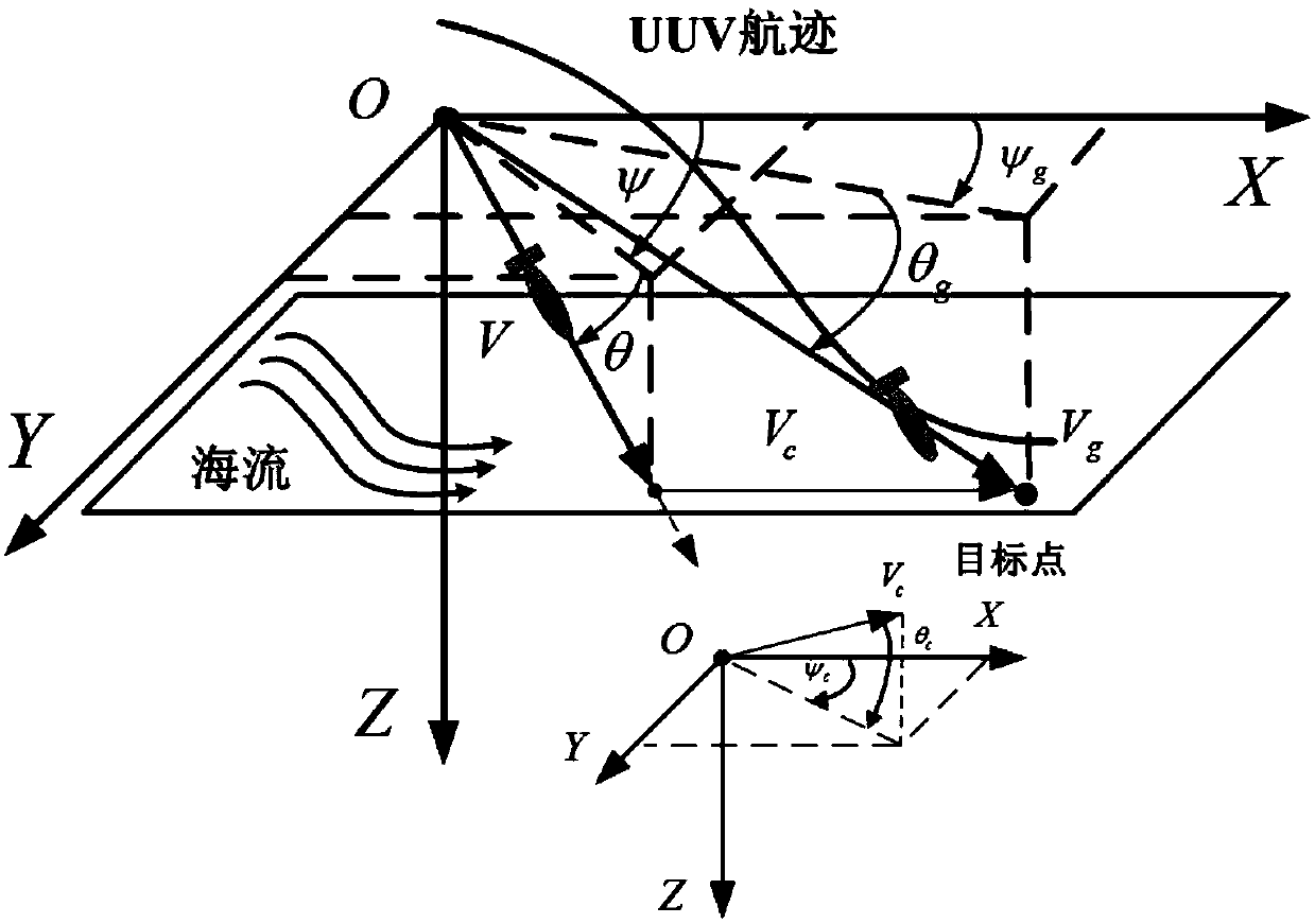
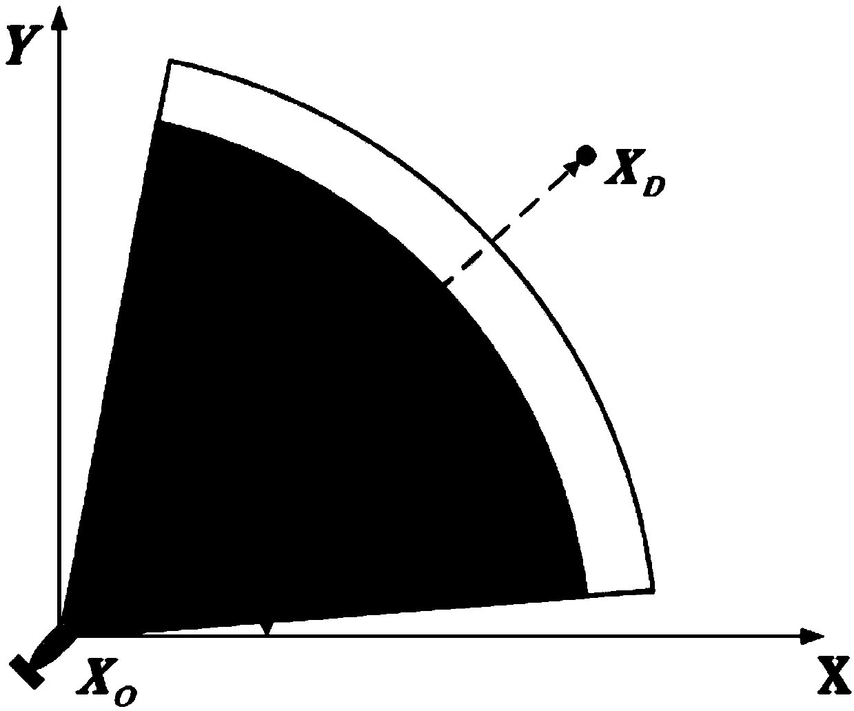
[0057] combine figure 1 -8. The path planning method of the present invention can use various optimization algorithms to realize the optimization process of planning by establishing a UUV-based energy consumption model, such as an evolutionary algorithm. Taking the QPSO algorithm as an example, it can be implemented according to the following steps:
[0058] Step 1: Determine the actual speed V of the UUV over the ground g And real-time updated ocean current information V c . Among them, the specific method of determining the speed and the establishment of the coordinate system are as follows:
[0059] like figure 1 As shown, a fixed coordinate system for UUV navigation in a two-dimensional ocean environment is established, where the X-axis faces the true north of the geographic location, and the Y-axis faces the true east of the geographic location. Among t...
PUM
 Abstract
Description
Claims
Application Information
 - R&D
- Intellectual Property
- Life Sciences
- Materials
- Tech Scout
- Unparalleled Data Quality
- Higher Quality Content
- 60% Fewer Hallucinations
Browse by: Latest US Patents, China's latest patents, Technical Efficacy Thesaurus, Application Domain, Technology Topic, Popular Technical Reports.
© 2025 PatSnap. All rights reserved.Legal|Privacy policy|Modern Slavery Act Transparency Statement|Sitemap|About US| Contact US: help@patsnap.com


