VIVE virtual earth roaming browse method based on OsgEarth
An earth and digital earth technology, applied in the field of geographic information system, can solve the problems of artificial scene modeling and small scene scope, and achieve the effect of strong sense of reality, realistic effect and convenient operation and use.
- Summary
- Abstract
- Description
- Claims
- Application Information
AI Technical Summary
Problems solved by technology
Method used
Image
Examples
Embodiment Construction
[0036] The present invention will be described in further detail below in conjunction with the accompanying drawings.
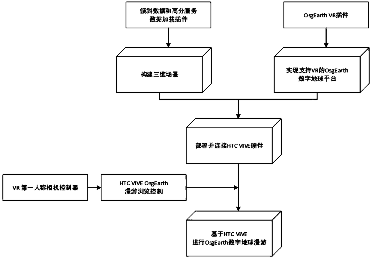
[0037] A kind of roaming browsing method of VIVE virtual globe based on OsgEarth, such as figure 1 shown, including the following steps:
[0038] Step 1. Based on the OsgEarth digital earth platform, construct a 3D geographic information scene. The specific method is as follows:
[0039] First of all, the data required to construct a 3D geographic scene are acquired through surveying and mapping methods, mainly including: (1) DOM image data reflecting landforms. Mosaic, uniform light and color processing, etc., to meet certain precision index requirements; (2) DEM elevation data reflecting terrain features, which are obtained through aerospace stereo photography and other means; (3) oblique photography data reflecting architectural details, these The data is acquired by means of aerial oblique photography and edited manually.
[0040] Then, the above-ment...
PUM
 Abstract
Description
Claims
Application Information
 - R&D
- Intellectual Property
- Life Sciences
- Materials
- Tech Scout
- Unparalleled Data Quality
- Higher Quality Content
- 60% Fewer Hallucinations
Browse by: Latest US Patents, China's latest patents, Technical Efficacy Thesaurus, Application Domain, Technology Topic, Popular Technical Reports.
© 2025 PatSnap. All rights reserved.Legal|Privacy policy|Modern Slavery Act Transparency Statement|Sitemap|About US| Contact US: help@patsnap.com


