Method and system for determining earth gravitational field recovered from satellite gravity gradient full tensor
A technique for determining gravity gradients and methods, applied in the field of physical geodesy, can solve problems such as inability to make full use of observation information and inability to obtain a more accurate model of the earth's gravity field
- Summary
- Abstract
- Description
- Claims
- Application Information
AI Technical Summary
Problems solved by technology
Method used
Image
Examples
Embodiment 1
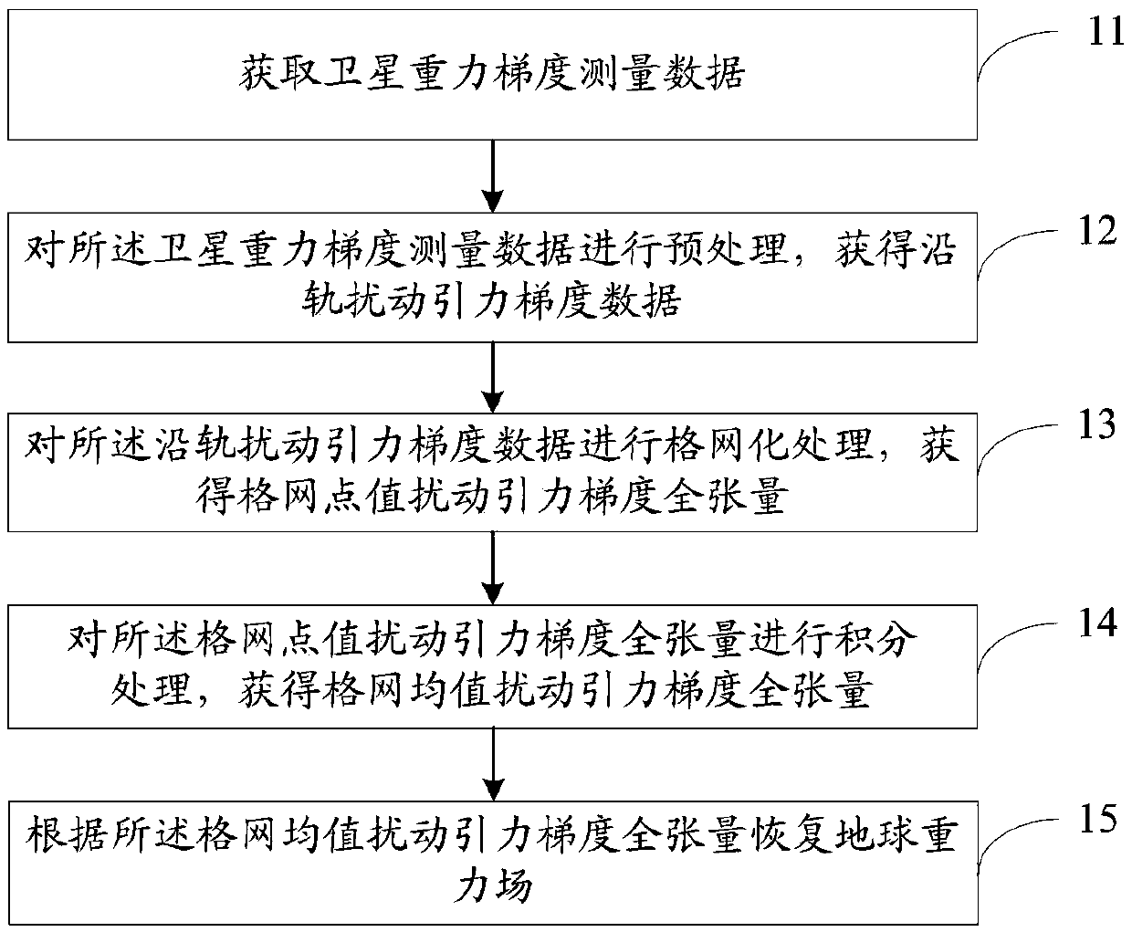
[0050] figure 1 It is a flow chart of the method for determining the full tensor of the satellite gravity gradient to recover the earth's gravity field provided by Embodiment 1 of the present invention. Such as figure 1 As shown, a method for determining the full tensor of the satellite gravity gradient to restore the earth's gravitational field includes:
[0051] Step 11: Obtain satellite gravity gradient measurement data.
[0052] Step 12: Perform preprocessing on the satellite gravity gradient measurement data to obtain along-orbit disturbance gravity gradient data. The preprocessing specifically includes: gross error elimination processing, coordinate transformation processing, and normal field correction processing.
[0053] Step 13: Perform grid processing on the perturbation gravitational gradient data along the track to obtain the full tensor of the perturbation gravitational gradient of grid points.
[0054] Specifically, the step 13: performing grid processing on the grav...
Embodiment 2
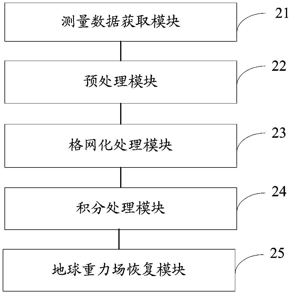
[0080] figure 2 This is a structural block diagram of the system for determining the full tensor of the satellite gravity gradient to restore the earth's gravity field provided by the second embodiment of the present invention. Such as figure 2 As shown, a system for determining the full tensor of the satellite gravity gradient to restore the earth's gravitational field includes:
[0081] The measurement data acquisition module 21 is used to acquire satellite gravity gradient measurement data;
[0082] The preprocessing module 22 is used to preprocess the satellite gravity gradient measurement data to obtain the gravitational gradient data of the disturbance along the orbit;
[0083] The grid processing module 23 is configured to perform grid processing on the gravitational gradient data of the disturbance along the track to obtain the full tensor of the grid point value disturbance gravitational gradient;
[0084] The integration processing module 24 is configured to perform integr...
Embodiment 3
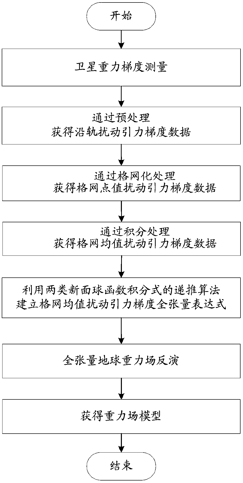
[0087] Such as image 3 As shown, the satellite gravity gradient measurement data is preprocessed and gridded to obtain grid point value perturbation gravitational gradient data, which is integrated to obtain grid mean perturbation gravitational gradient data. A grid needs to be established for gravity field inversion. The full tensor expression of the mean perturbation gravitational gradient, and the recursive algorithm of two types of new surface sphere function integral expressions plays a key role in this process. Through this algorithm, the full tensor expression of the grid mean perturbation gravitational gradient can be realized The establishment of, combined with the observation data to carry out the inversion of the gravity field, and finally obtain a more accurate earth's gravity field model.
[0088] The inversion of the full tensor Earth's gravity field uses all disturbing gravitational gradient data (T x′x′ , T y′y′ , T z′z′ , T x′y′ , T x′z′ And T y′z′ ), the f...
PUM
 Abstract
Description
Claims
Application Information
 - R&D
- Intellectual Property
- Life Sciences
- Materials
- Tech Scout
- Unparalleled Data Quality
- Higher Quality Content
- 60% Fewer Hallucinations
Browse by: Latest US Patents, China's latest patents, Technical Efficacy Thesaurus, Application Domain, Technology Topic, Popular Technical Reports.
© 2025 PatSnap. All rights reserved.Legal|Privacy policy|Modern Slavery Act Transparency Statement|Sitemap|About US| Contact US: help@patsnap.com


