
Method for monitoring river runoff through remote-sensing hydrologic station

A technology for hydrological stations and rivers, which is applied in the measurement of flow/mass flow, open-air water source survey, measurement devices, etc. It can solve the problem of difficult to meet the requirements of guaranteeing hydrological parameters and variable accuracy, limited characteristics of spatially varying hydrological components, and difficult water resources management in river basins. To achieve the effect of flexible and controllable acquisition time, rich time scale, and important social benefits

Inactive Publication Date: 2018-11-27
BEIJING NORMAL UNIVERSITY +1
View PDF5 Cites 25 Cited by
  • Summary
  • Abstract
  • Description
  • Claims
  • Application Information

AI Technical Summary

Problems solved by technology

[0003] In the past, when carrying out hydrological calculations in areas without data, most of the watersheds with relatively abundant precipitation were selected for calculation. limitations: (1) When establishing a relationship between input and output based on measured data to predict output, when any of the three links of the input, output and model of the watershed is unknown, the hydrological forecast will face severe challenges
(3) Focusing on the runoff forecast and mostly the total runoff at the outlet of the basin, the spatial variation of the hydrological process in the basin and the characteristics of each hydrological component are limited
(4) There are many empirical types and few quantitative ones. Based on the assumption of a relatively stable and static environment to study the hydrological phenomena of the watershed, it is impossible to describe the hydrological process of the watershed under the changing environment, and it cannot meet the analysis of the hydrological response of the watershed under the influence of human activities. It cannot be coupled with climate models such as the Global Climate Model (GCM), and it is difficult to truly guide water resource management in river basins
[0005] To sum up, the hydrological parameters and variables monitored by conventional remote sensing have been difficult to meet the accuracy requirements of hydrological parameters and variables for ensuring the security of water resources in data-scarce areas

Method used


Image

  • Method for monitoring river runoff through remote-sensing hydrologic station
  • Method for monitoring river runoff through remote-sensing hydrologic station
  • Method for monitoring river runoff through remote-sensing hydrologic station

Examples


Embodiment Construction

[0033] The remote sensing hydrological enhancement station proposed by the present invention fills the shortcoming of the lack of hydrological survey stations in the arid inland areas of Xinjiang. After the platform is established, 100 hydrological monitoring sections will be added to provide runoff hydrological data on the basis of the number of hydrological survey stations in the existing river basin.

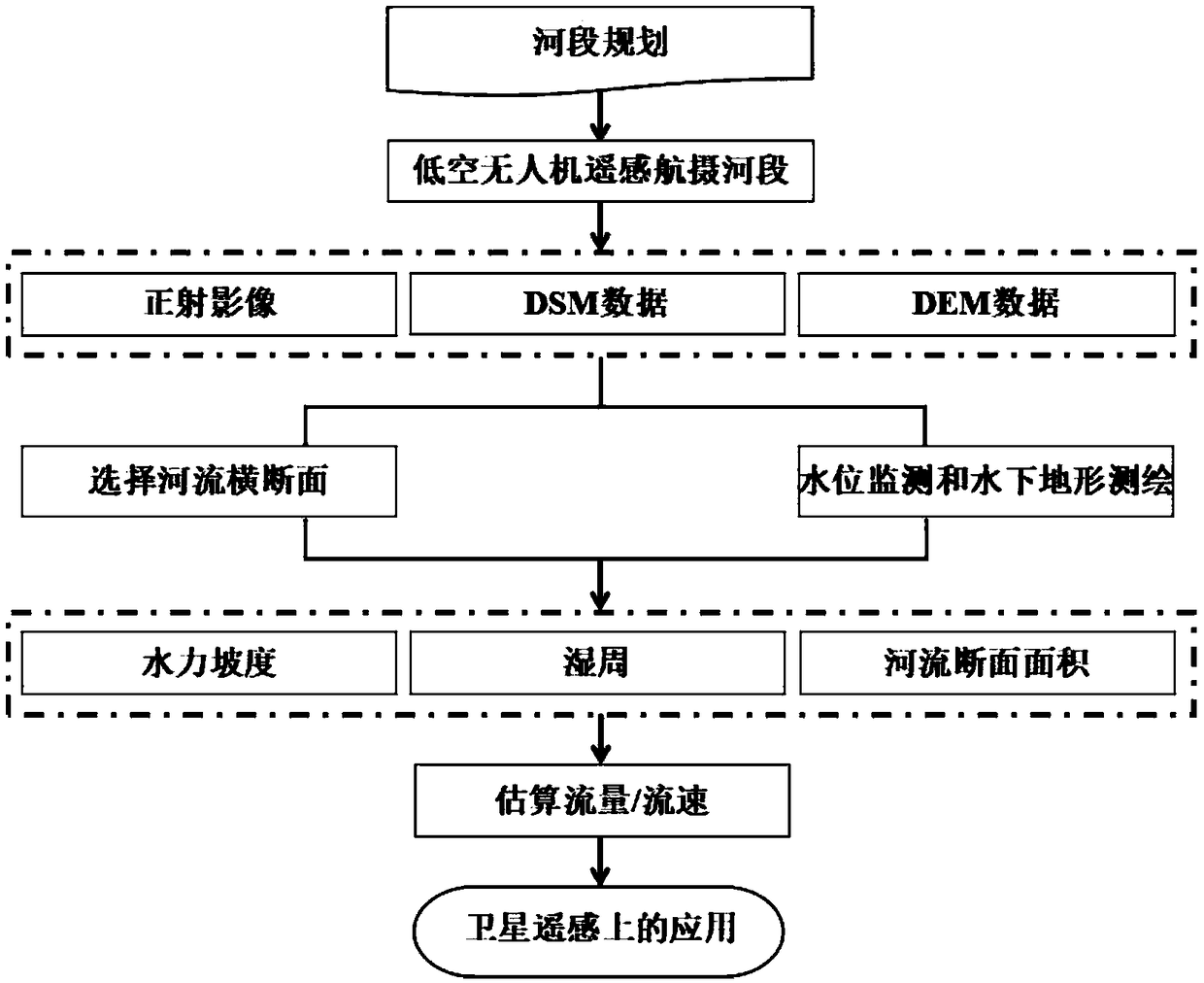
[0034] See figure 1 , the present invention is a method for monitoring river runoff at a remote sensing hydrological station, and the specific steps of the method are as follows:

[0035] Step 1: Selection of key channel sections in the missing station area

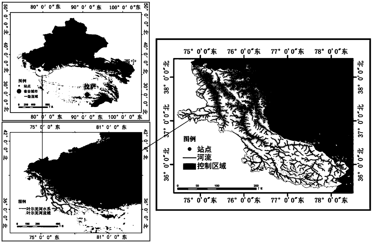
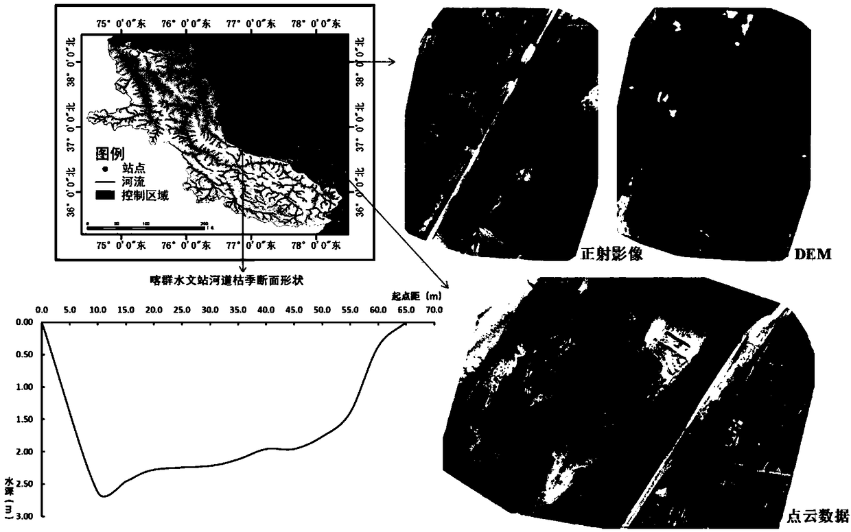
[0036] This case selects the Yarkant River and Kashgar River Basin in the key area of ​​the Asian water tower as an example analysis. In this example, the monitoring section of the remote sensing hydrological station mainly carries out ground measurement and control flight experiments at the monitoring sections of the h...


PUM


Abstract

The invention relates to a method for monitoring river runoff through a remote-sensing hydrologic station. The method comprises the steps of 1, selecting key fluvial sections lacking measuring stationareas; 2, conducting low-altitude remote sensing retrieval on the information of the fluvial sections lacking the measuring station areas; conducting real-time drone control flight on monitoring points of the fluvial sections selected in step 1, preprocessing the obtained data, extracting earth surface information, obtaining the longitudinal section gradient, the cross section area and the watersurface width of the fluvial sections on this basis, combining ground water level monitoring and underwater topographic surveying and mapping, and utilizing a manning formula for deduction to solve the flow of the monitored section. The method has the advantages that satellite remote sensing and low-altitude remote sensing are coupled, each other's advantages are complemented, and the blank of thelack of hydrologic data is filled up; during emergency management, the real-time river channel segment width is obtained, the river runoff is calculated, the river runoff data is reported in real time, and the runoff monitoring precision is smaller than 8%; the problem that hydrometric stations of an arid region are scarce, and cannot handle flood, water pollution and other emergency events is solved.

Description

technical field [0001] The invention relates to a method for monitoring river runoff by a remote sensing hydrological station, which belongs to the technical field of remote sensing monitoring of river runoff, and is especially a coupling satellite remote sensing and low-altitude remote sensing technology involved in the remote sensing monitoring of river runoff in areas lacking hydrological measuring stations in arid inland areas. method of estimating. Background technique [0002] In today's world, there are a large number of areas with no data or scarce data. How to carry out hydrological forecasting in areas with no data or scarce data has always been one of the problems that plague hydrologists at home and abroad. A common feature of most current hydrological forecasting methods is to establish certain empirical or physical mechanism hydrological models based on existing hydrological data to describe complex hydrological phenomena. However, globally, especially in deve...

Claims


Application Information

Patent Timeline
Patent Type & Authority Applications(China)
IPC IPC(8): G01F1/00G01C13/00G01C11/00
CPCG01C11/00G01C13/00G01F1/002Y02A90/30
Inventor 杨胜天巩同梁赵长森娄和震王娟王鹏飞潘天力王静达瓦晋美
Owner BEIJING NORMAL UNIVERSITY
Learn More