
Unmanned aerial vehicle-based marine aeromagnetic daily variation station and geomagnetic measurement method

A UAV, aeromagnetic technology, applied in geophysical survey, radio wave measurement system, measurement device, etc., can solve the problem of unstable measurement position, difficult data collection, geomagnetic diurnal variation observation station can not reach measurement accuracy, etc. problems, to achieve the effect of meeting the measurement accuracy requirements and overcoming the limitations

Inactive Publication Date: 2018-11-27
上海通用卫星导航有限公司
View PDF6 Cites 7 Cited by
  • Summary
  • Abstract
  • Description
  • Claims
  • Application Information

AI Technical Summary

Problems solved by technology

Island and reef daily change station: There must be islands and reefs in the survey area or near the survey area. Landing on islands and reefs is dangerous and difficult, and it is not applicable in open seas
Submarine daily change station: Due to the need for transmitting antennas on the seabed, it is difficult to collect data and equipment, and the cost is too high as a one-time consumable. Therefore, both island and reef daily change stations and submarine daily change stations have certain limitations.
[0004] And when there are no islands and reefs near the far sea, the daily geomagnetic observation station can only be placed on the survey ship. Because the survey ship itself is affected by ocean currents, sea winds, etc., the measurement position is not fixed, which makes the geomagnetic daily change observation station unable to reach the desired location. Required measurement accuracy

Method used


Image

  • Unmanned aerial vehicle-based marine aeromagnetic daily variation station and geomagnetic measurement method
  • Unmanned aerial vehicle-based marine aeromagnetic daily variation station and geomagnetic measurement method
  • Unmanned aerial vehicle-based marine aeromagnetic daily variation station and geomagnetic measurement method

Examples


Embodiment Construction

[0037] The following will clearly and completely describe the technical solutions in the embodiments of the present invention with reference to the accompanying drawings in the embodiments of the present invention. Obviously, the described embodiments are only some, not all, embodiments of the present invention. Based on the embodiments of the present invention, all other embodiments obtained by persons of ordinary skill in the art without making creative efforts belong to the protection scope of the present invention.

[0038] The purpose of the present invention is to provide a marine aeromagnetic diurnal variable station and a geomagnetic measurement method based on an unmanned aerial vehicle, which can overcome the limitations of the existing offshore geomagnetic diurnal variation observation stations and meet the measurement accuracy requirements of the remote sea geomagnetic diurnal variation observation stations.

[0039] In order to make the above objects, features and ...


PUM


Abstract

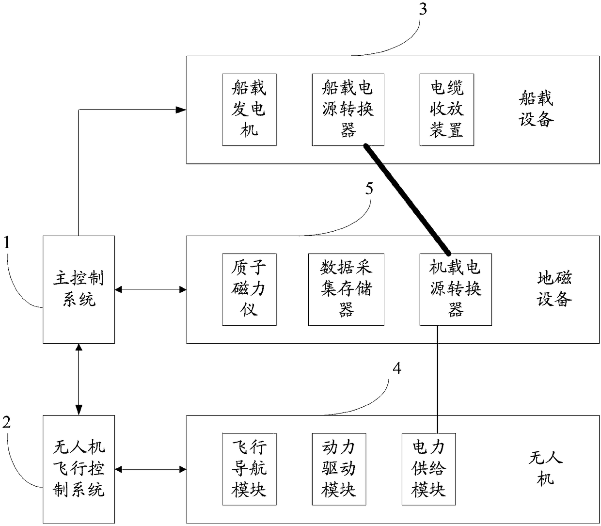
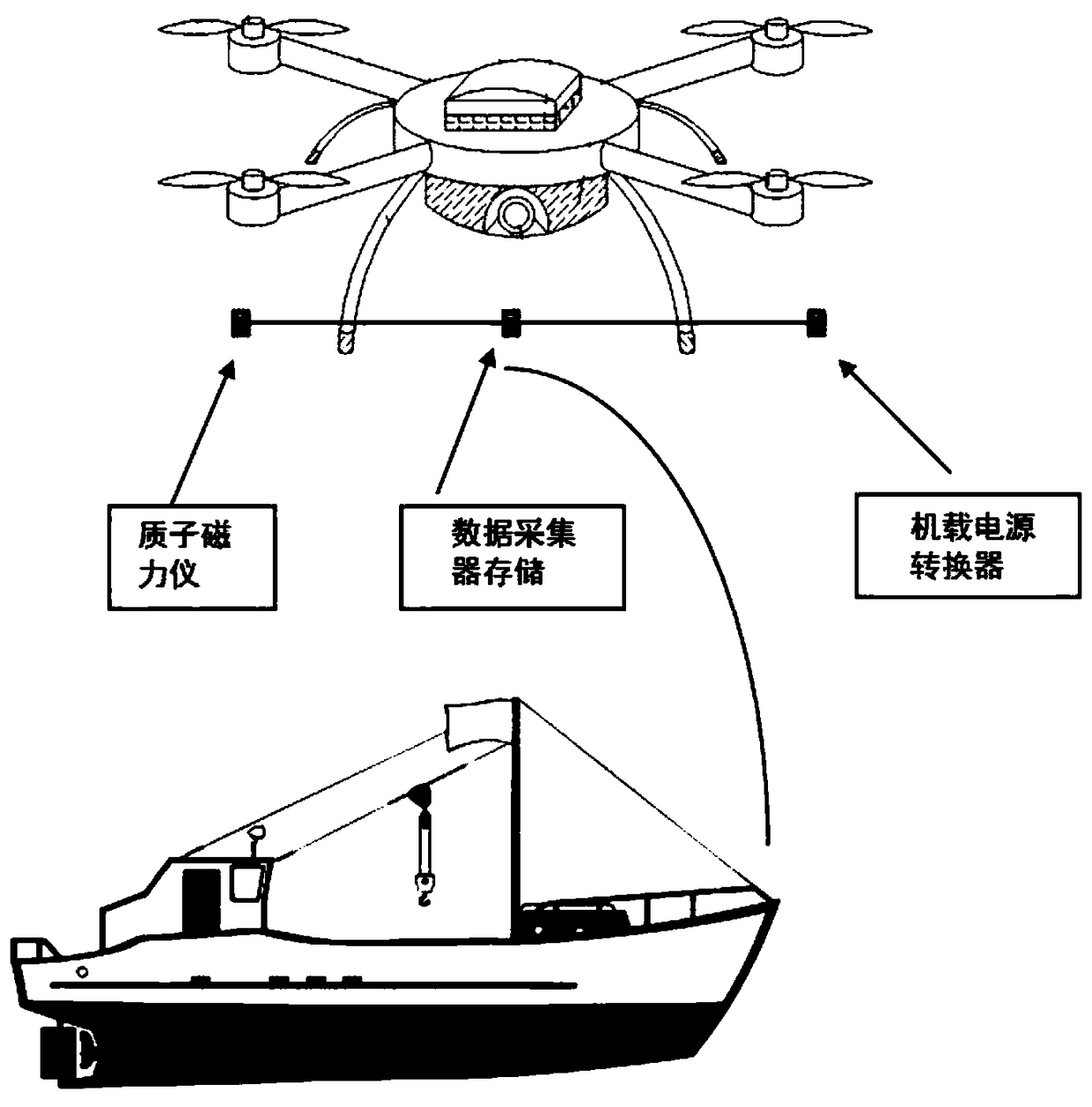
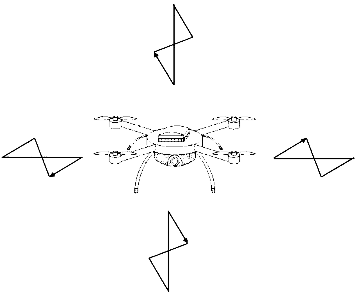
The invention discloses an unmanned aerial vehicle-based marine aeromagnetic daily variation station and a geomagnetic measurement method. The daily variation station comprises an unmanned aerial vehicle flight control system, a main control system and a ship-borne device arranged on a deck of a survey ship and a geomagnetic device arranged on the unmanned aerial vehicle, wherein the geomagnetic device comprises a crossbar, and a proton magnetometer, an airborne power converter and a data acquisition memory arranged on the crossbar according to a weight ratio; the unmanned aerial vehicle flight control system communicates mutually with the unmanned aerial vehicle; the unmanned aerial vehicle flight control system is used for controlling compensation flight, position adjustment and spot hover of the unmanned aerial vehicle; and the main control system communicates with the unmanned aerial vehicle flight control system, the ship-borne device and the geomagnetic device. A mode of adoptingthe proton magnetometer loaded on the unmanned aerial vehicle and the unmanned aerial vehicle flight control system to control compensation flight, position adjustment and spot hover of the unmannedaerial vehicle is adopted, the limitations of the existing far-sea geomagnetic daily variation observation station are overcome, and the measurement precision requirements of the far-sea geomagnetic daily variation observation station are met.

Description

technical field [0001] The invention relates to the technical field of geomagnetic field measurement, in particular to an unmanned aerial vehicle-based marine aeromagnetic daily variable station and a geomagnetic measurement method. Background technique [0002] The geomagnetic field is not a constant value, and the diurnal variation of the geomagnetic field is generally large during the day and small at night. In the process of measuring the geomagnetic field, in order to ensure the accuracy of data post-processing, it is generally necessary to set up a geomagnetic diurnal variation observation station in the survey area or in an area near the same latitude to conduct synchronous observation of the geomagnetic diurnal variation. the entire survey area. The geomagnetic diurnal change observation station needs to be placed in a place where the geomagnetic field is relatively flat, far away from vehicles, with little flow of people, and where it may cause changes in the geoma...

Claims


Application Information

Patent Timeline
Patent Type & Authority Applications(China)
IPC IPC(8): G01V3/40
CPCG01V3/40
Inventor 许庆丰魏巍谌静维夏如春张雪镕马媛王志良殷征欣沈泽中
Owner 上海通用卫星导航有限公司
Learn More