A Sky Wave Positioning Method Applied to Loran System
A positioning method and sky wave technology, applied in positioning, radio wave measurement systems, instruments, etc., can solve problems such as small scope of action, and achieve the effect of wide spread of sky waves and improved coverage.
- Summary
- Abstract
- Description
- Claims
- Application Information
AI Technical Summary
Problems solved by technology
Method used
Image
Examples
Embodiment
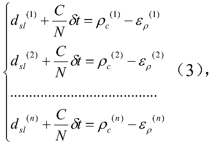
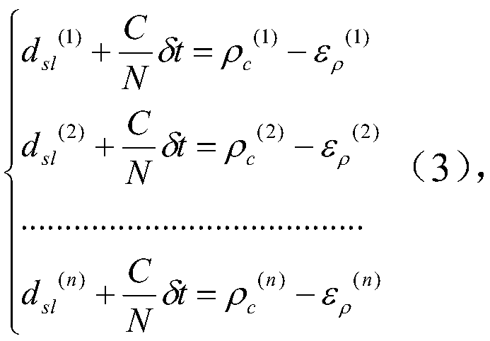
[0043] This embodiment provides a sky wave positioning method applied to the Roland system, which is specifically implemented according to the following steps:
[0044] Step 1: Assuming that the radius of the earth is r=6371km, the height of the ionosphere h=70km, the speed of light C=299792458m / s, and the refractive index of air N=1.0003, the coordinates of the four sky-wave transmitting stations in Raoping, Rongcheng, Xuancheng and Hezhou are shown in Table 1 Shown:
[0045] Table 1
[0046] station name longitude latitude Height (unit m) Xuancheng 138°09′53″ 09°32′45″ 400 Rongcheng 122°19′26″ 37°03′52″ 400 Raoping 116°53′45″ 23°43′26″ 400 He County 111°43′10″ 23°58′03″ 400
[0047] Received the Luolan signal from Raoping, Rongcheng, Xuancheng and Hezhou Luolan stations, and observed the receiving time within seconds as follows:
[0048]
[0049] 10.00333404798551371s, 10.00393025351481085s], local receive day seconds τ...
PUM
 Abstract
Description
Claims
Application Information
 - R&D
- Intellectual Property
- Life Sciences
- Materials
- Tech Scout
- Unparalleled Data Quality
- Higher Quality Content
- 60% Fewer Hallucinations
Browse by: Latest US Patents, China's latest patents, Technical Efficacy Thesaurus, Application Domain, Technology Topic, Popular Technical Reports.
© 2025 PatSnap. All rights reserved.Legal|Privacy policy|Modern Slavery Act Transparency Statement|Sitemap|About US| Contact US: help@patsnap.com


