
Method and device for calculating high spatial resolution remote sensing surface temperature data

A technology with high spatial resolution and surface temperature, which is applied in the field of remote sensing estimation of surface temperature, can solve the problems affecting the accuracy of high spatial resolution surface temperature and achieve the effect of spatial downscaling and high accuracy

Active Publication Date: 2019-01-25
INST OF GEOGRAPHICAL SCI & NATURAL RESOURCE RES CAS +1
View PDF7 Cites 7 Cited by
  • Summary
  • Abstract
  • Description
  • Claims
  • Application Information

AI Technical Summary

Problems solved by technology

[0003] The current spatial downscaling method for remotely sensed surface temperature is mainly to use the difference between vegetation indices with different spatial resolutions, and through the empirical regression relationship between vegetation indices and surface temperature, to downscale the low spatial resolution surface temperature data to obtain High spatial resolution surface temperature, but this type of method only considers the effect of the temperature-related vegetation index, while ignoring the effects of other parameters closely related to surface temperature, which seriously affects the estimated high spatial temperature. Accuracy of Resolution Surface Temperature

Method used


Image

  • Method and device for calculating high spatial resolution remote sensing surface temperature data
  • Method and device for calculating high spatial resolution remote sensing surface temperature data
  • Method and device for calculating high spatial resolution remote sensing surface temperature data

Examples


Embodiment Construction

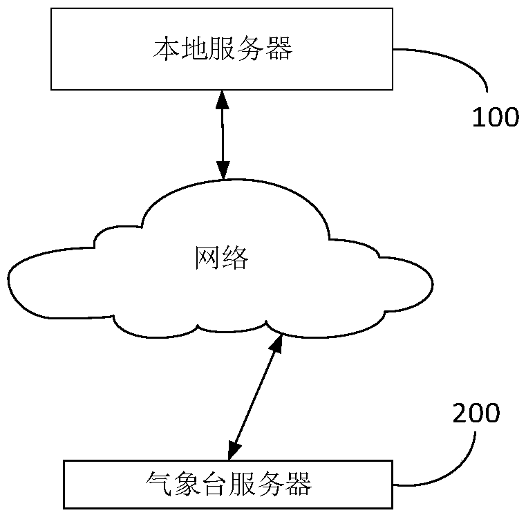
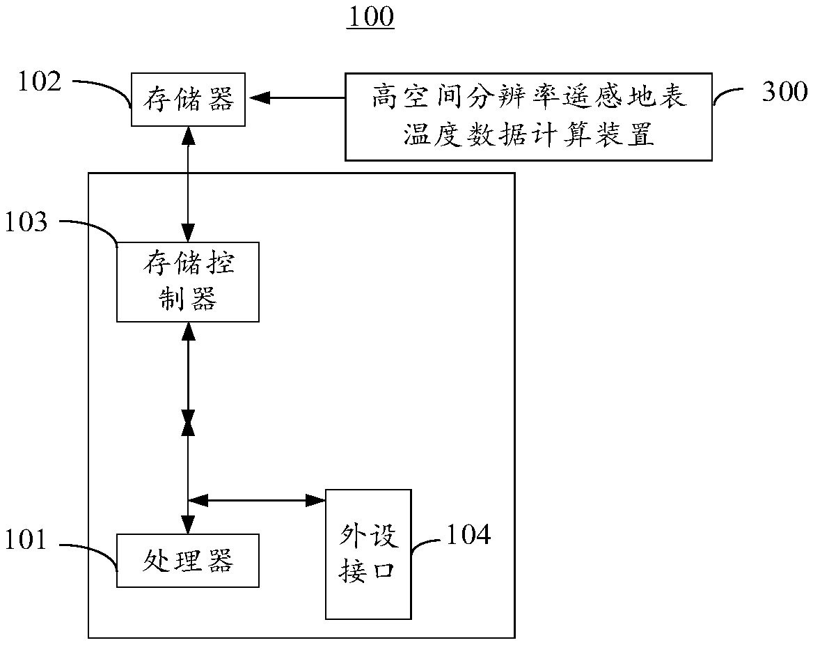
[0021] The following will clearly and completely describe the technical solutions in the embodiments of the present invention with reference to the accompanying drawings in the embodiments of the present invention. Obviously, the described embodiments are only some, not all, embodiments of the present invention. The components of the embodiments of the invention generally described and illustrated in the figures herein may be arranged and designed in a variety of different configurations. Accordingly, the following detailed description of the embodiments of the invention provided in the accompanying drawings is not intended to limit the scope of the claimed invention, but merely represents selected embodiments of the invention. Based on the embodiments of the present invention, all other embodiments obtained by those skilled in the art without making creative efforts belong to the protection scope of the present invention.

[0022] The high spatial resolution remote sensing su...


PUM


Abstract

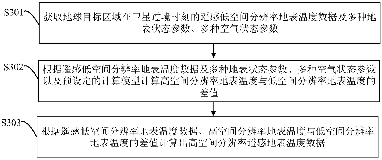
The invention provides a method and device for calculating high spatial resolution remote sensing surface temperature data, which relates to the field of remote sensing estimation of surface temperature. Firstly, the low spatial resolution land surface temperature data, many kinds of land surface state parameters and many kinds of air state parameters of the earth target area at the time of satellite transit are obtained. Then calculating the difference between the high spatial resolution surface temperature and the low spatial resolution surface temperature according to the remote sensing lowspatial resolution surface temperature data and the plurality of surface state parameters, the plurality of air state parameters and the preset calculation model; At last, based on that remote sensing low spatial resolution land surface temperature data, The difference between high spatial resolution land surface temperature and low spatial resolution land surface temperature is used to calculatethe high spatial resolution land surface temperature, and the precision of the high spatial resolution land surface temperature is high, so the spatial downscaling of the low spatial resolution surface temperature data is realized.

Description

technical field [0001] The invention relates to the field of remote sensing estimation of surface temperature, in particular to a method and device for calculating remote sensing surface temperature data with high spatial resolution. Background technique [0002] Surface temperature is a key parameter in surface energy balance and water cycle on a regional and global scale. It is used to evaluate surface energy and hydrological balance, surface thermal inertia, and soil moisture. Researches such as meteorology and hydrology are of great significance. The surface temperature varies greatly both in space and in time. However, there is a contradiction between spatial resolution and temporal resolution when obtaining land surface temperature through satellite remote sensing technology: satellites with high spatial resolution have low temporal resolution, and vice versa. In order to solve this contradiction, it is usually necessary to obtain high-spatial-resolution and high-tim...

Claims


Application Information

Patent Timeline
IPC IPC(8): G06F17/10G01K11/00
CPCG01K11/00G06F17/10
Inventor 唐荣林姜亚珍李召良黄凌霄邸苏闯
Owner INST OF GEOGRAPHICAL SCI & NATURAL RESOURCE RES CAS
Learn More