
A Segmentation Method of Hyperspectral Remote Sensing Image Based on Spectral Curve Spectral Distance
A hyperspectral remote sensing and spectral curve technology, applied in the field of image segmentation, can solve the problems of affecting the remote sensing image segmentation effect, edge gradient image noise, too many false edges, and complex ground object types, so as to suppress over-segmentation and improve reliability. , the effect of improving production efficiency and quality of results
Patent Information
- Authority / Receiving Office
- CN · China
- Patent Type
- Patents(China)
- Current Assignee / Owner
- Publication Date
- 2022-04-08
Smart Images
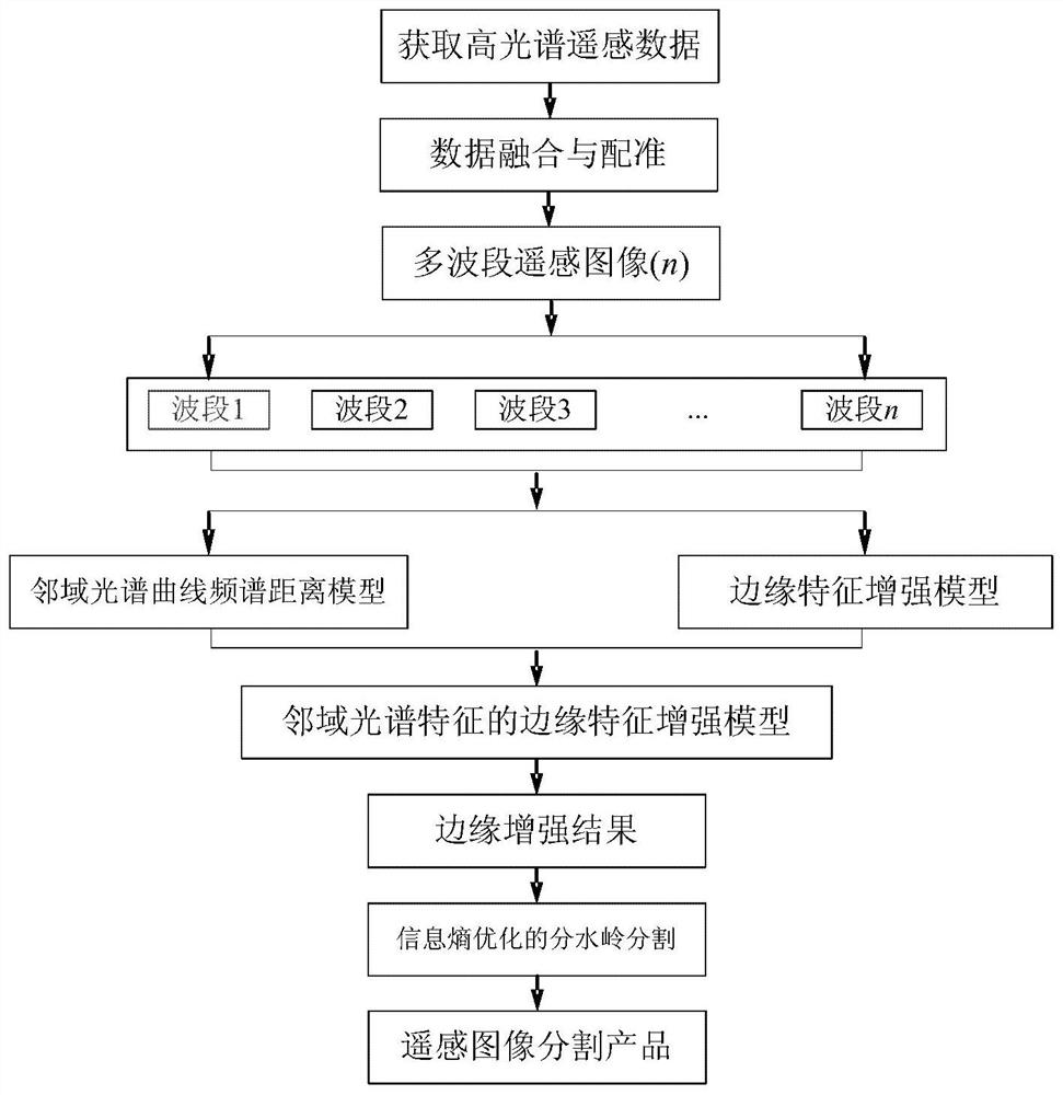
Figure 1 
Figure 2 
Figure 3
Abstract
Description
technical field
[0001] The invention belongs to the technical field of image segmentation, and in particular relates to a hyperspectral remote sensing image segmentation method based on spectral curve spectral distance. Background technique
[0002] Hyperspectral data provides hundreds of narrow spectral bands, which can form a complete and continuous spectral response curve to record the spectral information of the target object. Compared with multispectral data, hyperspectral remote sensing images provide richer spectral information of ground objects and more obvious spectral features, so it is possible to finely classify and directly identify ground object coverage types from spectral space. Image segmentation is the key technology of remote sensing information acquisition and ground object recognition, which provides a new idea for information extraction of hyperspectral images, and its core is to realize the segmentation of hyperspectral remote sensing images.
[0003] ...
Examples
Embodiment Construction
[0046] The technical solutions of the present invention will be further elaborated below according to the drawings and in conjunction with the embodiments.
[0047] A method for segmenting hyperspectral remote sensing images based on spectral curve spectral distance, an embodiment such as figure 1 As shown in , data preprocessing is performed after obtaining hyperspectral remote sensing data, including data fusion and registration, and deleting bands with too much noise (that is, noise exceeding the preset value), and finally determining n bands of hyperspectral remote sensing data as hyperspectral Input data for remote sensing image segmentation (multi-band remote sensing image). The spectral distance model of the neighborhood spectral curve is used to reduce the noise and false edge phenomenon, and at the same time reduce the gradient dependence of the edge enhancement, and then construct the edge feature enhancement model based on the neighborhood spectral feature, and comb...