Meteorological facsimile map contour interpolation method based on T-spline

A meteorological facsimile, interpolation method technology, applied in the direction of graphics and image conversion, image data processing, instruments, etc., can solve the problems of poor robustness, a large number of line segment sets, small application range, etc., to achieve convenient analysis and processing, easy local refinement , the effect of efficient splicing

Active Publication Date: 2019-02-26
NANJING UNIV OF SCI & TECH
View PDF3 Cites 7 Cited by
  • Summary
  • Abstract
  • Description
  • Claims
  • Application Information

AI Technical Summary

Problems solved by technology

[0003] At this stage, the digitization level of the meteorological fax map is not high, and the weather conditions in all places in the map cannot be displayed, so interpolation is required to predict unknown data based on existing data
Commonly used spatial interpolation methods include: Delaunay triangulation method, minimum curvature method, natural neighbor interpolation method, etc. However, the application range of these interpolation algorithms is small, and good interpolation effects can only be achieved under a relatively uniform point distribution, and the calculation The process is complex and requires high hardware
Norman proposed an alg

Method used


Image

  • Meteorological facsimile map contour interpolation method based on T-spline
  • Meteorological facsimile map contour interpolation method based on T-spline
  • Meteorological facsimile map contour interpolation method based on T-spline

Examples


Embodiment

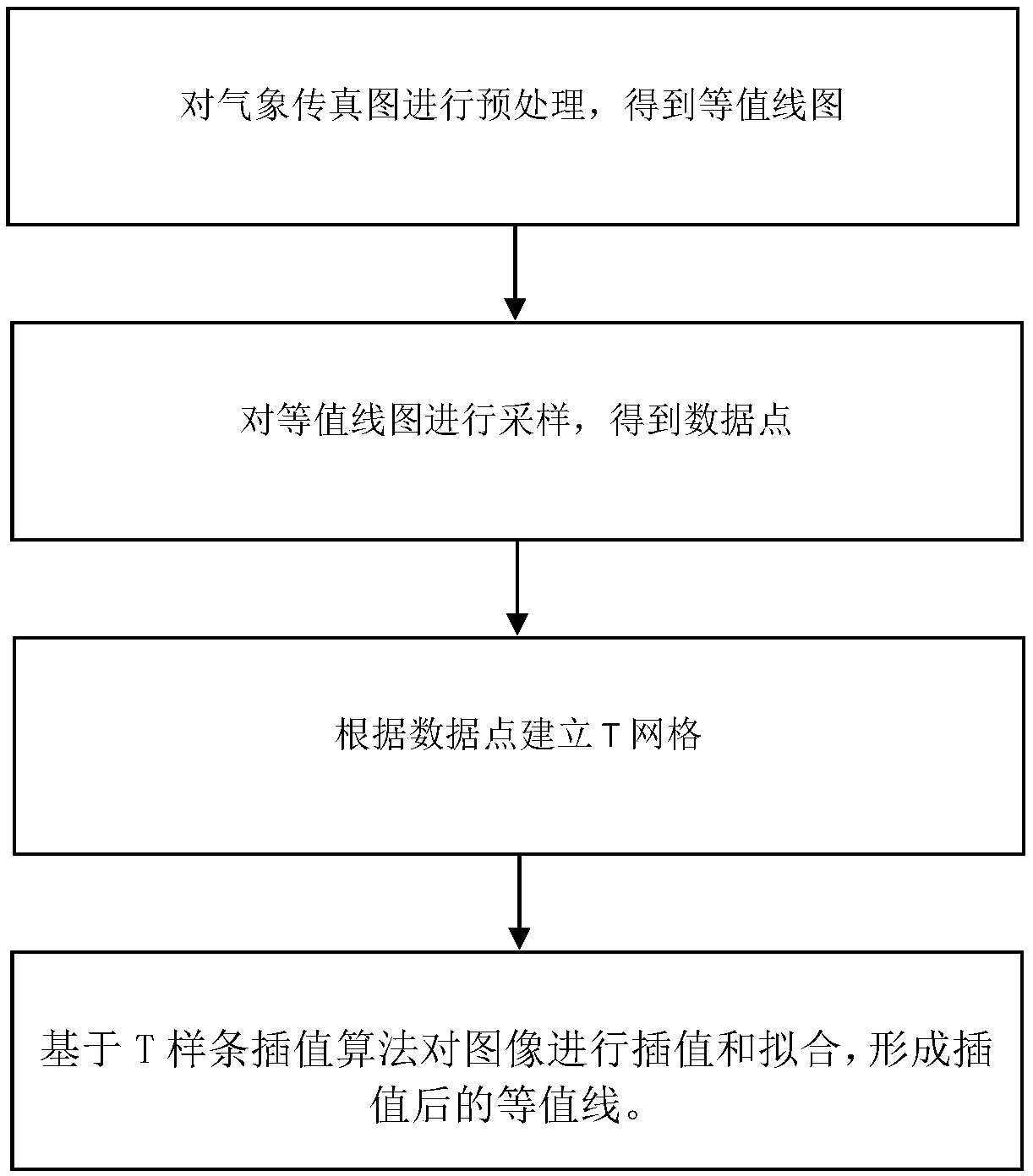
[0052] The present invention adopts a contour interpolation model based on T-splines. This model utilizes the special properties of T-splines to have a unified expression except for singular points in the interpolation process, which can bring great benefits to curved surface reconstruction. Great convenience, and use the T-spline local interpolation algorithm to subdivide the contour for better interpolation. Such as figure 1 As shown, the interpolation method based on T-spline meteorological facsimile map contours includes the following steps:

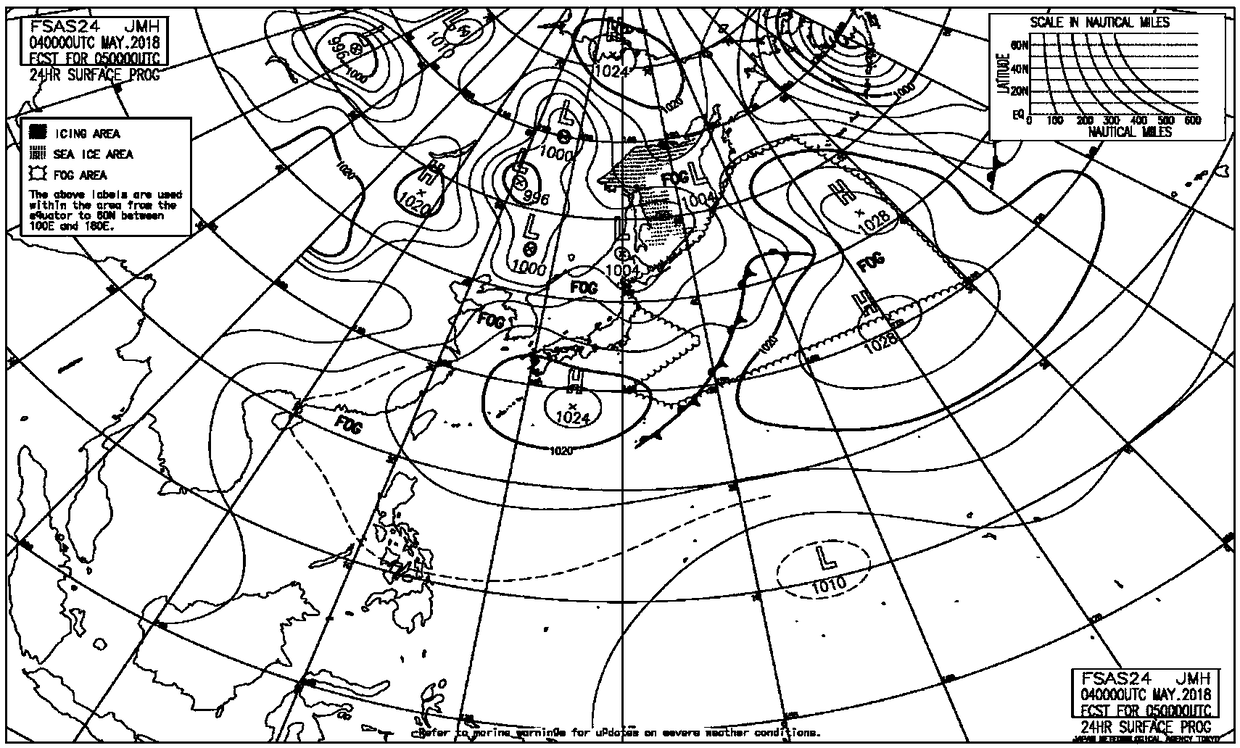
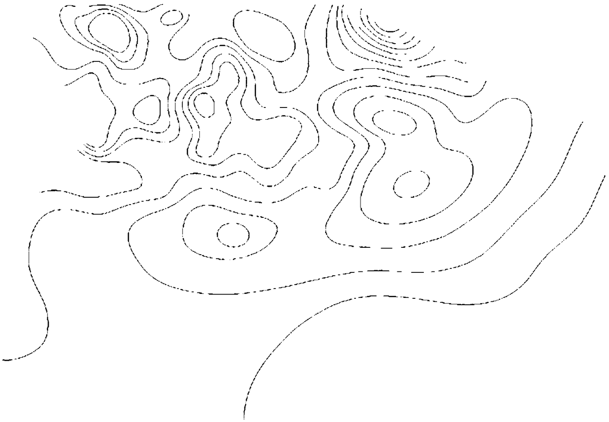
[0053] The first step is to preprocess the meteorological facsimile map, and only keep the contour lines. figure 2 It shows an original meteorological facsimile map released by Japan JMH in April 2018. It can be seen from the map that in addition to the required contour lines, it also contains redundant information such as longitude and latitude lines, base maps, title legends, and front lines. Therefore, it needs to be processed ...


PUM


Abstract

The invention discloses a meteorological facsimile map isoline interpolation method based on T-spline. Firstly, the meteorological facsimile map is pretreated to obtain an image only containing the isoline. Then point-by-point screening method is used to sample the processed contours and extract the data points. T grid is established according to the data points; Finally, the T-spline local node interpolation algorithm is used to interpolate the image, and the interpolated points are fitted into curves to form the interpolated contours. The invention improves the operation speed and the ability of local interpolation, and reduces the accumulation of errors and data redundancy.

Description

technical field [0001] The invention belongs to the field of computer graphics, in particular to a T-spline-based contour interpolation method for weather facsimile maps. Background technique [0002] Meteorological Facsimile Chart (Meteorological Facsimile Chart) is a simple and intuitive weather chart received by a meteorological fax machine. It fills in the meteorological data of each observation point in a certain area at the same time on a special base map. , thus reflecting the weather conditions and changing trends in the region. As an important tool for maritime navigation, meteorological facsimile maps can be used to observe and monitor the occurrence, evolution and movement of sea conditions and weather systems in the navigation sea area, which is helpful for ships to stay away from bad weather, choose reasonable routes, arrange effective operations, and ensure navigation safety. Significance. [0003] At this stage, the digitization level of the weather facsimil...

Claims


Application Information

Patent Timeline
IPC IPC(8): G06T3/40
CPCG06T3/4007
Inventor 张芮张雪禹潘海朗
Owner NANJING UNIV OF SCI & TECH
Why Eureka
Try Eureka