

Beidou/GNSS (Global Navigation Satellite System) satellite navigation teaching and experiment cloud platform
An experimental cloud platform and satellite navigation technology, applied in teaching aids, educational tools, space navigation equipment, etc., can solve the problems of inconvenient version update, time-consuming experiments, and incomplete understanding of knowledge points, so as to save lesson preparation time and facilitate rapid The effect of developing and promoting the opening of resources
- Summary
- Abstract
- Description
- Claims
- Application Information
AI Technical Summary
Problems solved by technology
Method used
Image

Examples
Embodiment Construction
[0042] The present invention will be further described in detail below in conjunction with the accompanying drawings and specific embodiments.
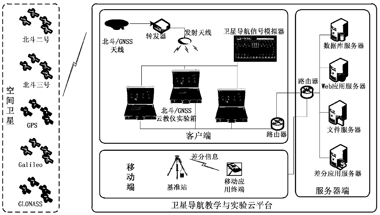
[0043] like figure 1 Shown, a kind of Beidou / GNSS satellite navigation teaching and experiment cloud platform of the present invention, comprises client end, mobile end, server end three parts. Among them, the client is deployed locally, including Beidou / GNSS cloud teaching instrument experiment box, satellite navigation signal simulator, Beidou / GNSS antenna, transponder, and transmitting antenna; the mobile terminal is deployed outdoors, including mobile application terminals and reference stations; The server side is also called the cloud, and it is deployed in a designated location, including database servers, file servers, Web servers and differential application servers. The mobile terminal and the server are connected through the Internet, and the data collected by the mobile terminal is stored in the differential server on the...
PUM
 Abstract
Description
Claims
Application Information