
Region marking method and device and electronic equipment

A technology of area marking and area, applied in the direction of electrical digital data processing, special data processing applications, instruments, etc., can solve the problems of not being able to display local objects, high hardware requirements, and inability to display large scenes, etc., to improve accuracy and reliability effects

Inactive Publication Date: 2019-05-24
CHONGQING JIAOTONG UNIVERSITY +2
View PDF0 Cites 7 Cited by
  • Summary
  • Abstract
  • Description
  • Claims
  • Application Information

AI Technical Summary

Problems solved by technology

When determining the condition of the road surface, if BIM technology is used, because BIM technology has great advantages in displaying the details of individual objects, it can provide detailed attribute information of the road model, but due to the high requirements for hardware, it cannot Show large scenes with surrounding environment
However, if GIS technology is used, it can display and analyze the spatial information of roads in a large scene, but it does not have the function of displaying specific details of local objects.

Method used


Image

  • Region marking method and device and electronic equipment
  • Region marking method and device and electronic equipment
  • Region marking method and device and electronic equipment

Examples


Embodiment Construction

[0053] The following will clearly and completely describe the technical solutions in the embodiments of the present invention with reference to the accompanying drawings in the embodiments of the present invention. Obviously, the described embodiments are some of the embodiments of the present invention, but not all of them. Based on the embodiments of the present invention, all other embodiments obtained by persons of ordinary skill in the art without making creative efforts belong to the protection scope of the present invention.

[0054] It should be understood that in this application, BIM may also be referred to by other names, such as Building Information Management (Building Information Management) or Building Information Manufacturing (Building Information Manufacture), etc., which are not limited in this application. The BIM is based on the relevant information data of the construction project, through digital information simulation, through the three-dimensional build...


PUM


Abstract

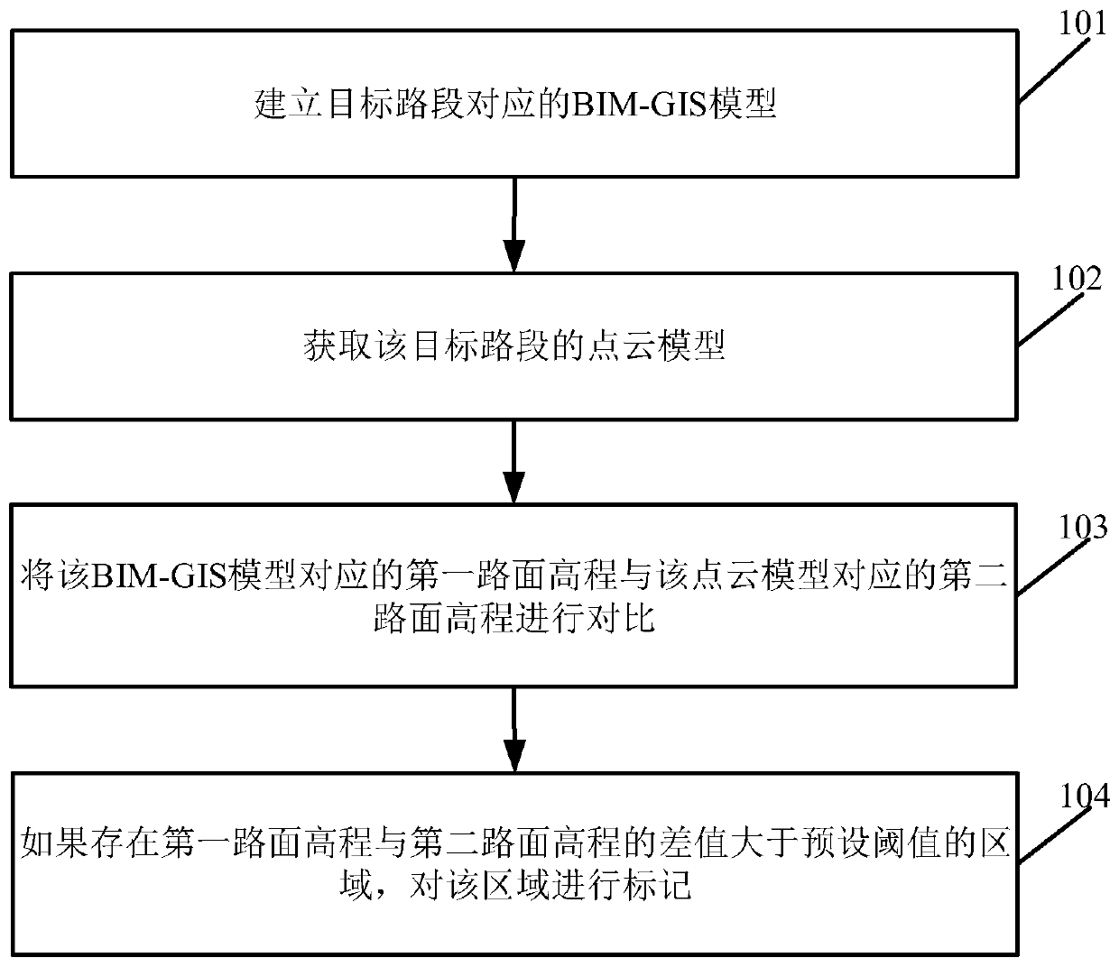
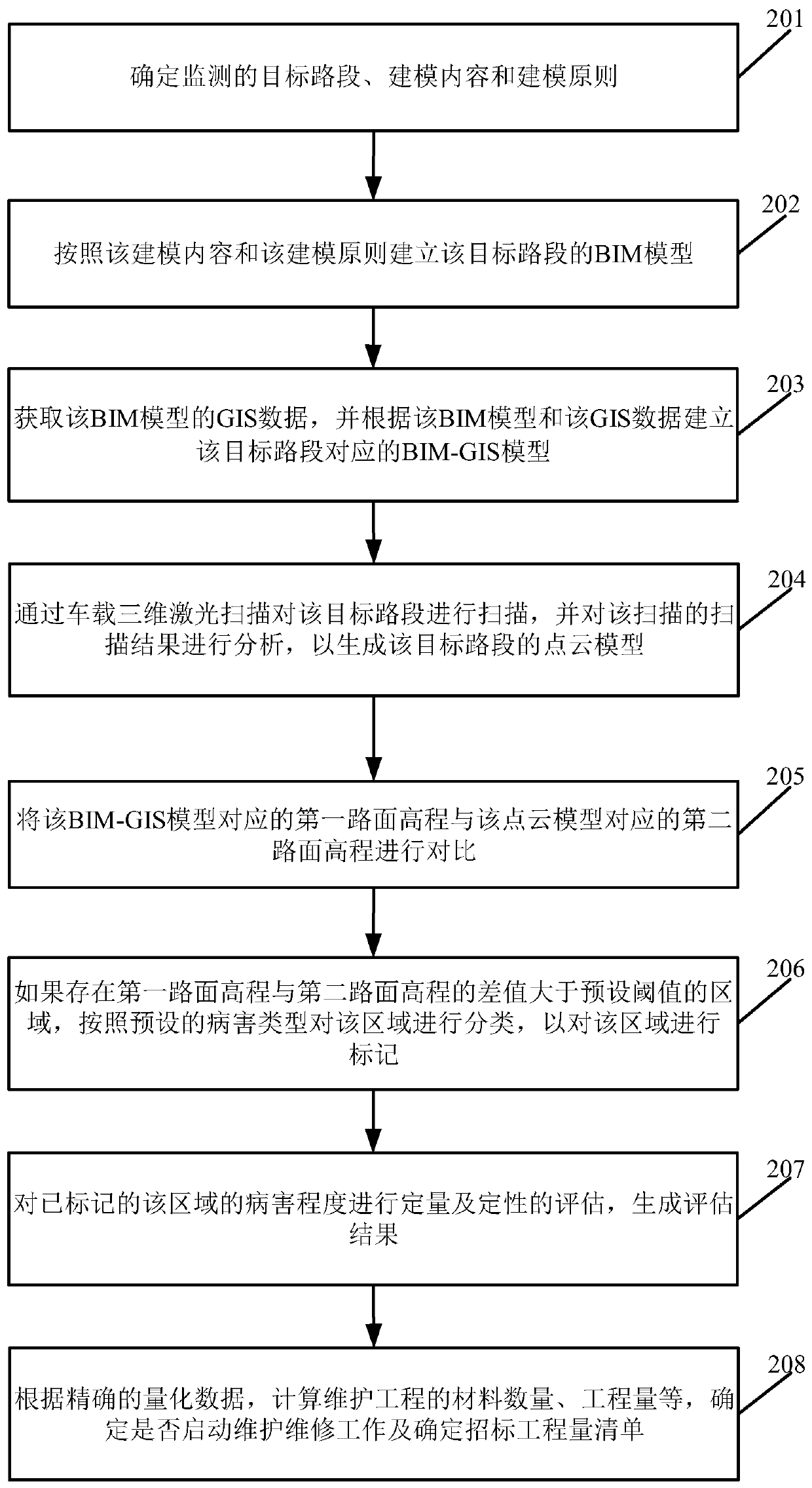
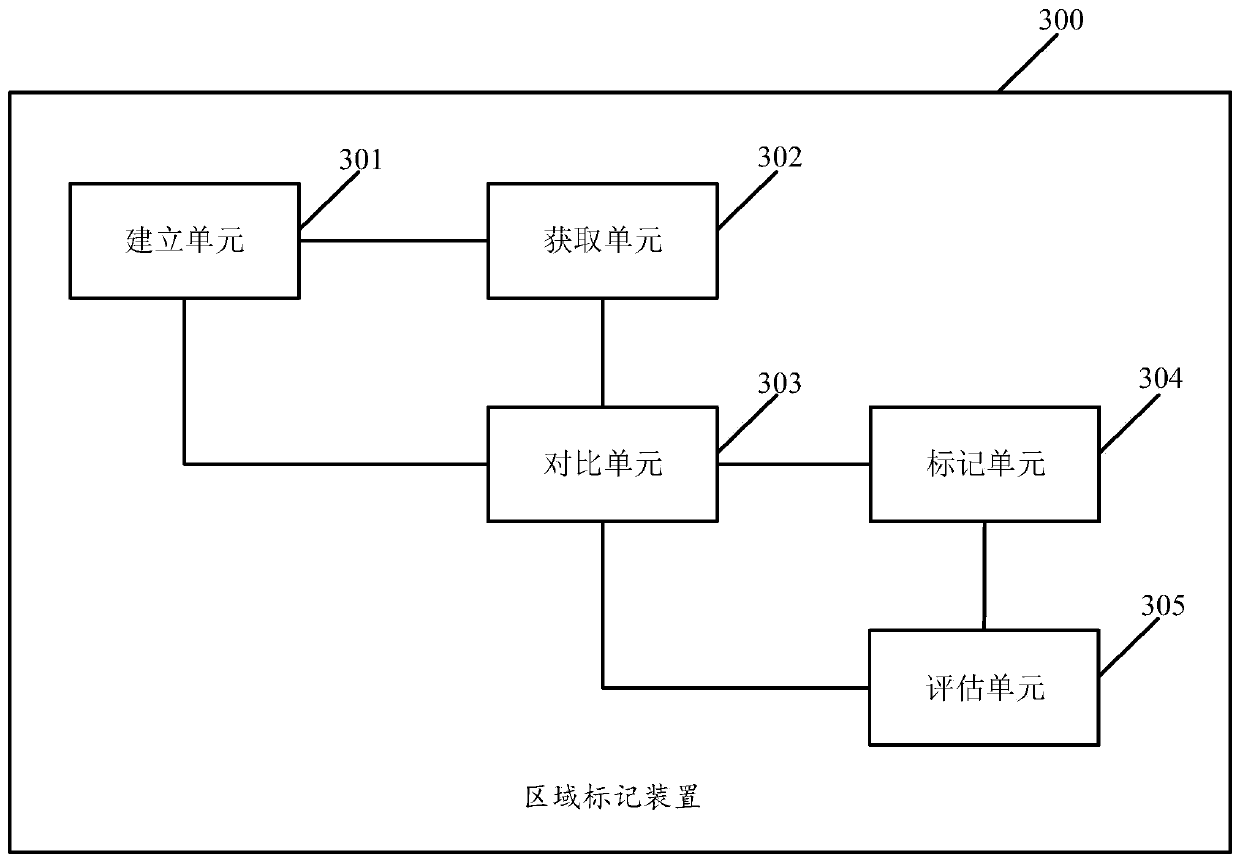
The embodiment of the invention discloses a region marking method, device and electronic device, wherein the method comprises: establishing a building information model geographic information system BIM-GIS model corresponding to a target road segment, wherein the BIM-GIS model is based on the target Determining the BIM model of the road segment and the GIS data; acquiring a point cloud model of the target road segment; comparing the first road surface elevation corresponding to the BIM-GIS model with the second road surface elevation corresponding to the point cloud model; There is an area where the difference between the first road surface elevation and the second road surface elevation is greater than a preset threshold, and the area is marked. The implementation of the embodiments of the present invention helps to determine the area where the road is diseased in time to improve the accuracy and reliability of the road disease determination.

Description

technical field [0001] The invention relates to the field of computer application technology, in particular to an area marking method, device and electronic equipment. Background technique [0002] Building Information Modeling (Building Information Modeling, BIM) is an information model applied in the whole life cycle management of buildings. It can be stored in BIM to realize refined and informational management of the construction industry. Geographic Information System (GIS) is a spatial information system that can collect, store, manage, calculate, analyze, display and describe data related to geographical distribution in the entire or part of the earth's surface space. The display and analysis of spatial information has the advantage of being fast and intuitive. [0003] As a major mode of transportation, highway plays a vital role in the development of social economy. There will be many diseases and problems in the operation of highways at all levels, such as the u...

Claims


Application Information

Patent Timeline
IPC IPC(8): G06F17/50
Inventor 高宇于晨晨刘亚超郭杰明周银应春莉高洪闻郭彤
Owner CHONGQING JIAOTONG UNIVERSITY
Learn More