Structure construction multi-point synchronous high-precision positioning method based on Beidou GNSS & BIM

A positioning method and high-precision technology, applied in satellite radio beacon positioning system, building structure, building material processing, etc., can solve the problems that cannot meet the large-scale monitoring of large-span structure construction, to ensure accuracy and synchronization Effect

Active Publication Date: 2019-06-28
NANTONG SIJIAN CONSTR GRP
View PDF6 Cites 4 Cited by
  • Summary
  • Abstract
  • Description
  • Claims
  • Application Information

AI Technical Summary

Problems solved by technology

The existing technical means can only monitor individual key nodes (patent number: 201610637972.0, patent name: a BIM-based method for controlling the hydraulic lifting accuracy of steel structure grids), which cannot meet the large-scale monitoring of large-span structure construction needs

Method used


Image

  • Structure construction multi-point synchronous high-precision positioning method based on Beidou GNSS & BIM
  • Structure construction multi-point synchronous high-precision positioning method based on Beidou GNSS & BIM
  • Structure construction multi-point synchronous high-precision positioning method based on Beidou GNSS & BIM

Examples


Embodiment 1

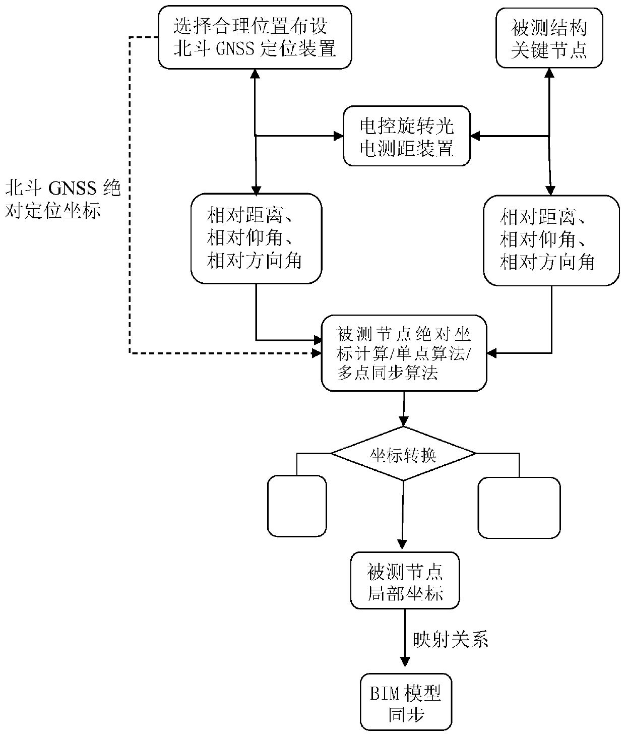
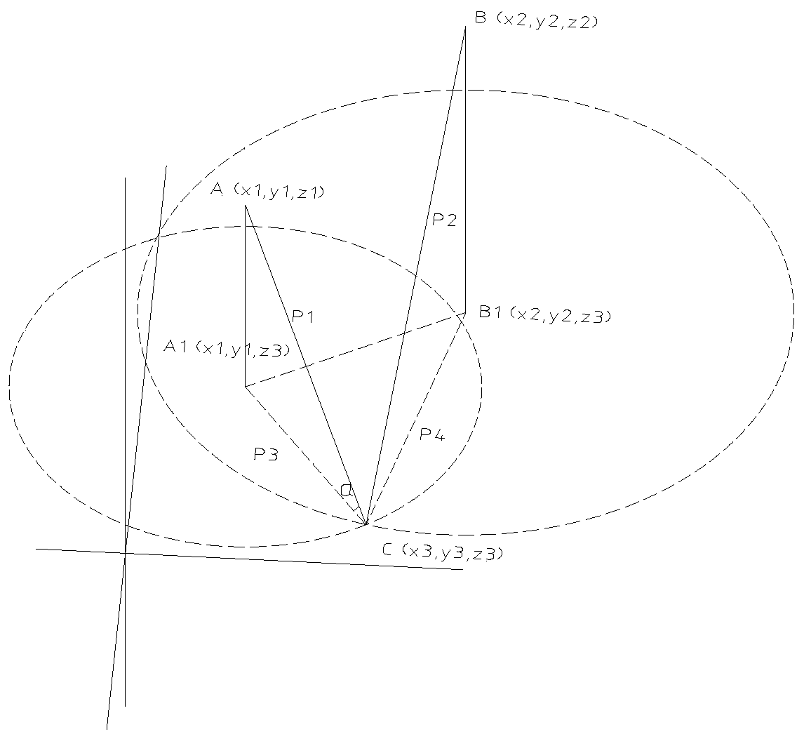
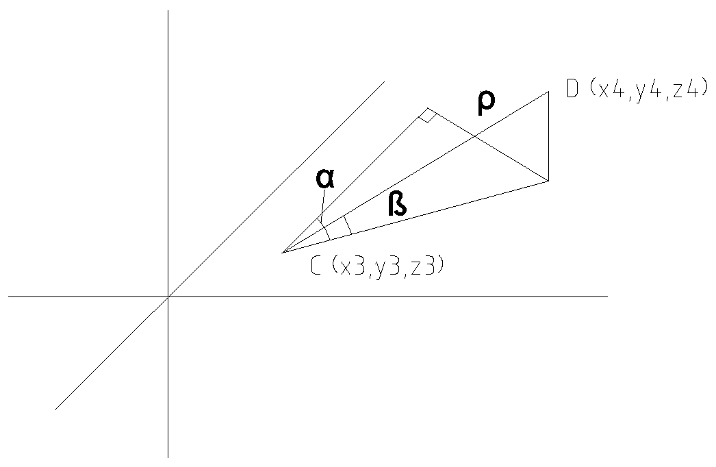
[0067] Example 1, an international convention and exhibition center project in a coastal city along the river, including two main bodies, the conference center and the exhibition center, with a total construction area of ​​about 123,000 m 2 . The structural roof adopts steel truss and steel grid roof respectively, and correspondingly adopts jacking and sliding construction. In order to control the deflection deformation of the steel roof joints during the jacking and sliding process, the method provided by the patent of the present invention is adopted, through 2 sets of high-precision GNSS positioning equipment and 2 sets of 360-degree high-precision electronically controlled photoelectric ranging devices Simultaneously monitor the lifting and sliding process of the steel structure to ensure a successful construction without safety and quality construction.

[0068] A multi-point synchronous high-precision positioning method for structural construction based on Beidou GNSS&B...


PUM


Abstract

The invention provides a structure construction multi-point synchronous high-precision positioning method based on a Beidou GNSS & BIM. Multiple key nodes of a measured structure are synchronously measured through a 360-degree electronically-controlled rotating electro-optical distance measurement device, the geodetic coordinates of the measured nodes are automatically calculated according to coordinates provided by the Beidou GNSS, the relative distance and the relative elevation angle and direction angle between the distance measurement device and the high-precision positioning device and the relative distance and the relative elevation angle and direction angle between the distance measurement device and the measured key nodes, and the coordinates of corresponding nodes in the BIM are directly replaced through coordinate transformation and a mapping relationship. The structure construction multi-point synchronous high-precision positioning method based on the Beidou GNSS & BIM can realize synchronous measurement of the coordinates of multiple key nodes of the structure and keep the BIM synchronous with the structure construction.

Description

technical field [0001] It is mainly used in the measurement and precision control of civil engineering construction process, especially the intelligent analysis and construction simulation of construction precision using BIM technology. Background technique [0002] Due to the lack of data interaction, the construction BIM model is difficult to reflect the reality of the construction site. Although some automatic total stations can be set out and reviewed on site according to the BIM model, this technology cannot unify the BIM model with the site, which is not convenient for precision control and safety management services in the construction process. [0003] For the hydraulic lifting and sliding of large steel structures, it is extremely necessary to know the coordinates of the key nodes in the lifting and sliding process to evaluate the accuracy of the final construction and the safety of the construction process. The existing technical means can only monitor individual ...

Claims


Application Information

Patent Timeline
Patent Type & Authority Applications(China)
IPC IPC(8): E04G21/18G01C15/00G01S19/42G06F17/50
Inventor 徐卓顾东峰穆小香陈杨
Owner NANTONG SIJIAN CONSTR GRP
Why Eureka
Try Eureka