Method and device for extracting position information of obstacles

A technology of location information and obstacles, applied in the field of automatic driving, can solve the problems of hidden dangers in driving strategies, failure to obtain real location information of obstacle vehicles and pedestrians, and ignore location information, so as to eliminate mutual influence, improve safety, and accurately extract Effect

Active Publication Date: 2019-07-30
NEUSOFT REACH AUTOMOBILE TECH (SHENYANG) CO LTD
View PDF15 Cites 5 Cited by
  • Summary
  • Abstract
  • Description
  • Claims
  • Application Information

AI Technical Summary

Problems solved by technology

[0003] The current automatic driving technology uses radar to extract the position information of obstacles in front of the current road. However, when there are multiple obstacles in a certain area and there is partial occlusion between the multiple obstacles, the radar will only extract the location information between the area and the vehicle. The position information of the nearest obstacle will be ignored, and the position information of other partially covered obstacles will be ignored, which will cause safety hazards in the driving strategy of the vehicle during automatic driving.
See figure 1 In the scene shown, when the car is turning right during automatic driving, the obstacle vehicle driving on the left is blocked by the barrier (it can also be a green belt, building wall, signage and other facilities), and the pedestrian on the right is also blocked by the fence. If the barrier is blocked, the vehicle's radar may use the position information of the left barrier as the position information of the obstacle on the left and ignore the vehicle on the left, or / and use the position information of the barrier on the right as the position information of the obstacle on the right. The location information of pedestrians on the right is ignored, so that the car does not actually obtain the real location information of obstacle vehicles and pedestrians, which will make the driving strategy of the car when turning right, such as route selection, driving speed and braking time, etc. safe. Hidden danger

Method used


Image

  • Method and device for extracting position information of obstacles
  • Method and device for extracting position information of obstacles
  • Method and device for extracting position information of obstacles

Examples


Embodiment 1

[0047] Embodiment 1 of the present application provides a method for extracting obstacle location information, which will be described in detail below with reference to the accompanying drawings.

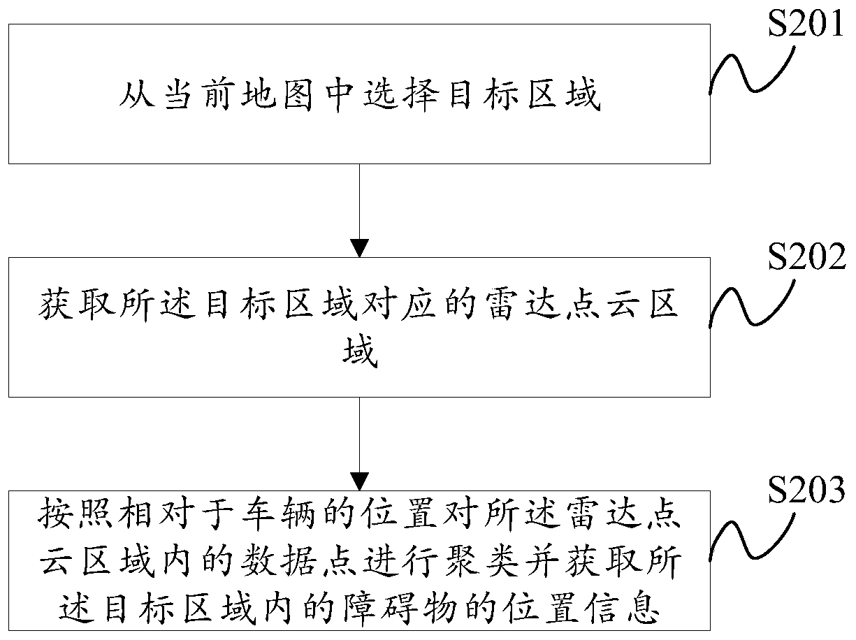
[0048] see figure 2 , which is a flowchart of a method for extracting obstacle position information provided in Embodiment 1 of the present application.

[0049] The method described in the embodiment of the present application includes the following steps:

[0050] S201: Select a target area from the current map.

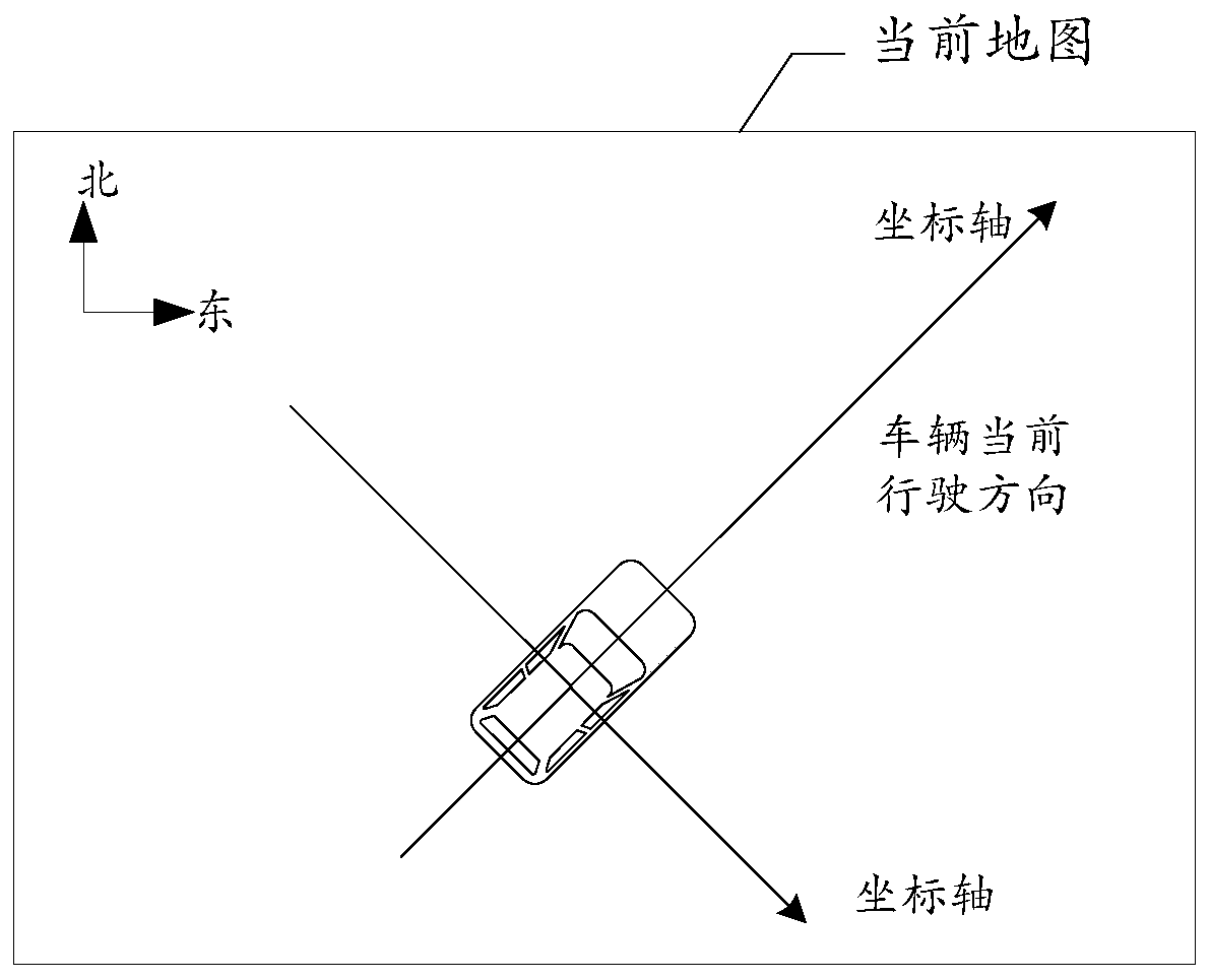
[0051] The current map refers to the map of the current driving area of ​​the vehicle. This application does not specifically limit the range of the current map. In a possible implementation, the specific location of the vehicle can be obtained by using a satellite navigation device on the vehicle information, combined with known map information to obtain the current map.

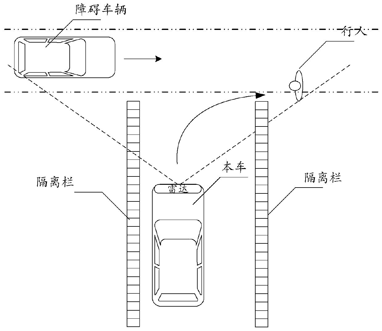
[0052] The target area is the area where the obstacle needs to be extracted, and the target ar...

Embodiment 2

[0071] Embodiment 2 of the present application also provides another method for extracting obstacle position information, which will be described in detail below with reference to the accompanying drawings.

[0072] see Figure 5 , which is a flow chart of another method for extracting obstacle position information provided in Embodiment 2 of the present application.

[0073] The method described in the embodiment of the present application includes the following steps:

[0074] S201: Select a target area from the current map.

[0075] S202a: Determine a radar point cloud area corresponding to the target area according to the position of the radar in the current map.

[0076] Further, when the vehicle is provided with a camera and the target area is within the shooting range of the camera, this step specifically further includes:

[0077] Converting the coordinate system of the radar into the coordinate system of the camera according to the relative position of the camera a...

Embodiment 3

[0092] Based on the method for extracting location information of obstacles provided in the foregoing embodiments, Embodiment 3 of the present application further provides a device for extracting location information of obstacles, which will be described in detail below with reference to the accompanying drawings.

[0093] see Figure 7 , which is a structural diagram of an apparatus for extracting obstacle position information provided in Embodiment 3 of the present application.

[0094] The device described in this embodiment of the present application includes: a selection unit 701 , a first acquisition unit 702 and a second acquisition unit 703 .

[0095] The selection unit 701 is configured to select a target area from the current map;

[0096] The first acquiring unit 702 is configured to acquire a radar point cloud area corresponding to the target area;

[0097] The second acquiring unit 703 is configured to cluster the data points in the radar point cloud area accordin...


PUM


Abstract

The invention provides a method for extracting position information of obstacles. The method comprises the following steps: selecting target areas from a current map, wherein the target areas are located in a measurement range of a radar; acquiring radar point cloud areas corresponding to the target areas; clustering data points located in the radar point cloud areas based on positions being relative to the positions of vehicles; and acquiring position information of the obstacles located in the target areas, wherein the data points comprise the data points corresponding to the obstacles located in the target areas. By utilizing the method provided by the invention, the position information of the obstacles can be accurately extracted, and the safety of the vehicles in an automatic drivingprocess is improved. The invention also provides a device for extracting the position information of the obstacles.

Description

technical field [0001] The present application relates to the technical field of automatic driving, in particular to a method and device for extracting obstacle position information. Background technique [0002] Autonomous driving technology is an important technology in the field of motor vehicles, and it is also a popular research direction for major manufacturers. Autonomous driving technology mainly relies on the cooperation of artificial intelligence, visual computing, radar, monitoring devices and global positioning system, etc., so that the on-board computer can automatically and safely operate the motor vehicle without any active human operation, and the obstacle position information As an important link in automatic driving, extraction directly affects the safety of automatic driving. [0003] The current automatic driving technology uses radar to extract the position information of obstacles in front of the current road, but when there are multiple obstacles in a...

Claims


Application Information

Patent Timeline
Patent Type & Authority Applications(China)
IPC IPC(8): G01S13/93
CPCG01S13/931
Inventor 张时嘉
Owner NEUSOFT REACH AUTOMOBILE TECH (SHENYANG) CO LTD
Why Eureka
Try Eureka