Underwater sensor network positioning method based on distance measurement correction

An underwater sensor, network positioning technology, applied in positioning, network topology, instruments and other directions, can solve the problem of not considering ranging error, affecting accuracy, high propagation delay, etc., to increase communication energy consumption, improve positioning accuracy, high The effect of practical value

Active Publication Date: 2019-08-02
QINGDAO UNIV OF SCI & TECH
View PDF6 Cites 2 Cited by
  • Summary
  • Abstract
  • Description
  • Claims
  • Application Information

AI Technical Summary

Problems solved by technology

Positioning technology is one of the key technologies of underwater wireless sensor networks; because underwater wireless sensor networks use underwater acoustic communication methods different from land communications, and the underwater environment is complex, ground node positioning methods cannot be directly applied to underwater wireless sensor networks.
[0003] In underwater wireless sensor networks, due to the complex underwater environment, there are many factors that cause node positioning errors, such as ranging errors, node movement, etc.; many existing underwater wireless sensor network positioning technologies are based on ranging In underwater wireless sensor networks, underwater acoustic channels have special characteristics such as narrow bandwidth, high propagation delay, and severe multipath scattering, which will lead to large ranging errors, which will greatly affect the performance of ranging-based positioning algorithms. Accuracy, underwater pressure, water temperature, and salinity have a great impact on underwater acoustic communication, making ranging errors the main source of errors in positioning algorithms; currently, most underwater positioning algorithms do not take this into account. One influencing factor, but focus on the error research caused by node movement
[0004] For the commonly used TP-TSFLA algorithm and SLA algorithm, these two algorithms need to measure the distance between the beacon node and the unknown node or between the beacon node and the beacon node in practical application. As we all know, as long as the distance is measured There will be ranging errors, but the above two algorithms do not consider the factor of ranging errors, which leads to large ranging errors; in order to solve the problem of poor measurement accuracy caused by ranging errors in underwater sensor networks, it is urgent to propose a A new positioning method that can correct the ranging error. By studying the geometric relationship between the position of the beacon node, the position of the unknown node containing the ranging error, and the true position of the unknown node, the ranging error is corrected to improve the positioning accuracy.

Method used


Image

  • Underwater sensor network positioning method based on distance measurement correction
  • Underwater sensor network positioning method based on distance measurement correction
  • Underwater sensor network positioning method based on distance measurement correction

Examples


Embodiment Construction

[0046]In order to understand the above-mentioned purposes and advantages of the present invention more clearly, the specific embodiments of the present invention will be described in detail below in conjunction with the accompanying drawings:

[0047] This embodiment adopts the underwater sensor network positioning method based on ranging correction to correct the ranging error, which mainly includes the following steps:

[0048] 1. Node pre-positioning:

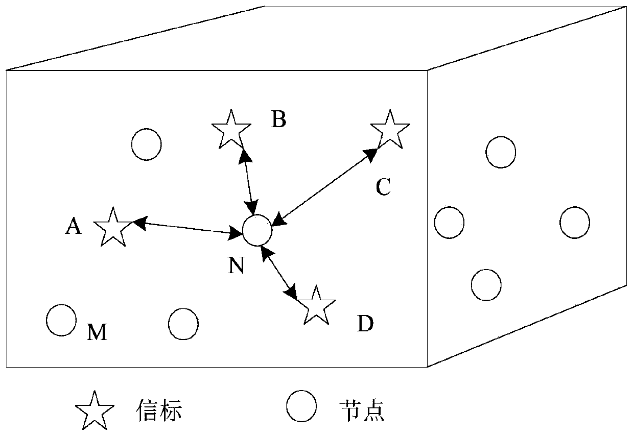
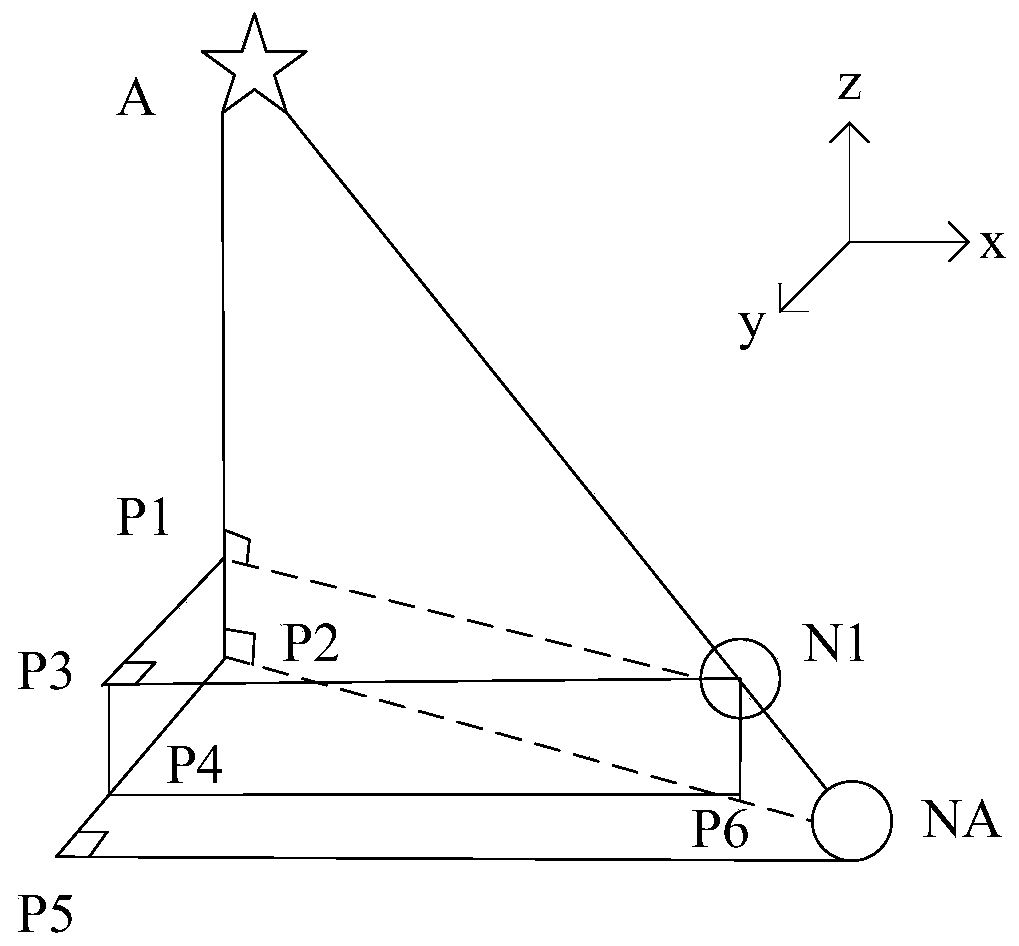
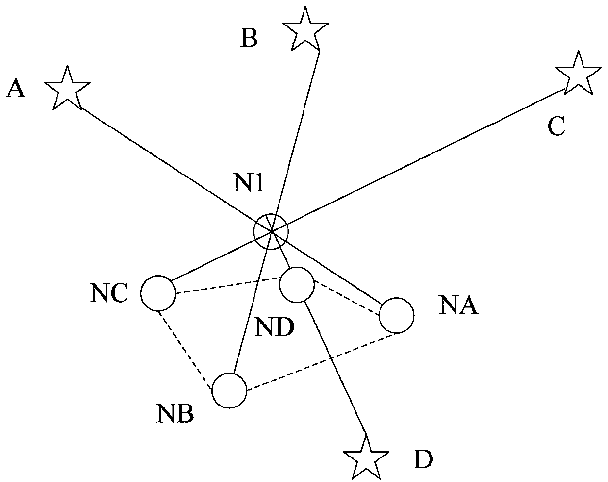
[0049] The distance between the beacon and the node is obtained by the ranging algorithm, and the pre-location position of the node is obtained based on the multilateral positioning algorithm. Specifically, the underwater sensor network is located in a cube area, and a corner of the cube is used as the center to establish Space Cartesian coordinate system; such as figure 1 As shown, this embodiment introduces beacons A, B, C, and D as examples. The positions of the beacons are known, and other nodes need to be positioned th...


PUM


Abstract

The invention discloses an underwater sensor network positioning method based on distance measurement correction, and the method mainly comprises the following steps of (1) carrying out the pre-positioning of a node, obtaining the distance between a beacon and the node through a distance measurement algorithm, and obtaining the pre-positioning position of the node through a multilateral positioning algorithm; (2) based on the accurate positioning of the distance measurement correction, reducing the distance measurement errors by utilizing a geometrical relationship between nodes, and calculating to obtain the accurate positions of the nodes. According to the scheme, the error correction caused by the limitation of a traditional positioning algorithm to node movement is broken through, andby starting from the beginning distance measurement error in the positioning process, the pre-positioning position of the node is obtained through the basic node positioning algorithm, then the geometric relation between the node positions is used for correcting the distance measurement error, so that the accurate position of the node is obtained, and the positioning precision is effectively improved.

Description

technical field [0001] The invention belongs to the technical field of underwater wireless sensor networks, and in particular relates to an underwater sensor network positioning method based on ranging correction. Background technique [0002] In recent years, with the rapid development of the marine economy, underwater wireless sensor networks have attracted much attention, providing sufficient technical support for marine resource detection, and are widely used in marine environmental governance, natural disaster prevention, and military defense. Positioning technology is one of the key technologies of underwater wireless sensor networks; because underwater wireless sensor networks use underwater acoustic communication methods different from land communications, and the underwater environment is complex, ground node positioning methods cannot be directly applied to underwater wireless sensor networks. . [0003] In underwater wireless sensor networks, due to the complex u...

Claims


Application Information

Patent Timeline
Patent Type & Authority Applications(China)
IPC IPC(8): H04W64/00H04W84/18G01S5/10
CPCG01S5/10H04W64/00H04W84/18
Inventor 郭瑛康晓月
Owner QINGDAO UNIV OF SCI & TECH
Why Eureka
Try Eureka