Large inland lake and wetland water level inversion method based on satellite altimetry data
A satellite altimetry and water level technology, which is applied in the field of data measurement and can solve the problems of complex calculation, low sea surface high precision, and large noise impact.
- Summary
- Abstract
- Description
- Claims
- Application Information
AI Technical Summary
Problems solved by technology
Method used
Image
Examples
Embodiment Construction
[0052] The present invention will be further described in detail below in conjunction with the accompanying drawings and embodiments.
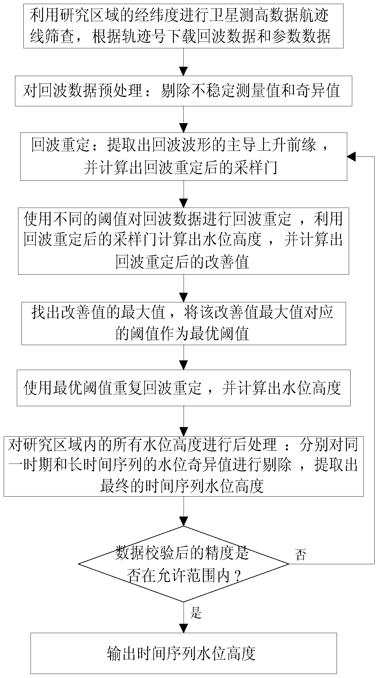
[0053] Such as figure 1 As shown, a large inland lake and wetland water level retrieval method based on satellite altimetry data includes the following steps:
[0054] Step 1. Use the latitude and longitude of the research area to screen the satellite altimetry data track line, and download the corresponding echo data and corresponding parameter data according to the track number;
[0055] Step 2. Preprocessing the echo data: removing unstable measurement values and singular values in the echo data to obtain preprocessed echo data;
[0056] In this embodiment, the auxiliary parameters in the parameter data are used to eliminate the unstable measurement values in the echo data, and then according to the histogram distribution of the measurement values, the 3δ rule is used to eliminate the obviously unreasonable measurement singular value...
PUM
 Abstract
Description
Claims
Application Information
 - R&D
- Intellectual Property
- Life Sciences
- Materials
- Tech Scout
- Unparalleled Data Quality
- Higher Quality Content
- 60% Fewer Hallucinations
Browse by: Latest US Patents, China's latest patents, Technical Efficacy Thesaurus, Application Domain, Technology Topic, Popular Technical Reports.
© 2025 PatSnap. All rights reserved.Legal|Privacy policy|Modern Slavery Act Transparency Statement|Sitemap|About US| Contact US: help@patsnap.com


