Spatial big data mining system based on clustering

A technology of data mining and large space, applied in data mining, structured data retrieval, geographic information database, etc., can solve the problems of system development cycle and heavy workload, low intelligence level, etc., to increase land output, improve The level of intelligence and the effect of improving land utilization

Inactive Publication Date: 2019-09-06
广州明领基因科技有限公司
View PDF0 Cites 2 Cited by
  • Summary
  • Abstract
  • Description
  • Claims
  • Application Information

AI Technical Summary

Problems solved by technology

[0004] The purpose of the present invention is to provide a cluster-based spatial big data mining system. For the data processing and basic space of the traditional system, a lot of human-computer interaction processing work is required, and the integration degree and intelligence level between the platforms are not high. System development Period and heavy workload, as well as the inability to scientifically provide decision support for

Method used


Image

  • Spatial big data mining system based on clustering
  • Spatial big data mining system based on clustering
  • Spatial big data mining system based on clustering

Examples


Embodiment Construction

[0016] The present invention will be described in more detail and complete below in conjunction with the accompanying drawings and specific embodiments. It should be understood that the specific embodiments described here are only used to explain the present invention, but not to limit the present invention.

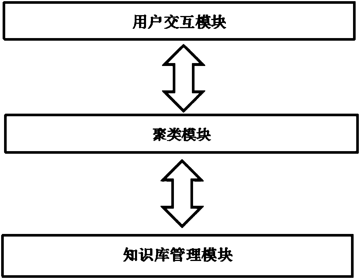
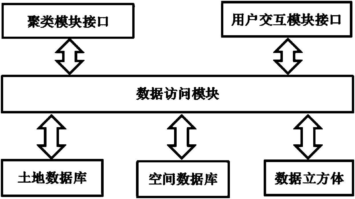
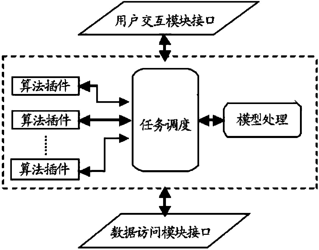
[0017] refer to figure 1 , a cluster-based spatial big data mining system of the present invention, the system includes: a data access module, a cluster module, a user interaction module and a knowledge base management module; wherein, the data access module is responsible for providing data access functions, which can As the data access interface of both the clustering module and the user interaction module, it simultaneously completes access to heterogeneous and heterogeneous data in the spatial database; the clustering module is responsible for accepting the data mining task request of the user interaction module And analyze, obtain the corresponding data through the...


PUM


Abstract

The invention discloses a spatial big data mining system based on clustering. The system comprises a data access module, a clustering module, a user interaction module and a knowledge base managementmodule, wherein the data access module is responsible for providing a data access function, can be used as a data access interface of the clustering module and the user interaction module, and completes access to heterogeneous and heterogeneous data in a spatial database at the same time; the clustering module is responsible for receiving and analyzing a data mining task request of the user interaction module, obtaining corresponding data through the data access module and completing clustering analysis, and finally transmitting a corresponding model back to the user interaction module; the user interaction module is responsible for helping a user to complete the interaction process of selecting a data mining algorithm, modeling, loading training data and completing prediction; and the knowledge base management module provides a transparent interface between the clustering module and the user interaction module and provides powerful support for spatial decision.

Description

technical field [0001] The invention belongs to the technical field of big data mining, and relates to a cluster-based spatial big data mining system. Background technique [0002] As the land use area has grown faster and faster in recent years, it is predicted that there will be more land use in the next few years. to the issue of effective management. [0003] There are several problems in the traditional resource management system. For example, data processing and basic space still require a lot of human-computer interaction processing work. The integration level and intelligence level between platforms are not high. Scientifically provide decision support for decision makers. Therefore, the society urgently needs to develop an efficient human-computer interaction processing system with a high level of artificial intelligence, to provide an intelligent analysis tool for land planning decision makers and to accurately predict the development trend of land use in the nex...

Claims


Application Information

Patent Timeline
IPC IPC(8): G06F16/29G06F16/35
CPCG06F2216/03G06F16/29G06F16/35
Inventor 徐继峰周峻松祁建明陈墩金
Owner 广州明领基因科技有限公司
Why Eureka
Try Eureka