Artificial intelligence-based unmanned aerial vehicle power transmission line inspection system and method
A transmission line, artificial intelligence technology, applied in the direction of finding the target control, etc., to achieve the effect of improving the level of automation, enhancing comprehensiveness, and shortening the time for troubleshooting
- Summary
- Abstract
- Description
- Claims
- Application Information
AI Technical Summary
Problems solved by technology
Method used
Image
Examples
Embodiment 1
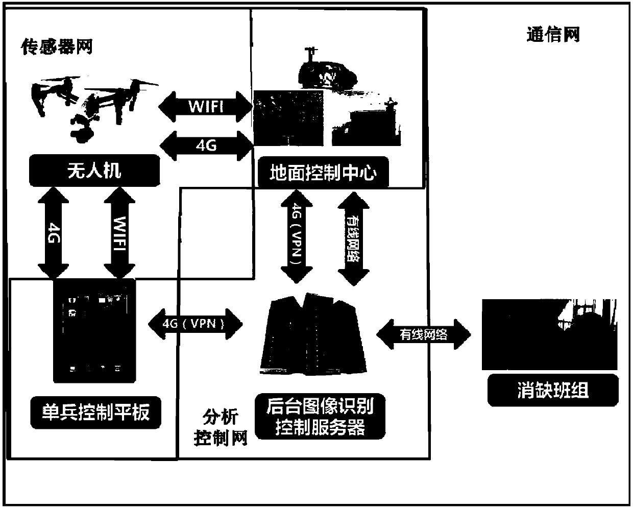
[0047]The purpose of this embodiment is to provide an artificial intelligence-based UAV transmission line inspection system.
[0048] In order to achieve the above purpose, this embodiment discloses a UAV transmission line inspection system, including: UAV, background server and UAV control platform. specifically,
[0049] The UAV collects target images according to preset control instructions and transmits them to the background server;
[0050] Specifically, through unmanned aerial vehicle flight control technology, standardize the flying height and shooting angle of unmanned aerial vehicles and other means to improve the quality of the captured images, establish a fixed cruising point for the unmanned aerial vehicle at the position of the tower, and at the same time stipulate Sequence of equipment to establish a standardized sampling process. The positioning device (such as GPS system, gyroscope) is built in the UAV, and when the image is taken, the position data is recor...
Embodiment 2
[0061] The purpose of this embodiment is to provide an inspection method based on the above inspection system.
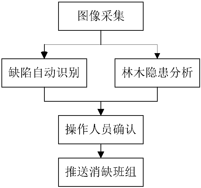
[0062] In order to achieve the above purpose, the present embodiment discloses an artificial intelligence-based UAV transmission line inspection method, including the following steps:
[0063] Step 1: The UAV collects the target image according to the preset control command and transmits it to the background server;
[0064] Specifically, through unmanned aerial vehicle flight control technology, standardize the flying height and shooting angle of unmanned aerial vehicles and other means to improve the quality of the captured images, establish a fixed cruising point for the unmanned aerial vehicle at the position of the tower, and at the same time stipulate Sequence of equipment to establish a standardized sampling process.
[0065] The UAV flight control system collects the flight state data measured by each sensor in real time, receives the control commands and d...
PUM
 Abstract
Description
Claims
Application Information
 - R&D
- Intellectual Property
- Life Sciences
- Materials
- Tech Scout
- Unparalleled Data Quality
- Higher Quality Content
- 60% Fewer Hallucinations
Browse by: Latest US Patents, China's latest patents, Technical Efficacy Thesaurus, Application Domain, Technology Topic, Popular Technical Reports.
© 2025 PatSnap. All rights reserved.Legal|Privacy policy|Modern Slavery Act Transparency Statement|Sitemap|About US| Contact US: help@patsnap.com


