
A Remote Sensing Method for Estimating Lake Suspended Sediment Concentration Using GOCI Data

A technology of concentration and sediment, which is applied in the field of water quality evaluation, can solve problems such as the difficulty in accurately evaluating the accumulation, drift, and settlement of suspended sediment, and the inability to estimate the concentration of suspended sediment in lakes, so as to achieve the effect of facilitating the overall evaluation

Active Publication Date: 2021-08-31
南京吉泽信息科技有限公司
View PDF10 Cites 0 Cited by
  • Summary
  • Abstract
  • Description
  • Claims
  • Application Information

AI Technical Summary

Problems solved by technology

[0003] Due to the influence of light attenuation, solar radiation often cannot penetrate the water body, but can only reach a certain depth. Therefore, for satellite remote sensing estimation of suspended sediment concentration in inland lakes, most of them only establish suspended sediment concentration estimation models for surface water bodies. , but only the calculation of the surface layer cannot estimate the suspended sediment concentration of the entire lake, so it is also difficult to accurately assess the accumulation, drift, settlement, and impact of suspended sediment on the downstream

Method used


Image

  • A Remote Sensing Method for Estimating Lake Suspended Sediment Concentration Using GOCI Data
  • A Remote Sensing Method for Estimating Lake Suspended Sediment Concentration Using GOCI Data
  • A Remote Sensing Method for Estimating Lake Suspended Sediment Concentration Using GOCI Data

Examples


Embodiment

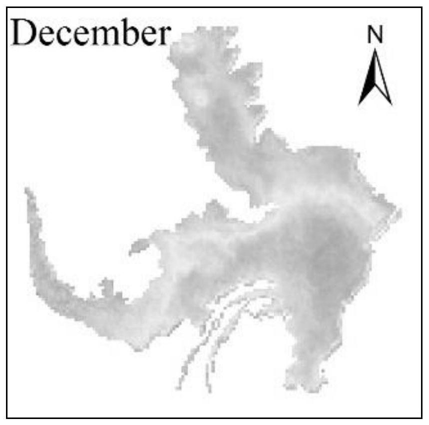
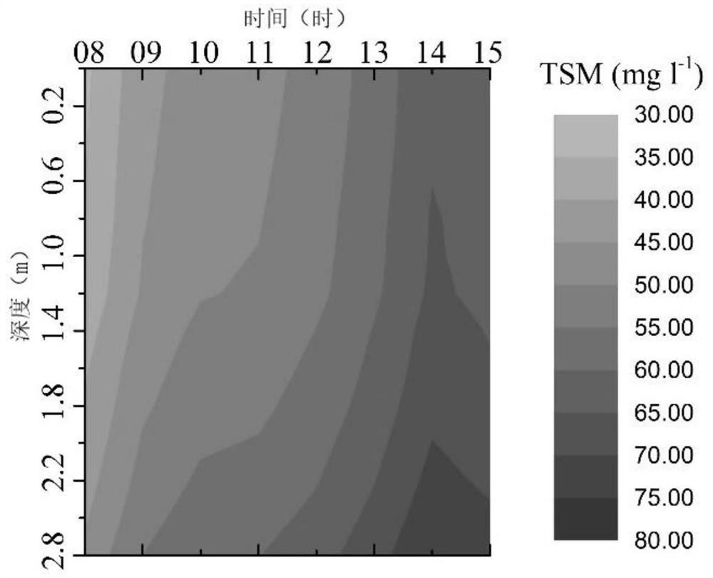
[0031] Using the GOCI data obtained in December 2016 of Hongze Lake, the suspended sediment concentration from the surface layer of Hongze Lake to the depth of 2.8m was estimated.

[0032] When implemented:

[0033] First, download and obtain COMS / GOCI data through the website (http: / / kosc.kiost.ac / eng / ), the location of the data is Hongze Lake, the data time is December 2016, and the data acquisition time is local time 8 and 9 , 10, 11, 12, 13, 14, 15.

[0034] Secondly, for all bands of the GOCI image of the water body obtained, the 6S model is used for atmospheric correction to obtain the water surface remote sensing albedo data of each band.

[0035] Then, use Equation 1 to estimate the suspended sediment concentration on the surface of Hongze Lake:

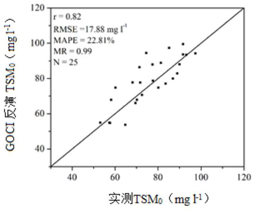
[0036] TSM 0 =4444.41*B2-5867.96*B3+1989.71*B6-8208.35*B7+11190.92*B8-711.26*B8 / B4+558.17*B7 / B4+34.6 Formula 1

[0037] Among them, TSM 0 is the concentration of suspended sediment on the surface, and B2, B3, B4, B6, B7,...


PUM


Abstract

The invention discloses a remote sensing method for recursively estimating suspended sediment concentrations in shallow lakes at different depths by using GOCI data, and belongs to the technical field of water body quality evaluation. The method includes the following steps: using the water color imager carried by the COMS satellite to carry out remote sensing monitoring of the water body to obtain the GOCI image of the water body; performing atmospheric correction on the obtained GOCI image of the water body to obtain the remote sensing reflectance values ​​after atmospheric correction in each band; using the formula Calculate the surface suspended sediment concentration; stratify the water body according to the depth, and the suspended sediment concentration in the lower water body is recursively calculated from the upper water body. This method uses the satellite remote sensing data obtained by GOCI to quickly obtain the suspended sediment concentration of the whole lake from the water surface to different depths.

Description

technical field [0001] The invention belongs to the technical field of water quality evaluation, and in particular relates to a remote sensing method for recursively estimating the concentration of suspended sediment in shallow lakes at different depths by using GOCI data. Background technique [0002] Suspended solids in water refer to solids that are suspended in the water and cannot pass through the filter membrane with a pore size of 0.45 microns. Suspended solids are the main water components that affect the turbidity, color and odor of the water. Therefore, they are important water quality parameters. In some river-connected lakes, such as Poyang Lake, Dongting Lake, Hongze Lake, etc., the suspended particles are mainly composed of suspended sediment, and the concentration of suspended sediment has long-term and continuous impact on the shape of the lakeshore and the bottom of the lake. [0003] Due to the influence of light attenuation, solar radiation often cannot pe...

Claims


Application Information

Patent Timeline
Patent Type & Authority Patents(China)
IPC IPC(8): G01N15/06
CPCG01N15/06G01N15/075
Inventor 李云梅雷少华
Owner 南京吉泽信息科技有限公司
Learn More