Path planning and wireless communication method for unmanned aerial vehicle cluster in ground sensor network

A ground sensor and path planning technology, applied in the field of UAV, can solve the problem of only considering the enhancement of energy efficiency or spectrum efficiency of ground sensor nodes

Inactive Publication Date: 2019-10-22
BEIJING JIAOTONG UNIV
View PDF5 Cites 22 Cited by
  • Summary
  • Abstract
  • Description
  • Claims
  • Application Information

AI Technical Summary

Problems solved by technology

However, most of the existing UAV applications only consider enhancing the energy efficiency or spectrum efficiency of ground sensor nodes, while ignoring that the limited energy of UAVs is the bottleneck of UAV-assisted wireless networks.

Method used


Image

  • Path planning and wireless communication method for unmanned aerial vehicle cluster in ground sensor network
  • Path planning and wireless communication method for unmanned aerial vehicle cluster in ground sensor network
  • Path planning and wireless communication method for unmanned aerial vehicle cluster in ground sensor network

Examples


Embodiment Construction

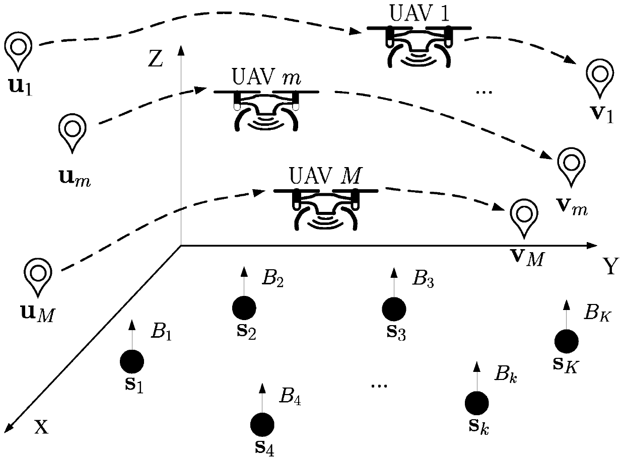
[0063] Embodiments of the present invention are described in detail below, examples of which are shown in the drawings, wherein the same or similar reference numerals denote the same or similar elements or elements having the same or similar functions throughout. The embodiments described below by referring to the figures are exemplary only for explaining the present invention and should not be construed as limiting the present invention.

[0064] Those skilled in the art will understand that unless otherwise stated, the singular forms "a", "an", "said" and "the" used herein may also include plural forms. It should be further understood that the word "comprising" used in the description of the present invention refers to the presence of said features, integers, steps, operations, elements and / or components, but does not exclude the presence or addition of one or more other features, Integers, steps, operations, elements, components, and / or groups thereof. It will be understoo...


PUM


Abstract

The present invention provides a path planning and wireless communication method for an unmanned aerial vehicle cluster in a ground sensor network. A plurality of ground sensor nodes are randomly distributed over a wide area. A path planning and wireless communication mechanism optimization model of unmanned aerial vehicle cluster information acquisition is established under the condition that each ground sensor node can successfully upload a certain amount of data with limited energy. A dichotomy-based algorithm is applied to solve the problem of minimizing the total flight time of the unmanned aerial vehicle in the path planning and wireless communication mechanism optimization model of the unmanned aerial vehicle cluster information acquisition, and the optimal time-of-flight interval number N of unmanned aerial vehicle is obtained. Specifically, the optimal flight trajectory of the unmanned aerial vehicle, unmanned aerial vehicle and ground sensor scheduling strategy and the corresponding ground sensor transmission time and transmitting power are solved by the path planning and wireless communication mechanism optimization model of unmanned aerial vehicle cluster information acquisition through the algorithm based on continuous convex approximation under the given N. The flight time of the unmanned aerial vehicle is minimized by jointly optimizing the flight trajectory of the unmanned aerial vehicle cluster, the scheduling strategy of the unmanned aerial vehicle and the ground sensor nodes and the corresponding ground sensor transmitting power and transmission time andthus the energy of the unmanned aerial vehicle can be saved.

Description

technical field [0001] The invention relates to the technical field of unmanned aerial vehicles, in particular to a path planning and wireless communication method for an unmanned aerial vehicle cluster in a ground sensor network. Background technique [0002] UAV (Unmanned Aerial Vehicle, UAV) is an unmanned aerial vehicle operated by radio remote control equipment or its own program control device. It uses aerodynamics to navigate and perform desired functions. It has wide application, low cost and strong survivability. , good mobility and easy to use. UAVs have been widely used in military and civilian fields, greatly reducing the cost of casualties and improving the security and adaptability of combat system platforms. In recent years, with the continuous reduction of production costs and the characteristics of miniaturization, high mobility, and flexible deployment, UAVs are increasingly used in civil and commercial fields, such as: flow control, cargo transportation, ...

Claims


Application Information

Patent Timeline
Patent Type & Authority Applications(China)
IPC IPC(8): G08G5/00H04W40/04H04W40/10H04W84/18G05D1/10
CPCG05D1/104G08G5/003G08G5/0043H04W40/04H04W40/10H04W84/18Y02T10/40Y02D30/70
Inventor 沈超宗佳颖成晶曹瑷麟
Owner BEIJING JIAOTONG UNIV
Why Eureka
Try Eureka