Estimation method of vehicle number in satellite video based on generative adversarial network

A satellite and video technology, applied in the field of satellite video vehicle number estimation, can solve problems such as detection difficulties, and achieve the effect of avoiding detection difficulties and data shortages

Active Publication Date: 2022-05-03
CHONGQING UNIV OF POSTS & TELECOMM
View PDF6 Cites 0 Cited by
  • Summary
  • Abstract
  • Description
  • Claims
  • Application Information

AI Technical Summary

Problems solved by technology

[0007] In order to solve the problem of difficult detection, the present invention uses "heat map" as the real label density map to provide a method for estimating the number of satellite video vehicles based on generative adversarial networks, which specifically includes the following steps:

Method used


Image

  • Estimation method of vehicle number in satellite video based on generative adversarial network
  • Estimation method of vehicle number in satellite video based on generative adversarial network
  • Estimation method of vehicle number in satellite video based on generative adversarial network

Examples


Embodiment Construction

[0036] The following will clearly and completely describe the technical solutions in the embodiments of the present invention with reference to the accompanying drawings in the embodiments of the present invention. Obviously, the described embodiments are only some, not all, embodiments of the present invention. Based on the embodiments of the present invention, all other embodiments obtained by persons of ordinary skill in the art without making creative efforts belong to the protection scope of the present invention.

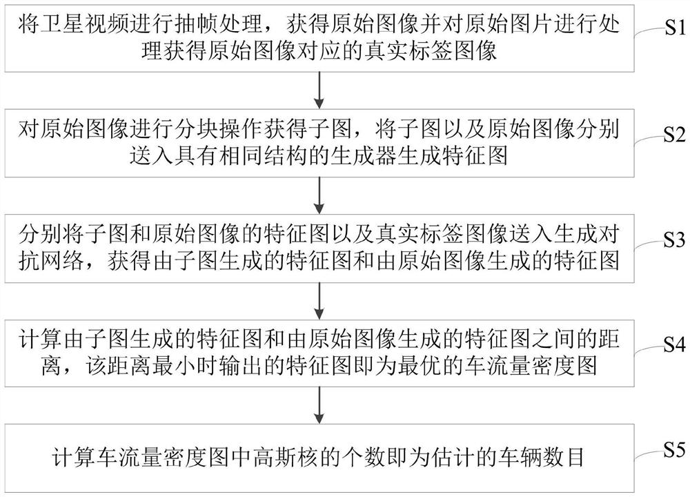
[0037] The present invention provides a method for estimating the number of satellite video vehicles based on generating an adversarial network, such as figure 1 , including the following steps:

[0038] S1: Extract frames from the satellite video to obtain the original image;

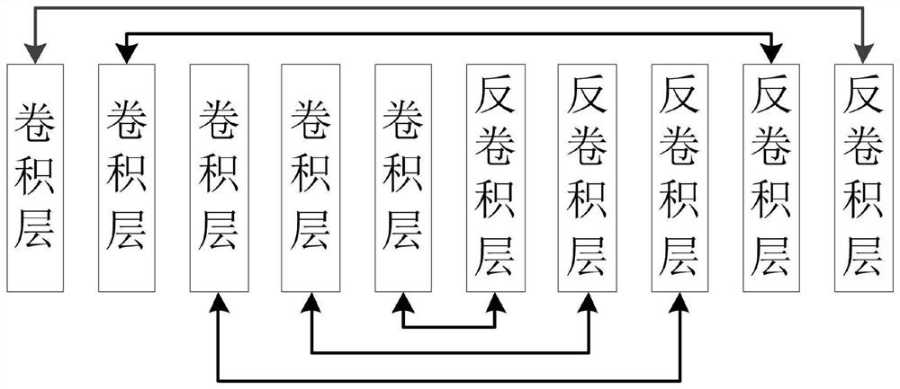
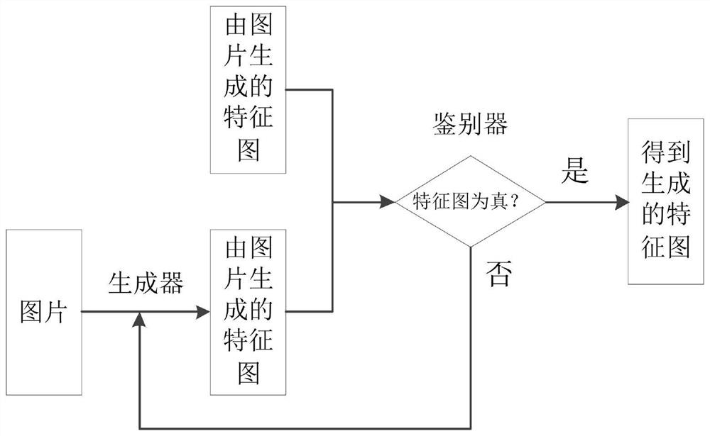
[0039] S2: Perform a block operation on the original image to obtain a sub-image, and send the sub-image and the original image to the codec network with the same structure to generat...


PUM


Abstract

The invention belongs to the technical field of image processing and computer vision, and in particular relates to a method for estimating the number of satellite video vehicles based on a generative confrontation network, which includes performing frame extraction processing on the satellite video to obtain the original image and the real label image corresponding to the original image; The original image is divided into blocks to obtain a sub-image, and the sub-image and the original image are sent to the generator with the same structure to generate a feature map; respectively, the sub-image and the feature map of the original image are sent to the generative confrontation network to obtain the sub-image generated by the sub-image. Feature map and feature map generated from the original image; calculate the distance between the feature map generated from the submap and the feature map generated from the original image, minimize the distance to obtain the optimal result, and obtain the traffic flow density map according to the optimal result ; The present invention not only makes full use of image information to avoid the problem of lack of data; it also uses the generative confrontation network to define the entire network framework as a regression problem, effectively avoiding the problem of difficult detection.

Description

technical field [0001] The invention belongs to the technical field of image processing and computer vision, in particular to a method for estimating the number of satellite video vehicles based on a generative confrontation network. Background technique [0002] With the development of social economy, people's quality of life is improving day by day, and the number of urban vehicles is increasing day by day. Urban congestion has become an inevitable social problem. In this context, traffic control is particularly important. Traffic flow density, also known as traffic flow density, refers to the number of vehicles at a certain moment in a lane or in one direction on a unit length (usually 1km) road section, which is used to indicate the density of vehicles on a road. Traffic density is a very important information for both government traffic regulation and personal travel. [0003] At present, vehicle density estimation is mostly based on surveillance video scenarios. Its ...

Claims


Application Information

Patent Timeline
Patent Type & Authority Patents(China)
IPC IPC(8): G06V20/40G06V20/52
CPCG06V20/40G06V20/52
Inventor 高陈强冉洁杨烽叶盛刘芳岑陈乔伊
Owner CHONGQING UNIV OF POSTS & TELECOMM
Why Eureka
Try Eureka