RBF-network-based visual navigation positioning method of unmanned aerial vehicle

A visual navigation and UAV technology, applied in the field of UAV navigation and positioning, can solve the problems of heavy calculation and memory usage

Active Publication Date: 2019-12-31
UNIV OF ELECTRONIC SCI & TECH OF CHINA
View PDF45 Cites 8 Cited by
  • Summary
  • Abstract
  • Description
  • Claims
  • Application Information

AI Technical Summary

Problems solved by technology

Map building requires multiple steps, such as tracking, relocalization, and loop cl

Method used


Image

  • RBF-network-based visual navigation positioning method of unmanned aerial vehicle
  • RBF-network-based visual navigation positioning method of unmanned aerial vehicle
  • RBF-network-based visual navigation positioning method of unmanned aerial vehicle

Examples


Embodiment Construction

[0026] In order to make the purpose, technical solution and advantages of the present invention clearer, the present invention will be further described in detail below in conjunction with the implementation methods and accompanying drawings.

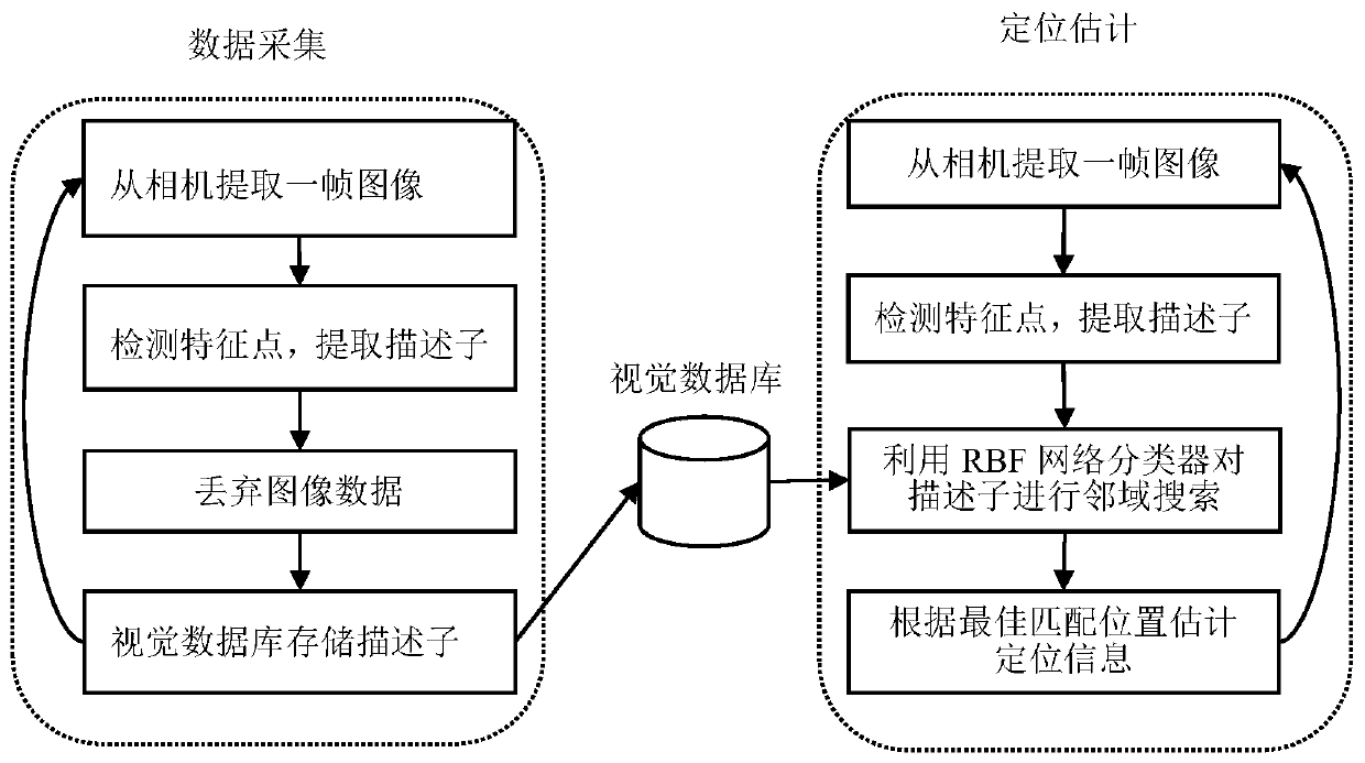
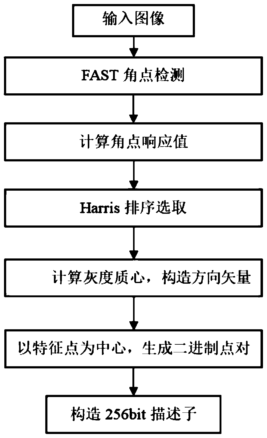
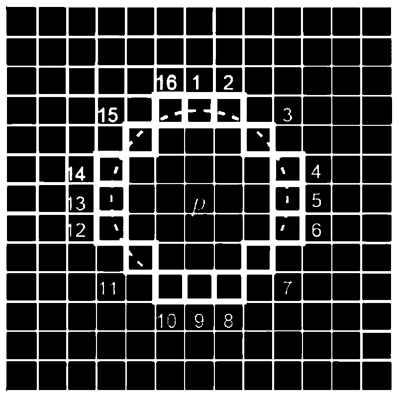
[0027] A vision-based UAV navigation and positioning method of the present invention, by collecting the ground image feature descriptor of the area where the UAV is currently located, using the RBF network classifier trained by the feature descriptor data set to describe the feature points of the collected image Neighborhood search is carried out to obtain the optimal matching position of the image, so as to estimate the more accurate positioning information of the UAV location.

[0028] see figure 1 , the vision-based UAV navigation and positioning method of the present invention mainly includes two parts: one is the data collection when sailing, and the other is the positioning estimation when returning;

[0029] In the data acquisit...


PUM


Abstract

The invention discloses an RBF-network-based visual navigation positioning method of an unmanned aerial vehicle. When a GNSS signal is not lost, images are collected through a camera and image framesare extracted from the camera, feature points of all image are detected, descriptors are extracted, and feature point information of the images is reserved; the extracted descriptors of the image frames are processed repeatedly and descriptor information and the positioning information are stored into a visual database; when the GNSS signal is lost, shot images of the camera are extracted, descriptor extraction is performed, and an RBF network classifier is trained by using visual database information; and neighborhood searching is carried out on the generated descriptors according to the RBFnetwork classifier, an optimal matching position is estimated, and current positioning information is obtained based on recorded positioning information. According to the invention, the positioning and navigation processing of the unmanned aerial vehicle can be realized based on the constructed visual database while the GNSS signal is lost; and the visual database only stores feature point descriptor information of the images and the occupied space of a memory is small.

Description

technical field [0001] The invention belongs to the technical field of navigation and positioning of unmanned aerial vehicles, and in particular relates to a method for visual navigation and positioning of unmanned aerial vehicles based on a RBF (Radial Basis Function) network. Background technique [0002] The UAV integrated positioning system plays a vital role in its stability and integrity. The most common solutions for localization include the combination of Global Navigation Satellite System (GNSS) and Inertial Navigation System (INS) within a multi-sensor fusion framework. In this case, GNSS is used as a concise and economical method to constrain the unbounded errors produced by INS sensors during the positioning process. But in fact, INS integrates time in the iterative process of continuously acquiring data from multiple sensors to obtain an approximate drone position. During this process, the measurement errors generated by the sensors will quickly accumulate and ...

Claims


Application Information

Patent Timeline
IPC IPC(8): G01C21/20
CPCG01C21/20
Inventor 贾海涛吴婕
Owner UNIV OF ELECTRONIC SCI & TECH OF CHINA
Why Eureka
Try Eureka