

Land surveying and mapping method for territorial planning
A land and planning technology, applied in surveying and mapping and navigation, surveying devices, surveying instruments, etc., can solve problems such as time-consuming, unfavorable surveying and mapping work, and large use limitations, so as to improve efficiency, reduce the time spent on surveying, The effect of reducing work intensity
- Summary
- Abstract
- Description
- Claims
- Application Information
AI Technical Summary
Problems solved by technology
Method used
Image

Examples
Embodiment 1
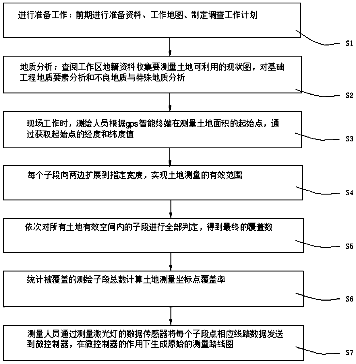
[0025] see figure 1 , the present invention provides a technical solution: a land surveying and mapping method for national land planning, comprising the following steps:
[0026] S1. Preparatory work: prepare materials, work maps, and formulate investigation work plans in the early stage;
[0027] S2. Geological analysis: consult the cadastral data collection of the work area to measure the current situation map of land availability, analyze the geological elements of the basic engineering, and analyze the bad geology and special geology;
[0028] S3. During on-site work, surveyors measure the starting point of the land area according to the GPS smart terminal, and obtain the starting point and corner and edge point values;
[0029] S4. Divide the land to be surveyed and mapped into multiple equal sub-sections, and each sub-section extends to both sides to a specified width, so as to realize the effective range of land survey;
[0030] S5. Carry out all judgments on all the...
Embodiment 2
[0035] see figure 1 , the present invention provides a technical solution: a land surveying and mapping method for national land planning, comprising the following steps:
[0036] S1. Preparatory work: prepare materials, work maps, and formulate investigation work plans in the early stage;
[0037] S2. Geological analysis: consult the cadastral data collection of the work area to measure the current situation map of land availability, analyze the geological elements of the basic engineering, and analyze the bad geology and special geology;
[0038] S3. During on-site work, surveyors measure the starting point of the land area according to the GPS smart terminal, and obtain the starting point and corner and edge point values;
[0039] S4. Divide the land to be surveyed and mapped into multiple equal sub-sections, and each sub-section extends to both sides to a specified width, so as to realize the effective range of land survey;
[0040] S5. Carry out all judgments on all the...
PUM
 Abstract
Description
Claims
Application Information