
Ecological environment quality evaluation method based on remote sensing and GIS

An environmental quality and ecological technology, applied in character and pattern recognition, structured data retrieval, resources, etc., can solve problems such as low accuracy, large error, ecological environment protection and governance impact, and achieve accurate detection results

Inactive Publication Date: 2020-01-07
FOSHAN UNIVERSITY
View PDF8 Cites 5 Cited by
  • Summary
  • Abstract
  • Description
  • Claims
  • Application Information

AI Technical Summary

Problems solved by technology

[0004] However, due to the late start in our country, there is a slight deficiency in the assessment of the ecological environment quality, and it is often impossible to carry out the detection of the ecological environment quality in an effective and reasonable way, and in the process of the detection and evaluation of the ecological environment quality, it cannot be effectively based on the actual situation. The detection will lead to large errors and low accuracy in the evaluation of the ecological environment quality, and it will not be able to effectively manage and protect the ecological environment, which will greatly affect the protection and governance of the ecological environment, which will be detrimental to the sustainable development of the country. impact, and cannot meet the objective needs of national environmental protection

Method used


Image

  • Ecological environment quality evaluation method based on remote sensing and GIS

Examples


Embodiment Construction

[0021] The technical solutions in the embodiments of the present invention will be clearly and completely described below. Obviously, the described embodiments are only some of the embodiments of the present invention, but not all of them. Based on the embodiments of the present invention, all other embodiments obtained by persons of ordinary skill in the art without creative efforts fall within the protection scope of the present invention.

[0022] The present invention is based on remote sensing and GIS ecological environment quality evaluation method, comprises the following steps:

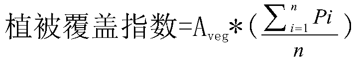
[0023] Acquisition of the original data and the latest data of the SS001 measurement area: First, obtain the original Landsat image and the original MODIS image of the measurement area through the Internet database, download and save them, and measure the latest Landsat image and MODIS of the measurement area through Landsat8 of the US NASA land satellite Acquire the latest images of images, d...


PUM


Abstract

The invention discloses an ecological environment quality evaluation method based on remote sensing and GIS, and relates to the technical field of ecological environment detection. The method providedby the invention comprises the following steps of: ; sS001, acquiring original data and latest data of a measurement area; the method comprises the following steps: firstly, acquiring an original Landsat image and an original MODIS image of a measurement area through an Internet database; and downloading and storing the Landsat image and the MODIS image, and acquiring the latest image of the Landsat image and the latest image of the MODIS image in the measurement area through an American NASA land satellite Landsat 8. According to the invention, the remote sensing technology and the GIS technology cooperate with each other; five indexes including a biological abundance index, a vegetation coverage index, a water network density index, a land stress index and a pollution load index are selected to construct an ecological environment condition index model; therefore, the original and latest ecological environment quality of the measured area can be evaluated, and the space-time distribution change and main influence factors of the ecological environment quality of the measured area are analyzed, so that the state can reasonably and effectively protect and treat the ecological environment.

Description

technical field [0001] The invention belongs to the technical field of ecological environment detection, in particular to a method for evaluating ecological environment quality based on remote sensing and GIS. Background technique [0002] With the rapid development of social economy and the overall progress of science and technology, great changes have taken place in the material life of human beings, but the pressure on the ecological environment system is also increasing, and the sustainable development strategy has attracted more and more attention. . In recent years, the frequent disasters caused by ecological damage, the loss of biodiversity and the spread of acid rain have posed a great threat to the survival and development of human beings. Compared with other developed countries, China faces particularly serious ecological and environmental problems. Since China's reform and opening up, the economy has developed very rapidly, but the ecological environment has als...

Claims


Application Information

Patent Timeline
IPC IPC(8): G06Q10/06G06Q50/26G06K9/00G06F16/29
CPCG06Q10/06395G06Q50/26G06F16/29G06V20/13
Inventor 王雪张珊珊欧伟健罗小丫
Owner FOSHAN UNIVERSITY
Features
  • Generate Ideas
  • Intellectual Property
  • Life Sciences
  • Materials
  • Tech Scout
  • Unparalleled Data Quality
  • Higher Quality Content
  • 60% Fewer Hallucinations
Learn More