Loess tableland area shallow groundwater supply-drainage unit division method

A groundwater and plateau area technology, applied in the direction of complex mathematical operations, etc., can solve the problem of lack of methods for dividing groundwater discharge units in loess plateau area, and achieve the effect of improving safety and technological content, improving accuracy and scientificity

Active Publication Date: 2020-01-14
CHINA INST OF WATER RESOURCES & HYDROPOWER RES
View PDF5 Cites 0 Cited by
  • Summary
  • Abstract
  • Description
  • Claims
  • Application Information

AI Technical Summary

Problems solved by technology

[0006] Aiming at the above-mentioned deficiencies in the prior art, the present invention provides a method for dividing shallow groundwater recharge-discharge units in the loess plateau area that can solve the problem in the prior art that lacks a method for dividing the groundwater discharge units in the loess plateau area

Method used


Image

  • Loess tableland area shallow groundwater supply-drainage unit division method
  • Loess tableland area shallow groundwater supply-drainage unit division method
  • Loess tableland area shallow groundwater supply-drainage unit division method

Examples


Embodiment Construction

[0043] The present invention will be further described below in conjunction with accompanying drawing:

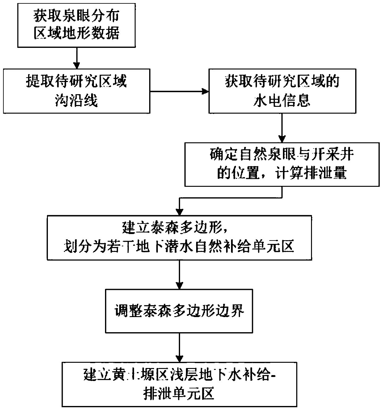
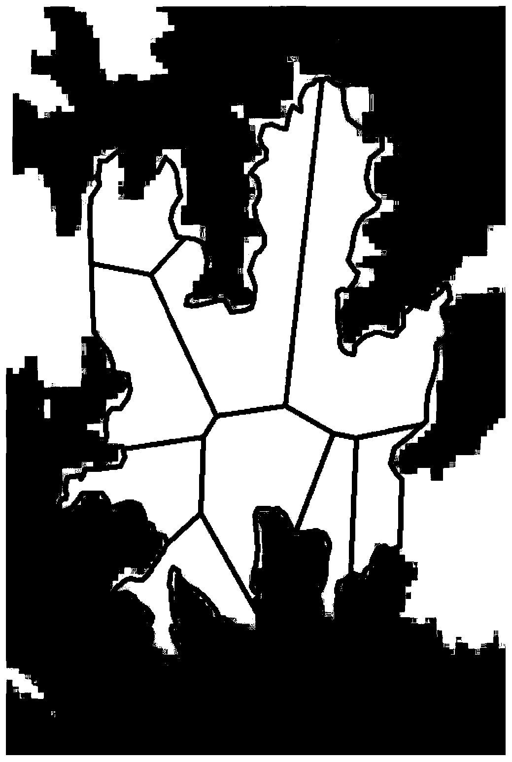
[0044] Such as figure 1 As shown, it is a flow chart of the shallow groundwater recharge-discharge unit division method in the loess plateau area of ​​the present invention.

[0045] Loess tableland shallow groundwater recharge-discharge unit division method of the present invention comprises the following steps:

[0046] S1. Determine the distribution area of ​​springs in the area to be studied.

[0047] Obtain the DEM image data with an accuracy of 30m in the area to be studied, and use the geographic information system software GIS to extract the topographic information of the research area, including slope, aspect, ground curvature, etc., and extract the line along the ditch in the research area.

[0048] In actual processing, the area surrounded by the ditch can be converted into a plane file, and the plane V is the target research area.

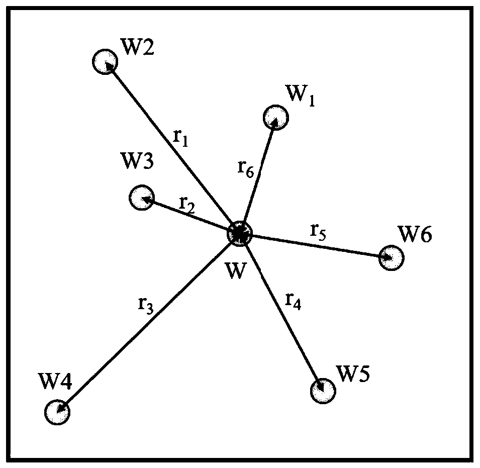
[0049] S2. Obtain the hydr...


PUM


Abstract

The invention discloses a loess tableland area shallow groundwater supply-drainage unit division method. The method comprises the steps that a spring hole distribution area is determined; obtaining water and electricity information of a to-be-studied area, determining the positions of a natural spring hole and a mining well, and calculating the discharge capacity; thiessen polygons are establishedin the area to be researched according to the positions of the natural spring holes, and the area to be researched is divided into a plurality of underground diving natural supply unit areas according to the boundaries of the Thiessen polygons; sequentially adjusting the boundary position of each Thiessen polygon according to the mining well position and the discharge capacity; and taking an areadivided by the boundary of the adjusted Thiessen polygon as a shallow groundwater supply-drainage unit area of the loess tableland area after human activities are considered. The method can solve theproblem of lack of a method for dividing the underground water drainage units of the loess highland in the prior art, and is high in accuracy, reliable in calculation and large in range.

Description

technical field [0001] The invention relates to the technical field of hydrology and water resources, in particular to a method for dividing shallow groundwater recharge-discharge units in a loess plateau area. Background technique [0002] The loess plateau area refers to the loess accumulation highland with a flat and open top surface and the surrounding area is cut by valleys. It is the main population gathering place and the main agricultural land in the Loess Plateau area. The Loess Plateau is located inland and is a temperate semi-arid area with typical continental monsoon climate characteristics. The loess plateau area is often distributed in the shape of petals on the plane. The plateau surface is flat and wide, and the slope is mostly less than 3°. The thickness of the loess layer is more than 100m. Tertiary red beds and Quaternary loess are widely distributed, and the geological conditions are relatively uniform. Because the evaporation is generally higher than th...

Claims


Application Information

Patent Timeline
IPC IPC(8): G06F17/10
CPCG06F17/10
Inventor 贾仰文龚家国赵思远牛存稳王英杜军凯郝春沣
Owner CHINA INST OF WATER RESOURCES & HYDROPOWER RES
Why Eureka
Try Eureka