
Method for batch generation of recyclable resource survey maps of urban and rural construction lands

A technology for construction land and resource maps, applied in geographic information databases, special data processing applications, geometric CAD, etc., can solve the problem of lack of batch production methods for reclamation resource maps, and achieve the effect of reducing labor costs

Active Publication Date: 2020-01-14
CHUZHOU UNIV
View PDF7 Cites 6 Cited by
  • Summary
  • Abstract
  • Description
  • Claims
  • Application Information

AI Technical Summary

Problems solved by technology

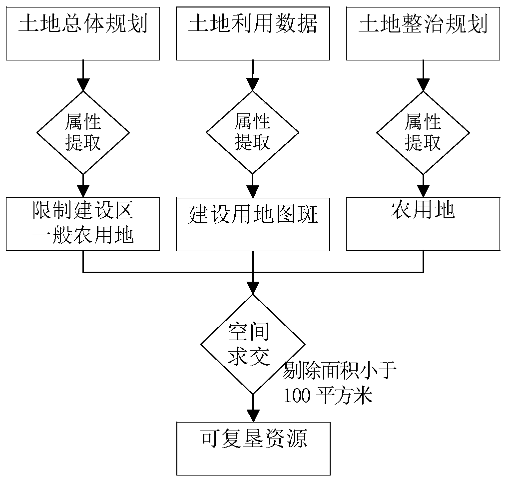
[0005] The purpose of the present invention is to propose a batch generation method for urban and rural construction land reclamation resource maps in view of the lack of specific batch production methods for existing urban and rural construction land reclamation resource maps

Method used


Image

  • Method for batch generation of recyclable resource survey maps of urban and rural construction lands
  • Method for batch generation of recyclable resource survey maps of urban and rural construction lands
  • Method for batch generation of recyclable resource survey maps of urban and rural construction lands

Examples


Embodiment Construction

[0032] The present invention will be further described below in conjunction with the accompanying drawings and embodiments.

[0033] This example uses Windows7 as the operating system environment, Microsoft visual studio 2010 as the development environment, C# as the development language, ArcGIS Objects10.2 as the secondary development platform; the operating environment is ArcGIS10.2 software, and the batch mapping program is compiled with the Add-in plug-in The form is embedded on the ArcGIS10.2 platform to realize the batch generation of urban and rural construction land reclaimable resource survey maps.

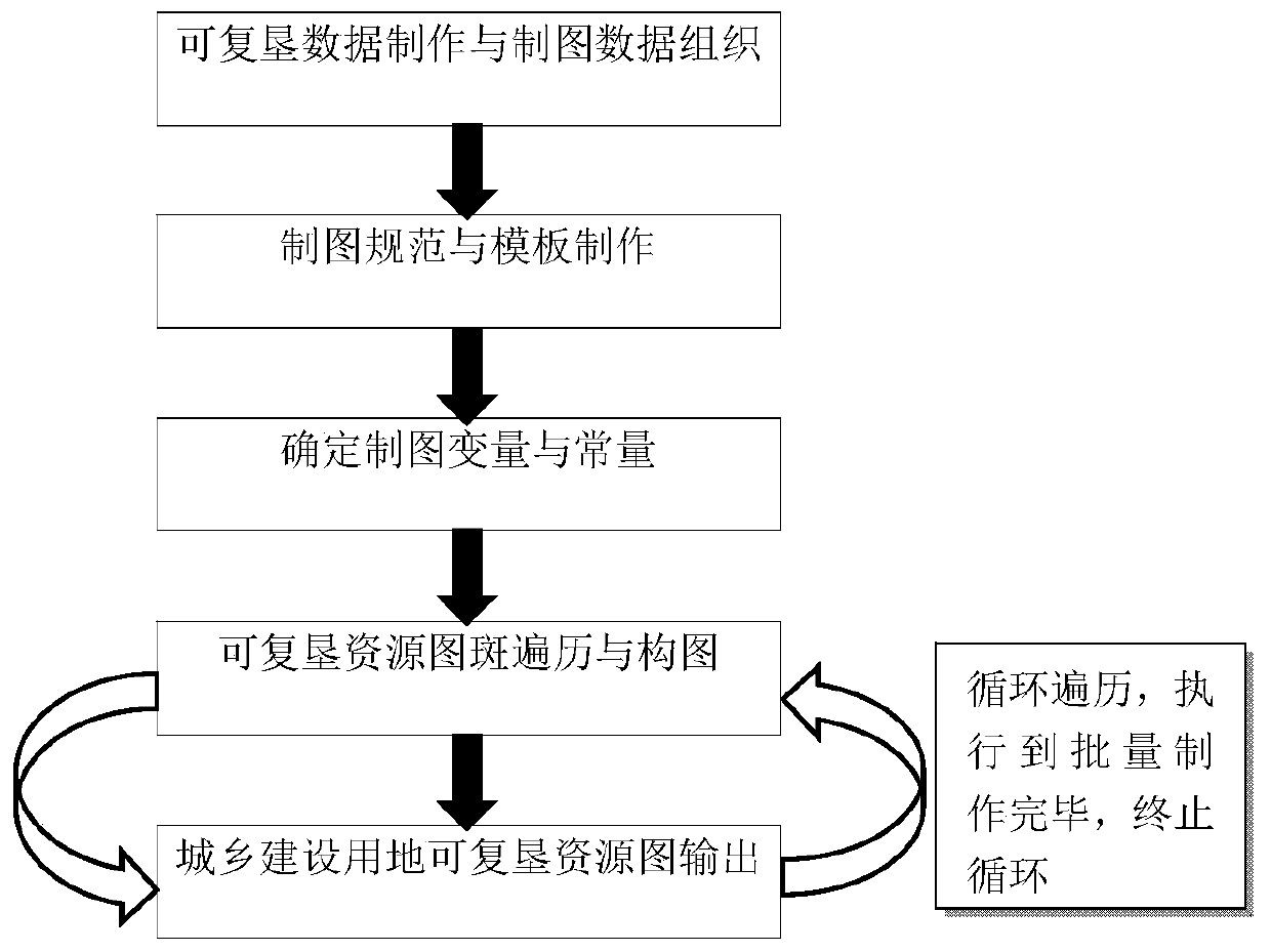
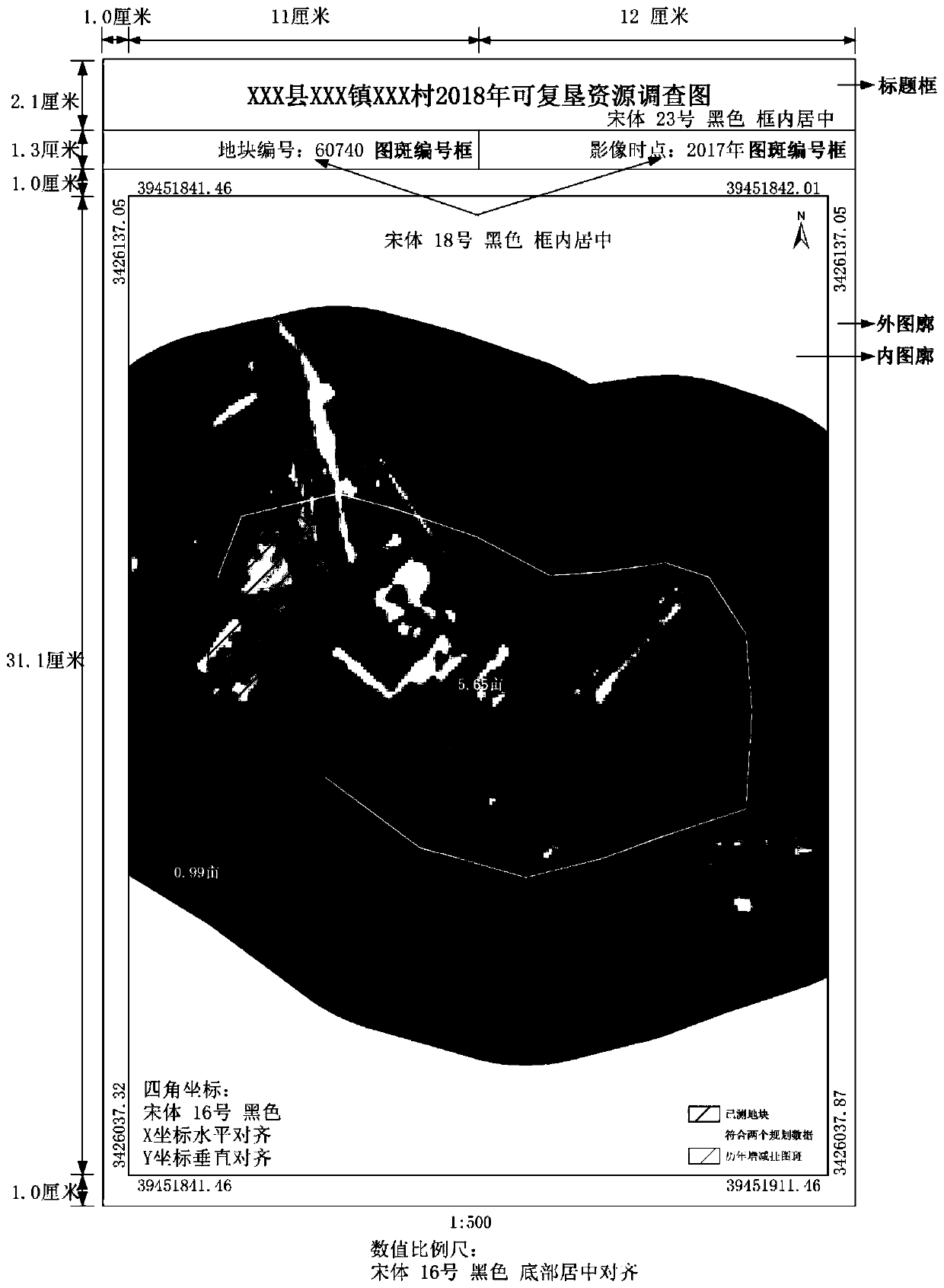
[0034] Such as figure 1 As shown, a method for batch generation of urban and rural construction land reclamation resource survey map, including: urban and rural construction land reclamation resource survey data production and mapping data organization, urban and rural construction land reclamation resource survey map specification and drawing template production, The fo...


PUM


Abstract

The invention discloses an urban and rural construction land reclamation resource survey map batch generation method. The method comprises the following steps: (1) making reclamation resource survey data, and organizing a drawing data layer; (2) standardizing drawing paper and drawing surface element positions, symbolizing drawing data, and annotating and expressing the drawing data; (3) determining variables and constants of drawing; (4) traversing the reclamation resource pattern spots to obtain attributes and element geometric information of the drawing pattern spots, and then updating drawing variables and constructing a drawing area; and outputting the reclamation resource map of the current drawing pattern spot, and circulating the process to complete batch generation of the reclamation resource survey map. According to the method, a whole set of technical processes of data organization, drawing template design and batch drawing generation are provided, and a technical basis anda feasibility scheme can be provided for land reclamation resource map making.

Description

technical field [0001] The invention relates to the field of visual expression of geographic information and map drawing, and in particular to a batch generation method for urban and rural construction land reclaimable resource survey maps. Background technique [0002] Maps are the main means of visual expression of geographic information and the epitome of the objective world. According to the content, maps can be divided into general maps and thematic maps. In the actual production process, thematic maps are widely used in land, planning, water conservancy, forestry, agriculture and other fields, and have very important scientific research and industry application value. [0003] The reclamation of urban and rural construction land is a process of vacating and reclamating homesteads that have been abandoned and without living conditions in the process of urbanization, and the purpose is to regenerate the destroyed and degraded construction land and system recovery. The...

Claims


Application Information

Patent Timeline
IPC IPC(8): G06F30/10G06F16/29
CPCG06F16/29
Inventor 陈梦琳王本林陈泰生王妮江伟兴
Owner CHUZHOU UNIV
Learn More