Coastal zone information service method and device, server and server cluster
A technology of information service and coastal zone, applied in the field of information service, can solve the problem of single service form and poor quality of coastal zone geological information, achieve the effect of enriching service types, increasing data types, and avoiding loss
- Summary
- Abstract
- Description
- Claims
- Application Information
AI Technical Summary
Problems solved by technology
Method used
Image
Examples
Embodiment 1
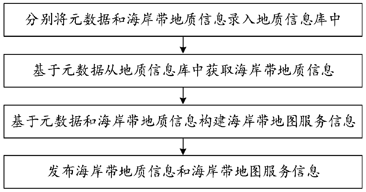
[0028] Such as figure 1 Shown is a flow chart of a coastal zone information service method, including:
[0029] Step 110, respectively input metadata and coastal zone geological information into the geological information database;
[0030] Step 120, obtaining coastal zone geological information from the geological information database based on the metadata;
[0031] Step 130, constructing coastal zone map service information based on metadata and coastal zone geological information;
[0032] Step 140, publishing coastal zone geological information and coastal zone map service information.
[0033] Exemplary, metadata and coastal zone geological information can be stored unstructured in the geological information database, the geological information database includes non-relational databases, metadata includes geological information metadata and map metadata, etc., coastal zone geological information can be Including groundwater dynamic monitoring information, land subsiden...
Embodiment 2
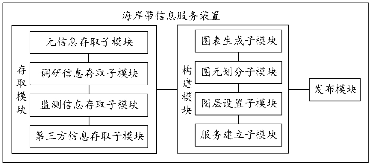
[0062] Such as figure 2 Shown is a structural diagram of a coastline information service device, including: an access module for respectively entering metadata and coastal zone geological information into the geological information database, and obtaining coastal zone geological information from the geological information database based on the metadata; The building module is used to construct coastal zone map service information based on metadata and coastal zone geological information; the publishing module is used to publish coastal zone geological information and coastal zone map service information.
[0063] Coastal zone geological information includes artificial survey geological information, monitoring geological information and third-party geological information. The geological information database includes survey data sub-database, monitoring data sub-database, third-party data sub-database and meta-information database.
[0064] Such as image 3 As shown, the acces...
Embodiment 3
[0071] Such as Figure 4 Shown is a network diagram of a coastline information service system, including: the memory can be configured to store at least one instruction or at least one program or code set or instruction set, and the instruction or program or code set or instruction set is loaded and executed by the processor In order to realize the operation steps performed in the coastal zone information service method described in the first embodiment.
[0072] Such as Figure 4 As shown, the coastline information service system includes a coastline information server 11, a business server 12, a business server 13, a business terminal 21, a business terminal 22, a business terminal 23, a geological environment monitoring station 31 and a geological environment monitoring station 32.
[0073] The coastal zone information server can publish the coastal zone geological information and coastal zone map service information to any business server or / and any business terminal thro...
PUM
 Abstract
Description
Claims
Application Information
 - R&D
- Intellectual Property
- Life Sciences
- Materials
- Tech Scout
- Unparalleled Data Quality
- Higher Quality Content
- 60% Fewer Hallucinations
Browse by: Latest US Patents, China's latest patents, Technical Efficacy Thesaurus, Application Domain, Technology Topic, Popular Technical Reports.
© 2025 PatSnap. All rights reserved.Legal|Privacy policy|Modern Slavery Act Transparency Statement|Sitemap|About US| Contact US: help@patsnap.com


