
Simultaneous positioning mapping method and device

An image and image sequence technology, applied in the computer field, can solve problems such as insufficient precision, achieve the effect of small calculation amount, improve precision and speed

Active Publication Date: 2020-02-04
TSINGHUA UNIV
View PDF7 Cites 4 Cited by
  • Summary
  • Abstract
  • Description
  • Claims
  • Application Information

AI Technical Summary

Problems solved by technology

[0005] Embodiments of the present invention provide a simultaneous positioning and mapping method and device to solve or at least partially solve the defect of insufficient precision in the prior art

Method used


Image

  • Simultaneous positioning mapping method and device
  • Simultaneous positioning mapping method and device
  • Simultaneous positioning mapping method and device

Examples


Embodiment Construction

[0044] In order to make the purpose, technical solutions and advantages of the embodiments of the present invention clearer, the technical solutions in the embodiments of the present invention will be clearly and completely described below in conjunction with the drawings in the embodiments of the present invention. Obviously, the described embodiments It is a part of embodiments of the present invention, but not all embodiments. Based on the embodiments of the present invention, all other embodiments obtained by persons of ordinary skill in the art without creative efforts fall within the protection scope of the present invention.

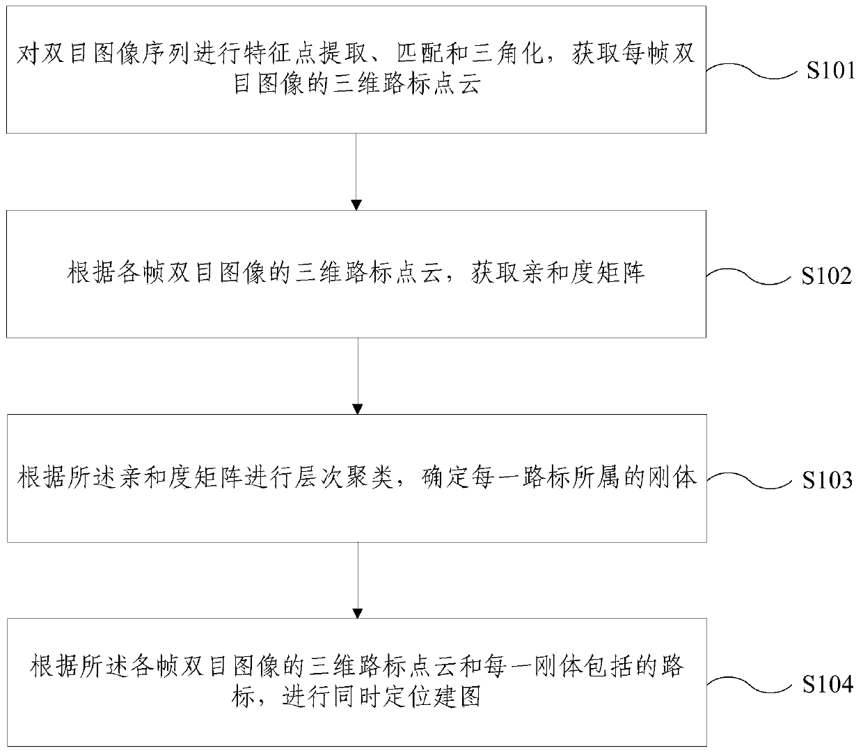
[0045] In order to overcome the above-mentioned problems in the prior art, an embodiment of the present invention provides a simultaneous positioning and mapping method and device. The inventive idea is to perform hierarchical clustering on each landmark according to the logarithmic probability that two landmarks belong to the same rigid body, Det...


PUM


Abstract

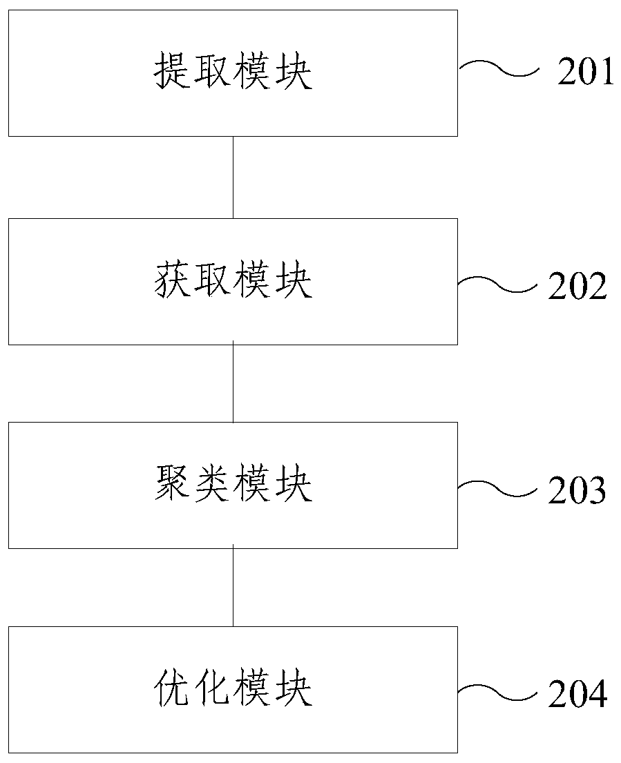
The embodiment of the invention provides a simultaneous positioning mapping method and device. The method comprises: carrying out feature point extraction, matching and triangularization on a binocular image sequence, and obtaining three-dimensional road sign point cloud of each frame of binocular image; obtaining an affinity matrix according to the three-dimensional road sign point cloud of eachframe of binocular image; performing hierarchical clustering according to the affinity matrix, and determining a rigid body to which each road sign belongs; performing simultaneous positioning mappingaccording to the three-dimensional road sign point cloud of each frame of binocular image and the road sign included in each rigid body, wherein the affinity is the logarithm probability that the tworoad signs belong to the same rigid body. According to the simultaneous positioning mapping method and device provided by the embodiment of the invention, hierarchical clustering is carried out according to the affinity, the moving object in the scene can be detected more accurately, modeling and pose estimation are carried out on the motion, and the calculated amount is smaller, so that the precision and speed of simultaneous localization mapping can be improved.

Description

technical field [0001] The present invention relates to the field of computer technology, and more specifically, to a method and device for simultaneous positioning and mapping. Background technique [0002] The perception and modeling of the surrounding environment is the basis of autonomous object (AuT) navigation, and the most commonly used method is simultaneous positioning and mapping. Simultaneous Localization and Mapping (SLAM), also known as real-time localization and mapping, simultaneous localization and mapping, simultaneous localization and mapping, refers to the subject carrying a specific sensor without prior information, Estimate its own trajectory through motion and build a map of the surrounding environment. With the increasing demand for service robots and autonomous driving, SLAM in dynamic scenarios becomes more important. [0003] At present, SLAM in dynamic scenes mainly includes two technical routes: removing dynamic features and directly tracking an...

Claims


Application Information

Patent Timeline
IPC IPC(8): G06T17/05G06T15/00G06K9/62
CPCG06T17/05G06T15/005G06F18/23
Inventor 胡事民黄家晖杨晟
Owner TSINGHUA UNIV
Learn More