VSP field data acquisition management system and method
A technology for managing systems and data, applied in the management field of geophysical exploration, can solve problems such as weak pertinence and inability to specify the reliability of instruments and equipment under feasible conditions, and achieve the effect of precise and detailed content.
- Summary
- Abstract
- Description
- Claims
- Application Information
AI Technical Summary
Problems solved by technology
Method used
Image
Examples
no. 1 example
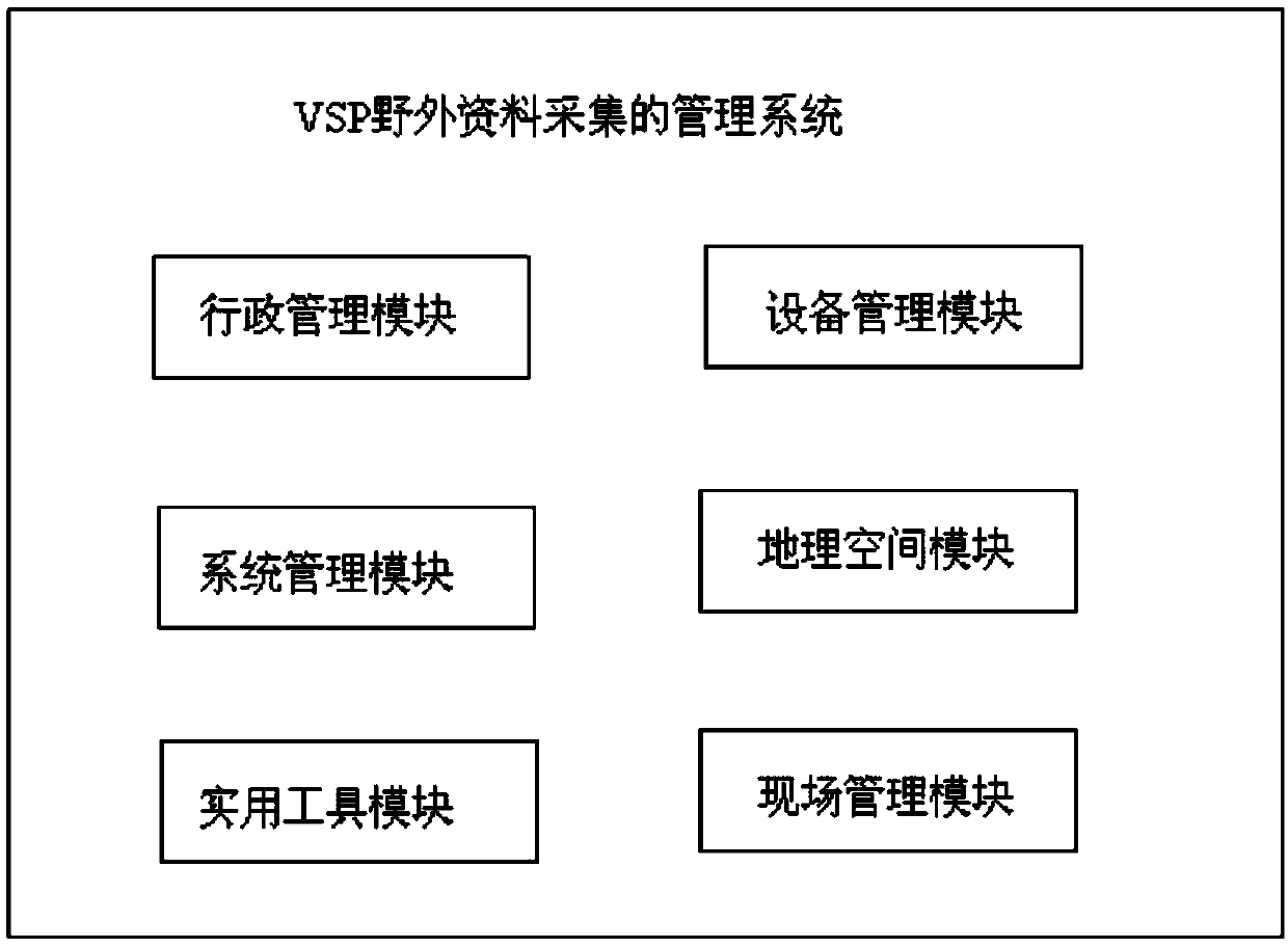
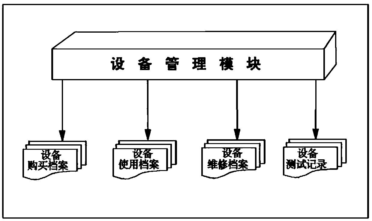
[0048] Such as Figure 1-Figure 4 A VSP field data collection and management system according to an embodiment of the present invention is shown. The management system for VSP field data collection in this embodiment consists of an administrative management module, a system management module, an equipment management module, a geographic space module, a field management module and a utility module.
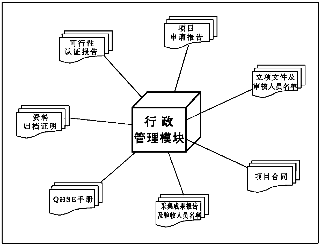
[0049] 1) Administrative management module:
[0050] The administrative management module is configured to include the pre-feasibility certification of the VSP project, the project application report, the project approval document and the list of reviewers, the project contract, the VSP collection result report and the list of checkers, the data archiving certificate and the QHSE manual Calling and processing, including viewing, supplementing and modifying.
[0051] In this embodiment, by calling the administrative management module, the manager terminal can clearly display the p...
no. 2 example
[0074] Such as Figure 5 The operating method of the VSP field data acquisition management system of an embodiment of the present invention is shown, comprising the following steps:
[0075] S101. Register as managers and technicians and assign permissions according to the corresponding personnel;
[0076] S102. Use a password to log in to the acquisition management system according to the registered authority;
[0077] S103. Create a new VSP project file, input the project name, and save the VSP project file in *.vsp format;
[0078] S104. Load the VSP project file, input the turning point coordinates of the work area, automatically register the geographic location through mapX, and visually display it on the screen;
[0079] S105. Through the administrative management module, load the feasibility certification of the early stage of the VSP project, the project application, the project approval opinion and the list of reviewers, the project contract, the VSP collection repo...
PUM
 Abstract
Description
Claims
Application Information
 - R&D
- Intellectual Property
- Life Sciences
- Materials
- Tech Scout
- Unparalleled Data Quality
- Higher Quality Content
- 60% Fewer Hallucinations
Browse by: Latest US Patents, China's latest patents, Technical Efficacy Thesaurus, Application Domain, Technology Topic, Popular Technical Reports.
© 2025 PatSnap. All rights reserved.Legal|Privacy policy|Modern Slavery Act Transparency Statement|Sitemap|About US| Contact US: help@patsnap.com


