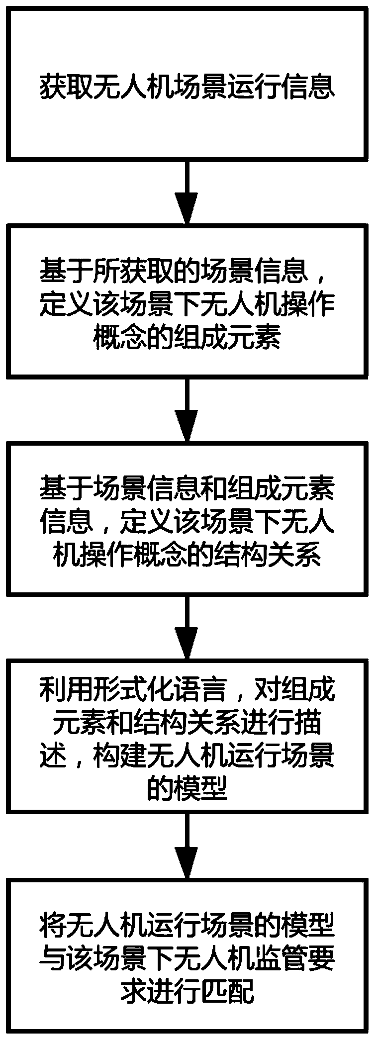
Unmanned aerial vehicle operation scene modeling method
A technology of operating scenarios and modeling methods, applied in the field of drones, can solve the problems of lack of formal description of drone operation concepts, etc., and achieve the effect of rich information acquisition means, rich categories, and precise definition and expression
- Summary
- Abstract
- Description
- Claims
- Application Information
AI Technical Summary
Problems solved by technology
Method used
Image
Examples
Embodiment 1
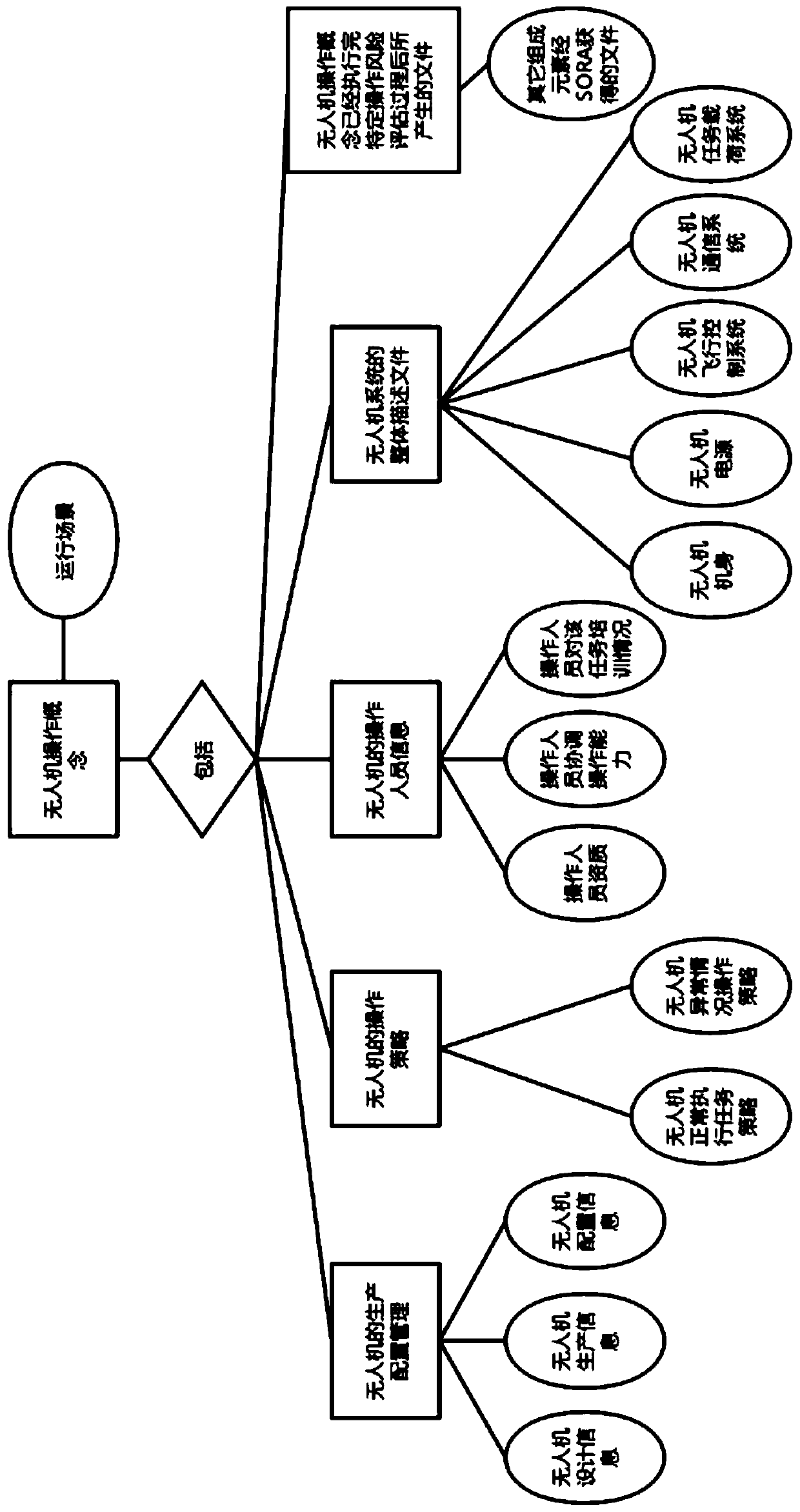
[0095] Embodiment 1: Solution model construction of UAV monitoring system in multi-line-of-sight scenarios:
[0096] Multi-line-of-sight operation refers to the networked operation between UAVs based on network interfaces. The task execution of such UAVs is within the operator’s line of sight, and finally the information between multiple UAVs is achieved. shared. In the multi-line-of-sight scenario, the operator can identify the actual flight attitude, flight height, and flight direction of the UAV in the air with the naked eye. The operator also needs to always pay attention to whether there are other unknown aircraft in the airspace where the UAV is flying. Or unknown dangerous conditions, in addition, the operator must pay attention to ensure that the drone does not pose a threat and injury to the life and property of others during operation. Therefore, the operation concept of the UAV can be obtained when it is substituted into the multi-line-of-sight operation: it is mai...
Embodiment 2
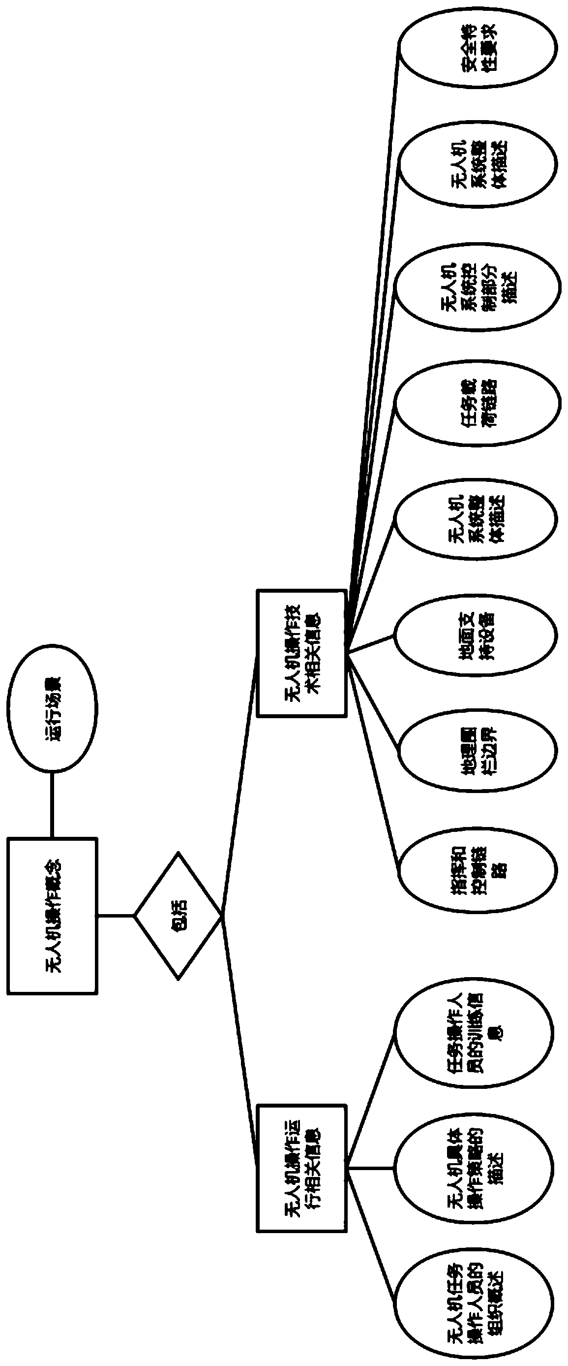
[0107] Example 2: Construction of a demand model for UAV marine dynamic management in a multi-horizon scenario:
[0108] Compared with the operation of multi-line-of-sight drones, the difference between multi-line-of-sight distances is that it exceeds the line-of-sight range. Due to the over-the-horizon flight, the UAV operator cannot see the state of the UAV with the naked eye, and cannot directly obtain the state data of the UAV that can be directly obtained when flying within the line-of-sight. Monitoring management system and UAV air traffic control system that meets the requirements of oceanic airspace management. The UAV air traffic control system includes flight route sharing and intent sharing. The area boundary in which the UAV operates should also be demarcated, that is, the geo-fence is set, so the aspects that need to be designed in the operation concept of the UAV are roughly the same as those required for the operation of the UAV in the multi-line-of-sight range...
PUM
 Abstract
Description
Claims
Application Information
 - R&D
- Intellectual Property
- Life Sciences
- Materials
- Tech Scout
- Unparalleled Data Quality
- Higher Quality Content
- 60% Fewer Hallucinations
Browse by: Latest US Patents, China's latest patents, Technical Efficacy Thesaurus, Application Domain, Technology Topic, Popular Technical Reports.
© 2025 PatSnap. All rights reserved.Legal|Privacy policy|Modern Slavery Act Transparency Statement|Sitemap|About US| Contact US: help@patsnap.com


