Supercharge Your Innovation With Domain-Expert AI Agents!

A method of realizing dynamic distribution of river water quality based on gis technology

A technology of river and water quality, applied in the field of dynamic distribution of river water quality based on GIS technology, can solve the problems of lack of mileage piles, inability to directly use dynamic segmentation technology, and small amount of data collection, and achieve the effect of strong applicability

Active Publication Date: 2020-08-25
YANGTZE DELTA REGION INST OF TSINGHUA UNIV ZHEJIANG
View PDF9 Cites 0 Cited by
  • Summary
  • Abstract
  • Description
  • Claims
  • Application Information

AI Technical Summary

Problems solved by technology

However, due to the small number of water environment monitoring stations and the small amount of data collection, the lack of data such as mileage piles in road data, and there are not as many monitoring sections as road data (there may be only a few monitoring sections on a river), it is impossible to use GIS directly The dynamic segmentation technology provided by the software, and the application of GIS dynamic segmentation technology to express the river water quality intuitively and accurately

Method used


Image

  • A method of realizing dynamic distribution of river water quality based on gis technology
  • A method of realizing dynamic distribution of river water quality based on gis technology
  • A method of realizing dynamic distribution of river water quality based on gis technology

Examples


Embodiment 1

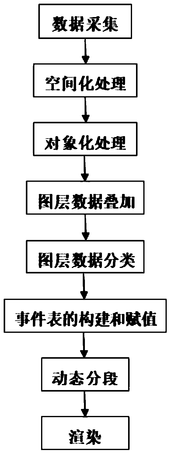
[0047] A method for realizing the dynamic distribution of river water quality based on GIS technology, the specific steps are as follows:

[0048] (1) Data collection: collect attribute data of all rivers in the area to be processed, attribute data of all water quality monitoring stations, and real-time water quality monitoring data of all actual water quality monitoring stations;

[0049] The attribute data of the river is the river number and the name of the river; the attribute data of the water quality monitoring site is the number of the water quality monitoring site, the name of the water quality monitoring site, and the latitude and longitude of the water quality monitoring site;

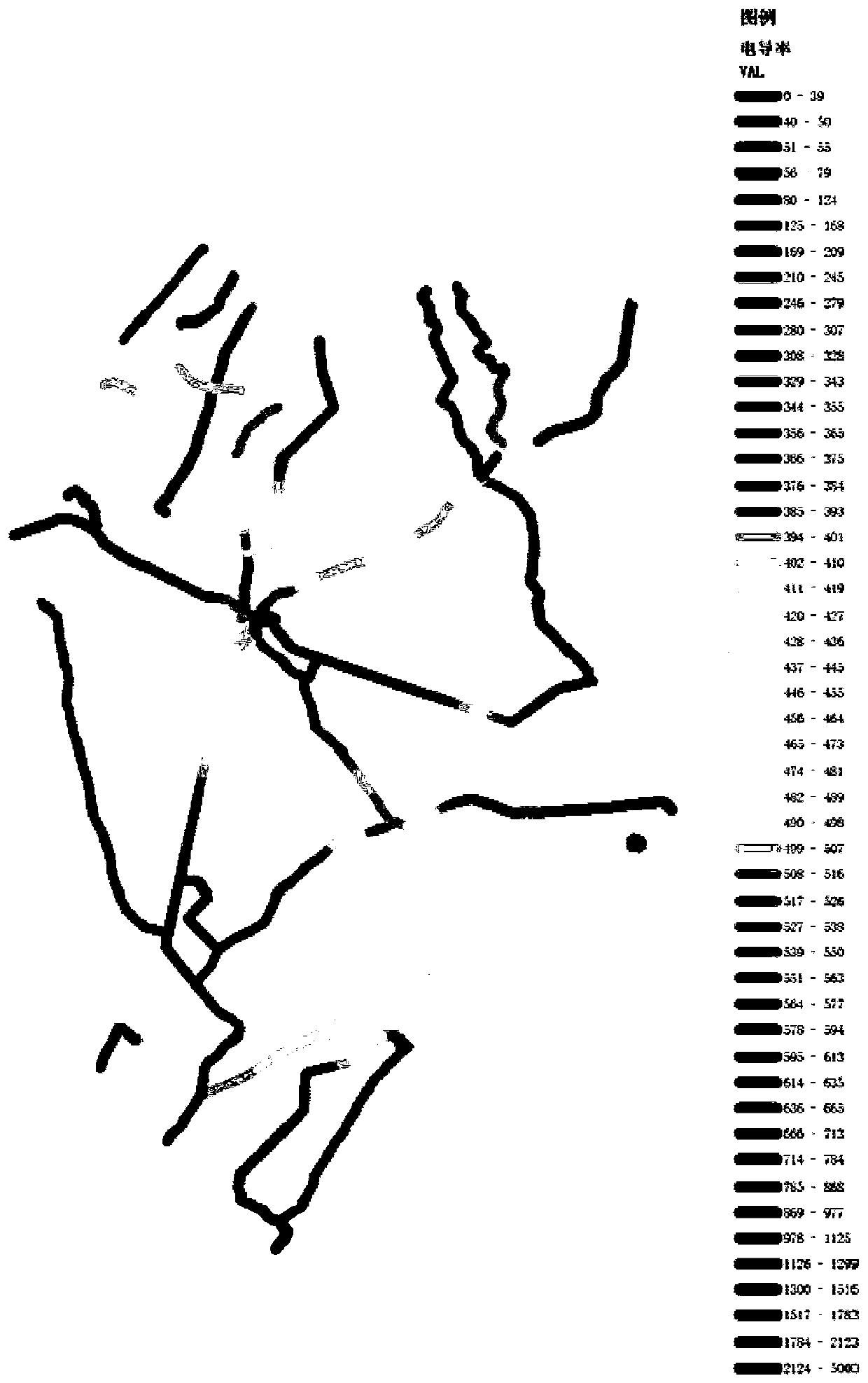
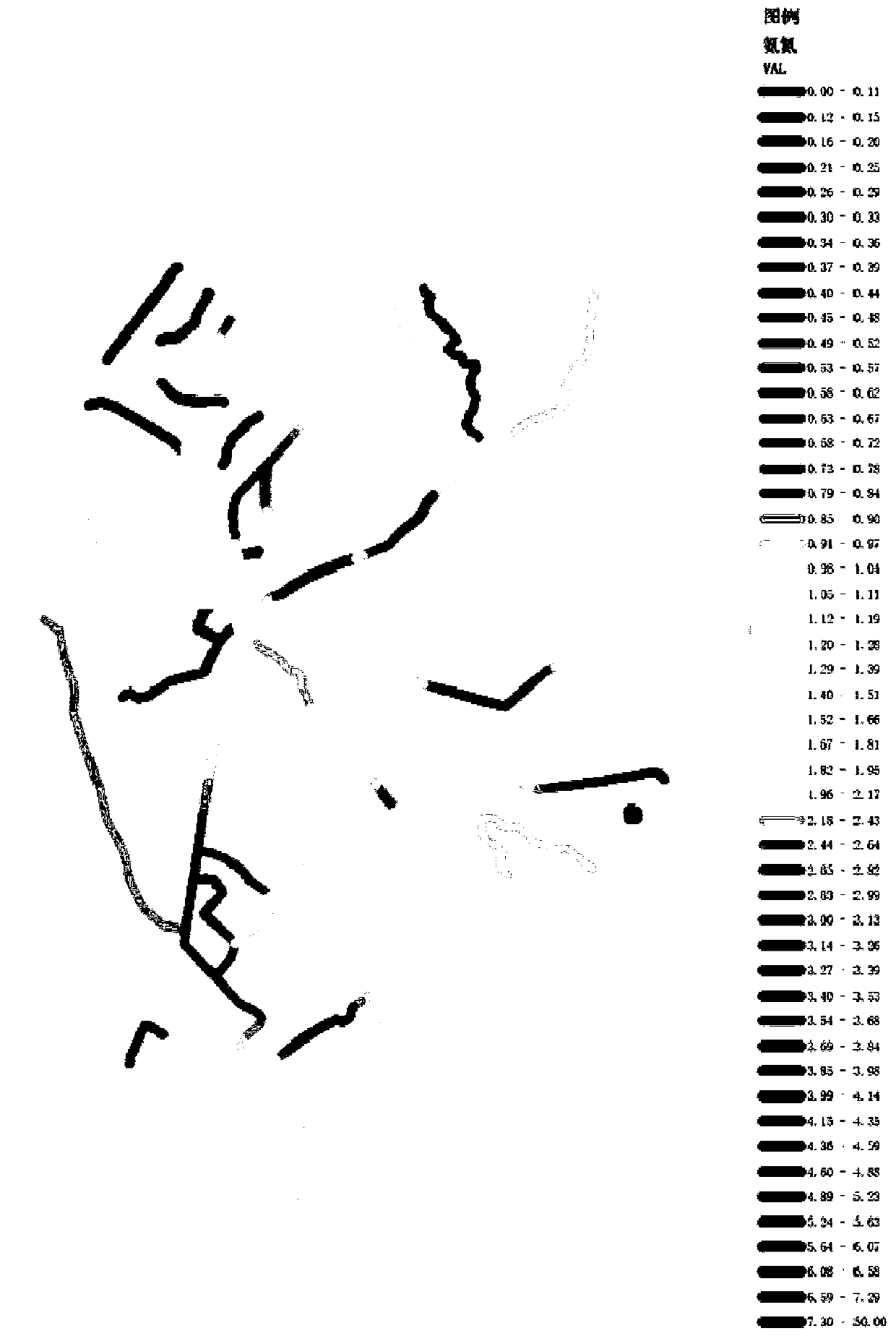
[0050] The real-time water quality monitoring data of the water quality monitoring station includes routine water quality indicators and comprehensive water quality indicators;

[0051] The conventional indicators of water quality are: water temperature, pH, dissolved oxygen, electrical condu...


PUM


Abstract

The invention discloses a method for realizing the dynamic distribution of river water quality based on GIS technology. The method includes: data collection, spatial processing, object processing, layer data superposition, layer data classification, event table construction and assignment, dynamic Segmentation and rendering, and finally a rendering that reflects the dynamic distribution of river water quality. In the case of limited water environment monitoring data, the present invention realizes dynamic linear reference segmentation and assignment of rivers, thereby performing multi-level seamless dynamic rendering without interrupting the river, and supports automatic update and processing of the whole process.

Description

technical field [0001] The invention relates to the technical field of environmental protection information management, in particular to a method for realizing dynamic distribution of river water quality based on GIS technology. Background technique [0002] Geographic Information System (GIS) is a computer technology system used for geospatial information processing and management, which can support the acquisition, management, and analysis of geospatial data. The dynamic segmentation technology provided by GIS system is generally used in the transportation field. On the road, mileage piles and monitoring information are used to dynamically render and intuitively view road conditions, such as road congestion, high-speed foggy road sections, etc. [0003] At present, with the development of my country's society and economy, the quality of water environment has been greatly affected, and the data related to water environment quality also have spatial distribution characterist...

Claims


Application Information

Patent Timeline
Patent Type & Authority Patents(China)
IPC IPC(8): G01N33/18G01N27/06G01N27/26G01K13/02G06F16/29
CPCG01N33/18G01N27/06G01N27/26G01K13/02G06F16/29G01K13/026
Inventor 宋小燕刘锐高毅平刘树彬陈吕军
Owner YANGTZE DELTA REGION INST OF TSINGHUA UNIV ZHEJIANG
Features
  • R&D
  • Intellectual Property
  • Life Sciences
  • Materials
  • Tech Scout
  • Unparalleled Data Quality
  • Higher Quality Content
  • 60% Fewer Hallucinations
Learn More