Maritime meteorological early warning navigation system and method based on electronic chart
A technology of electronic charts and navigation methods, applied in navigation, surveying and navigation, navigation calculation tools, etc., can solve the problems that ships cannot use weather information, restrict the depth and breadth of weather information use, and weather navigation relies on manual labor, etc., to achieve Reduce manual participation, avoid untimely interaction, and reduce the effect of work difficulty
- Summary
- Abstract
- Description
- Claims
- Application Information
AI Technical Summary
Problems solved by technology
Method used
Image
Examples
Embodiment 1
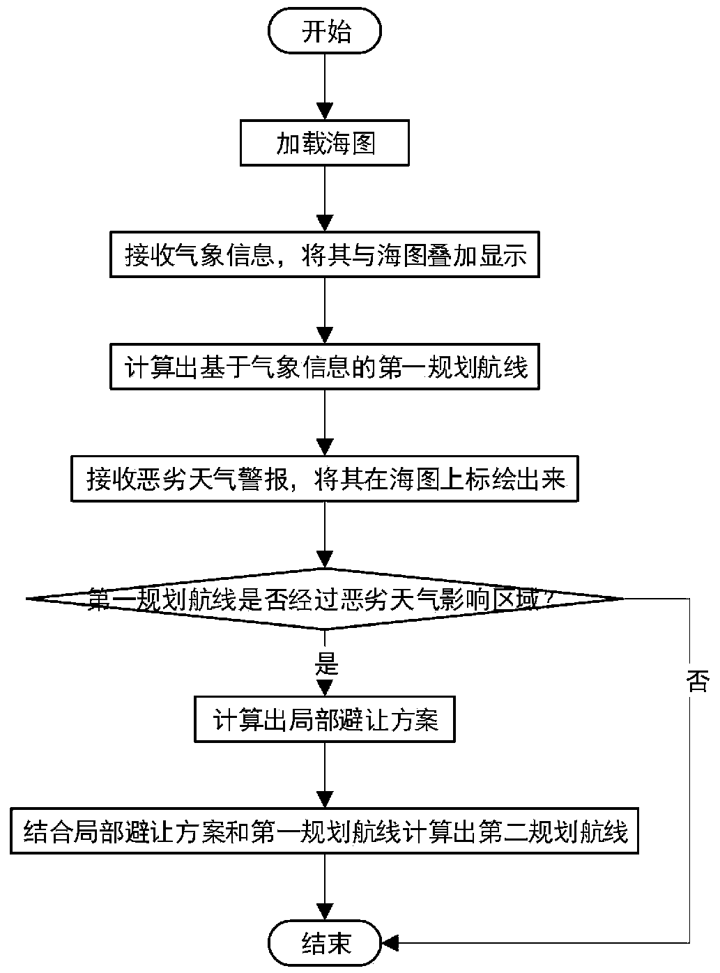
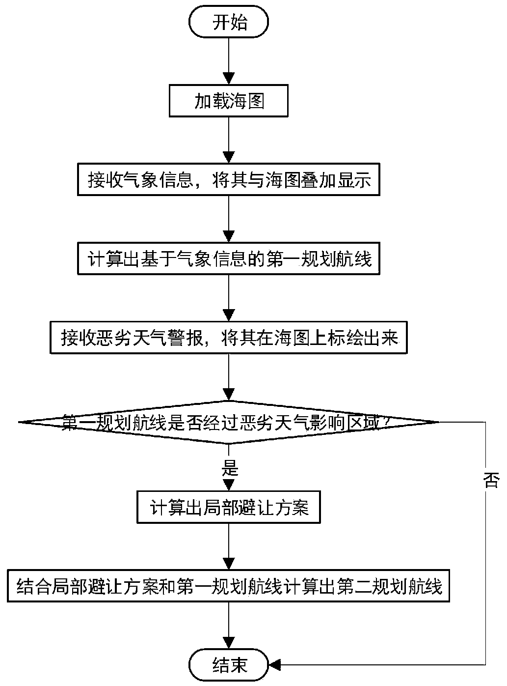
[0044] The present embodiment provides a kind of marine meteorological warning and navigation method based on electronic chart, comprising the following steps:
[0045] Step A1, obtaining the electronic chart information from the current position of the ship to the sea area of the preset target port.
[0046] Step A2, receiving pre-encrypted weather information sent by the shore-based data center, the weather information includes wind, wave, current, temperature, rainfall, atmospheric pressure and ocean circulation and other weather information.
[0047] Step A3, superimposing the electronic chart information and meteorological information to obtain initial navigation environment information, obtaining the first planned route according to the initial navigation environment information, preset target port position information, and current ship status parameters, and combining the The first planned route is plotted on the electronic chart. The plotting operation is completely...
Embodiment 2
[0066] This embodiment provides a marine meteorological early warning navigation system based on electronic charts, including:
[0067] The obtaining module is used to obtain the electronic chart information from the current position of the ship to the sea area of the preset target port;
[0068] The first receiving module is used to receive the meteorological information sent by the shore-based data center;
[0069] The first decision-making module is used to superimpose the electronic chart information and meteorological information to obtain initial navigation environment information, and obtain the first planned route according to the initial navigation environment information, preset target port position information, and current ship status parameters , and plotting the first planned route on the electronic chart;
[0070] The second receiving module is used to receive the severe weather warning information sent by the shore-based data center, and perform risk assessme...
PUM
 Abstract
Description
Claims
Application Information
 - R&D
- Intellectual Property
- Life Sciences
- Materials
- Tech Scout
- Unparalleled Data Quality
- Higher Quality Content
- 60% Fewer Hallucinations
Browse by: Latest US Patents, China's latest patents, Technical Efficacy Thesaurus, Application Domain, Technology Topic, Popular Technical Reports.
© 2025 PatSnap. All rights reserved.Legal|Privacy policy|Modern Slavery Act Transparency Statement|Sitemap|About US| Contact US: help@patsnap.com


